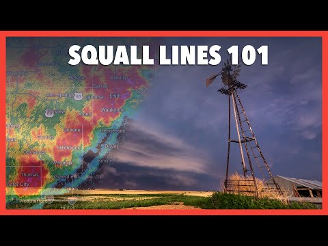
A squall line forms when a line of thunderstorms develops along or ahead of a cold front. These thunderstorms are created by updrafts that push warm, moist air upward, where it cools and condenses to form clouds and rain.
As the storm matures, downdrafts can occur, causing gusty winds and heavy rainfall, often making squall lines dangerous.
These systems can produce severe weather, including damaging winds and tornadoes. Meteorologists use radar to track and predict the movement of squall lines, helping to warn people in affected areas.
Understanding the dynamics of a squall line is essential for anyone interested in extreme weather, especially during storm season.
For those curious about the scientific aspects behind these events, exploring related topics like the atmospheric phenomena can provide deeper insights into weather patterns. This knowledge is vital for both safety and appreciation of nature’s power.
Formation and Characteristics of Squall Lines

Squall lines form under specific meteorological conditions and exhibit distinct characteristics. Understanding the elements that contribute to their development helps in predicting their behavior and associated impacts.
Meteorological Conditions Leading to Development
Squall lines typically develop along or ahead of a cold front. These storms are often classified as a quasi-linear convective system.
A key factor is wind shear, which refers to the change in wind speed or direction with height. This creates an environment conducive to thunderstorms.
Another important element is the presence of a low pressure system. When warm, moist air rises and meets cooler air, it creates instability.
Convective available potential energy (CAPE) also plays a role, as it measures the potential energy available for storm development. When these conditions are right, thunderstorm cells can organize into a squall line, leading to severe weather events like downbursts and transient tornadoes.
Types of Squall Lines and Associated Weather
Squall lines can vary in intensity and form. Multi-cell thunderstorms often create these lines, which may exhibit bow echoes, indicating strong winds.
These bow echoes can lead to significant damage due to the associated heavy precipitation, hail, and strong winds.
Derechos are another potential outcome of squall lines, characterized by widespread, damaging winds. As these storms move, they can produce severe weather, including intense rain and hail. Awareness of these storm types helps in understanding their potential impact on the environment and safety. Monitoring wind patterns and surface movement is essential for accurate predictions.
Effects and Detection of Squall Lines

Squall lines produce intense weather events that pose hazards. Detecting these lines in real-time is crucial for safety and preparedness. Understanding how squall lines form and their characteristics helps in predicting their impact.
Real-Time Monitoring and Prediction
Real-time monitoring is essential for detecting squall lines. Meteorologists use radar technology to track line echo wave patterns.
These patterns indicate the formation and movement of squall lines. Radar can also help identify environmental wind conditions that contribute to the development of damaging winds and downbursts.
Forecasters analyze data to predict squall line behavior. Features such as gust fronts and outflow boundaries are monitored closely. These elements reveal how a squall line may evolve and what impacts it might have.
Effective monitoring allows for timely warnings to the public, potentially reducing harm during events like a progressive derecho.
Hazards and Protective Measures
Squall lines can bring various hazards, including straight-line winds, tornadoes, and flash flooding. Winds can exceed 60 mph, leading to significant damage.
It’s important to identify shelf clouds associated with these squall lines, as they often signal severe weather.
Protective measures are vital when a squall line approaches. Staying indoors, avoiding windows, and seeking shelter in sturdy structures are recommended.
Communities should have emergency plans in place, particularly in areas prone to severe weather. Understanding the risks and preparing minimizes the potential impact during such extreme conditions.
For more information on regional weather safety, see related articles on regional hazards.
