
Flying through an atmospheric river is indeed possible, and it is done by specialized aircraft. These weather phenomena, rich in moisture, can deliver significant precipitation and are essential for understanding extreme weather patterns.
Pilots and scientists utilize aircraft to gather crucial data, which enhances weather forecasts and prepares regions for potential flooding and storms.

Atmospheric rivers are massive bands of water vapor that flow through the sky, transporting more moisture than all the rivers on Earth combined. As climate change intensifies these events, they become increasingly relevant to aviation operations and weather prediction.
Understanding how these systems work can help mitigate the risks associated with extreme weather and improve the accuracy of forecasting.
By studying atmospheric rivers from within, scientists can gain valuable insights into wind patterns, precipitation rates, and the overall dynamics of large-scale weather systems.
This knowledge aids in preparing communities for the impacts of heavy rainfall and helps to improve safety in aircraft operations during severe weather events.
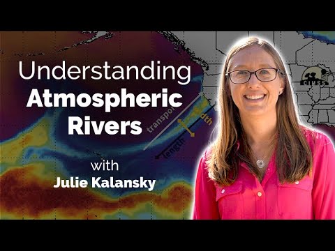
Understanding Atmospheric Rivers
Atmospheric rivers are significant weather phenomena that can impact climate and weather patterns. They play a crucial role in transporting moisture across regions, influencing precipitation and water supply.
This section explores their definition, historical impacts, scientific observations, and their role in water resources.
Definition and Formation
Atmospheric rivers (ARs) are narrow bands of moisture suspended in the atmosphere, often extending over 1,200 miles. These systems form when warm, moist air from the Pacific Ocean rises and cools, leading to condensation and precipitation.
As the air moves inland, it interacts with mountains like the Sierra Nevada, causing heavy rainfall or snowfall. This process is critical, especially in regions vulnerable to drought.
Atmospheric rivers can carry a water volume equivalent to 25 Mississippi Rivers, showcasing their massive potential.
Historical Impact on Climate and Weather
Historically, atmospheric rivers have shaped weather patterns significantly, especially in California. They can lead to both droughts and floods, depending on their intensity and frequency.
For instance, during the El Niño years, atmospheric rivers increase, bringing heavy precipitation that can cause catastrophic flooding. In contrast, less frequent atmospheric river events can lead to water shortages, stressing water supplies.
Understanding their historical impact helps researchers predict future weather scenarios as climate patterns evolve due to climate change.
Scientific Measures and Observations
Scientific studies of atmospheric rivers employ various techniques, including satellite imagery and climate models developed by organizations like NASA and NOAA.
These tools allow scientists to observe moisture transport and gauge the potential impact on weather.
Research conducted at UC San Diego enhances understanding of ARs by analyzing changes in temperature and pressure that lead to their formation.
Comprehensive data gathering enables better forecasting and planning for extreme weather events associated with ARs. Insights gained help in preparing for the social and economic effects of these phenomena.
Role in Water Supply and Climate Events
Atmospheric rivers are essential contributors to water supply in many regions. They deliver significant precipitation, replenishing reservoirs and aquifers, especially during dry periods.
For example, during winter months, ARs can provide crucial water to California, supporting agriculture and urban needs.
Conversely, their intense activity can also lead to extreme weather events, such as flooding and landslides.
As global warming progresses, the behavior of atmospheric rivers may shift, making it important to monitor their patterns for future climate stability.
Their dual role highlights the need for continued research into their effects on both the environment and society.
For more information on water resources, you can read articles about water.
Aviation and Atmospheric Rivers

Flying through atmospheric rivers presents unique challenges and opportunities for the aviation industry. Understanding flight planning and safety measures, utilizing technological tools for weather prediction, and analyzing past encounters with these phenomena are key to ensuring safe air travel.
Flight Planning and Safety Measures
Pilots must carefully plan flights around atmospheric rivers. These weather systems are characterized by high moisture and can produce heavy precipitation and strong winds.
The National Weather Service monitors these conditions, providing essential updates.
Before flying, crews assess wind speed and direction, avoiding areas with severe turbulence. The use of weather forecasts helps establish safe altitudes.
In some cases, planes, including high-performing jets like the Gulfstream IV, can navigate through less intense parts of an atmospheric river.
Detailed flight briefings often include information on current conditions and any expected changes. This preparation helps minimize risks and ensures safety during encounters with an atmospheric river.
Technological Tools for Weather Prediction
Advancements in technology enhance the ability to forecast atmospheric rivers. Tools like dropsondes, used by agencies such as NOAA, are deployed to gather real-time data.
This information helps refine weather prediction models.
Aircraft, like the Air Force’s Hurricane Hunter, play a vital role in atmospheric river reconnaissance. They collect data on moisture levels and wind patterns.
This data is crucial for accurate forecasting, aiding in website like ChaseDay.com that focus on atmospheric phenomena.
Weather prediction models use these data points to simulate conditions. Improved forecasting ultimately aids in water management and flood preparations, highlighting the importance of accurate predictions for aviation safety.
Case Studies of Flights and Atmospheric Encounters
Past flight encounters with atmospheric rivers have revealed important lessons.
For instance, during the Pineapple Express event in California, significant rain and flooding were reported. Flights were diverted or canceled due to unsafe conditions.
In one notable case, careful planning allowed a commercial airline to navigate safely through an atmospheric river, avoiding severe turbulence.
By using advanced sensors, pilots received timely updates about conditions ahead.
Studying these events helps improve flight safety protocols.
Each encounter adds to knowledge about managing risks associated with atmospheric rivers.
This underscores the aviation industry’s commitment to passenger safety while adapting to changing weather patterns.