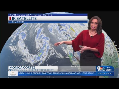
Pineapple Express and atmospheric rivers are terms often used interchangeably, but they do have specific meanings in meteorology.
A Pineapple Express is a type of atmospheric river that carries warm, moist air from the tropical Pacific, significantly impacting weather patterns, especially along the West Coast of the United States. These weather phenomena can transport massive amounts of moisture, sometimes bringing heavy rain and snow to coastal regions.
Understanding the differences can enhance how people prepare for weather events. While many atmospheric rivers are weak, the Pineapple Express is known for its strength and the potential for extreme weather. Such events are crucial for replenishing water supplies but can also lead to flooding and landslides.
For more information on how these systems work, one can explore various atmospheric phenomena that influence weather patterns.
The effects of these systems can be felt far and wide, making them an important topic of study for meteorologists and the general public alike. As climate patterns change, knowing how to identify and respond to a Pineapple Express could prove vital for safety and preparedness.
Understanding Pineapple Express

The Pineapple Express is a specific type of atmospheric river. It plays a crucial role in delivering moisture to the U.S. West Coast, especially California. This section highlights its characteristics, impacts, and how it stands out from other atmospheric rivers.
Characteristics of a Pineapple Express
The Pineapple Express is known for transporting warm, moist air from the Hawaiian Islands to the West Coast. This flow typically forms when strong winds in the atmosphere push moisture across the Pacific.
Key Features:
- Origin: It starts near Hawaii, influenced by large-scale weather patterns.
- Temperature: The warm air can significantly increase precipitation as it rises over land.
- Width: These events usually span from 250 to 375 miles wide.
The Scripps Institution of Oceanography explains how this moist air leads to heavy rain and snowfall in the Sierra Nevada mountains. While many atmospheric river events are weak, a robust Pineapple Express can bring intense rainfall that leads to flooding and mudslides.
Impact on the West Coast
Pineapple Express events can cause substantial impacts on the West Coast, particularly in California. Heavy rain from these storms is essential for replenishing water supplies but can also transform into hazards.
Consequences Include:
- Flooding: Intense rainfall can lead to localized flooding in urban areas.
- Mudslides: Steep terrain becomes vulnerable when saturated with moisture, often resulting in dangerous mudslides.
- Snowfall: In higher elevations of the Sierra Nevada, the moisture falls as snow, crucial for the region’s water supply.
The National Weather Service often issues warnings during such storms to prepare residents for adverse conditions. The balance between needed precipitation and potential hazards underscores the complexity of a Pineapple Express.
Differentiating Pineapple Express and Atmospheric Rivers
While all Pineapple Express events are atmospheric rivers, not all atmospheric rivers are Pineapple Expresses. The distinction lies primarily in their moisture source and specific characteristics.
Differences:
- Moisture Source: A Pineapple Express specifically draws moisture from the tropics, whereas other atmospheric rivers may originate from different regions.
- Temperature and Precipitation: The warm, moist air characteristic of a Pineapple Express usually leads to heavy rain, in contrast to colder atmospheric rivers that can produce snow.
Recognizing these differences is essential for understanding weather patterns and the potential effects each event can have on local areas. The data from organizations studying atmospheric rivers helps in predicting and managing their impacts effectively.
Analyzing Atmospheric Rivers

Atmospheric rivers are significant weather phenomena that influence rainfall patterns and can lead to severe weather events. Understanding their formation, consequences, and how they are monitored is crucial for effective management of their impacts.
Formation and Behavior of Atmospheric Rivers
Atmospheric rivers form over warm ocean waters, primarily the tropical Pacific, where high humidity creates large plumes of water vapor. These moisture-laden bands are typically 250 to 375 miles wide and can transport water vapor equivalent to the flow at the mouth of the Mississippi River.
Winds associated with cyclones help these rivers move toward land. As they make landfall, the mountains of places like the Puget Sound create barriers that force this moisture to rise, leading to heavy precipitation. This phenomenon often results in intense rain and snowfall, significantly impacting the snowpack in mountainous regions.
Consequences of Atmospheric Rivers
The impact of atmospheric rivers can be far-reaching. They can bring heavy rainfall, leading to flooding and property damage. The National Oceanic and Atmospheric Administration (NOAA) often issues flood watches when atmospheric rivers approach.
In addition to flooding, high winds sometimes accompany these systems, resulting in power outages and hazardous conditions. Over time, these heavy rain events can replenish water supplies but can also cause significant short-term challenges, including severe weather conditions and safety risks for local communities.
Monitoring and Predicting Atmospheric Rivers
Monitoring atmospheric rivers is critical for predicting their effects on weather.
Organizations like the Center for Western Weather and Water Extremes use advanced tools to track these systems in real time.
Satellite imagery and weather models help meteorologists predict when and where atmospheric rivers will strike.
Accurate predictions allow for timely warnings and preparations to mitigate flooding and other related dangers.
The U.S. Geological Survey also plays a role in assessing the potential impacts, ensuring communities can prepare for these significant weather events.
