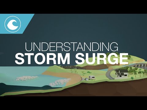
Storm surge is a critical aspect of hurricanes and tropical storms that can cause devastating impacts on coastal areas. Research shows that the right side of a hurricane typically experiences more intense storm surge due to the way winds and water are pushed by the storm’s rotation. This can lead to higher water levels, greater flooding, and more damage than the left side, especially for coastal communities.
Understanding the differences between the left and right sides of a storm is essential for preparation and safety. Tropical cyclones can create significant challenges, and knowing where the greatest risks lie can make a difference during an emergency.
For anyone living in or near hurricane-prone areas, being informed about these dynamics is crucial for making smart decisions.
As he shares insights from years of experience, it becomes clear that every hurricane carries unique risks. By examining storm surge patterns, readers can gain valuable knowledge that helps them navigate the complexities surrounding tropical storms and hurricanes.
Characteristics of Storm Surges

Storm surges are critical events during tropical cyclones and hurricanes that can cause severe flooding along coastlines. Understanding how they form and impact areas, as well as how they are predicted and measured, is crucial for preparedness.
Formation and Impact
Storm surge occurs when strong winds from a hurricane push ocean water toward the shore. This rise in sea level can lead to flooding, especially when a storm makes landfall. The surge can be more intense in certain areas, particularly in the storm’s right-front quadrant due to the cyclone’s rotational effects.
Key components of storm surge include storm tide, which is the combination of normal high tide and the additional rise caused by the storm. According to the National Hurricane Center, storm surge is often the leading cause of fatalities in hurricanes, emphasizing the importance of timely warnings and community awareness.
Predicting and Measuring Surge
Predicting storm surges involves using advanced technology and models to estimate potential impacts. Meteorologists analyze data such as wind speed, atmospheric pressure, and coastline shape to determine surge levels.
Various tools, including satellite imagery and buoys, help track real-time changes in water levels.
The National Oceanic and Atmospheric Administration (NOAA) also provides forecasts and warnings to aid preparation for storm surge flooding. Understanding surge prediction is vital for coastal communities, as it can significantly influence evacuation plans and safety measures.
Accessing resources on these predictions can help communities stay informed as they prepare for severe weather events. For more details, people can visit resources discussing water-related impacts.
Asymmetry in Hurricane Impact

Hurricanes do not impact coastlines uniformly. Understanding the differences between the left and right sides of a hurricane helps in assessing storm surge risks. Each side has distinct characteristics that affect wind speed and surge height.
Right Side Dominance
The right side of a hurricane often causes higher storm surges compared to the left side. This phenomenon is due to the hurricane’s forward motion and wind dynamics. The right-front quadrant typically sees the strongest winds, contributing to increased surge levels.
For instance, Hurricane Irma produced significant surge impacts on the right side as it approached Florida. This area, often referred to as the dirty side of a hurricane, combines the hurricane’s winds with the storm’s forward speed, leading to more severe flooding.
Additionally, when evaluating past storms like Hurricane Michael, the damage was predominantly concentrated on the right side. Areas in this zone faced severe inundation as waters were pushed ashore by strong winds, leading to heightened risks for coastal communities.
The Left Side Scenario
The left side of a hurricane is usually characterized by lower wind speeds and storm surge impacts. However, this does not mean it is free from danger.
While the left side may seem less destructive, the threat can still be significant.
In some hurricanes, storm dynamics can cause unexpected surges even on the left side. For example, local geography and water depth can influence how the storm’s energy translates into surge.
Residents in these areas must remain vigilant, as conditions can shift rapidly during landfall.
Moreover, the negative impacts may still be felt through heavy rainfall and potential tornadoes that can form in these less intense regions. This variability highlights the importance of comprehensive monitoring throughout the entire storm.
Eyewall Variability
The eyewall of a hurricane is the area surrounding the eye, where the most intense winds and rain occur.
Understanding its variability is crucial, as it can lead to drastic changes in storm effects.
Eyewall replacement cycles can cause shifts in intensity and wind direction, impacting how surge develops along the coastline.
For instance, as the eyewall strengthens or weakens, areas within the right-front quadrant may suddenly experience heightened wind speeds and surge.
This variability also means that predictions of storm impacts can change as the hurricane progresses.
Considering recent events, monitoring wind patterns and fluctuations in the eyewall can provide valuable information for forecasting potential damages from storm surges.
