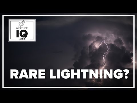
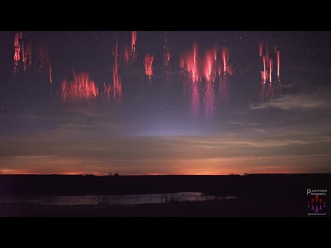
When discussing rare thunderstorms, one of the most unique events is thundersnow, a phenomenon that combines snow and thunder, creating a stunning sight and an unusual weather experience. This rare weather event occurs when the necessary conditions for a thunderstorm meet snowy air, making it far less common than typical thunderstorms.
Another notable mention is the derecho, which is a widespread and long-lived wind storm that moves in a straight line. Derechos can cause significant destruction, sometimes producing winds that rival those of tornadoes. These intense storms typically occur during hot summer months, often surprising those who are unprepared for such severe weather.
For those intrigued by various atmospheric phenomena, a deeper exploration into these unusual storms can be found in discussions about different types of atmospheric phenomena.
Types of Rare Thunderstorms

Rare thunderstorms often exhibit unique characteristics that set them apart from typical storms. Understanding these types can help identify their potential dangers and the conditions that create them.
Supercell Thunderstorms
Supercell thunderstorms are one of the most powerful types of storms. They can produce severe weather, including large hail, tornadoes, and intense wind damage.
Characterized by a rotating updraft called a mesocyclone, these storms can last for several hours.
Supercells form in environments with strong wind shear, which is the change in wind speed or direction with height. This instability can lead to significant tornado production.
Supercells are often associated with severe thunderstorms seen in areas like the Great Plains, where conditions are conducive to their development.
These storms can also lead to lightning, which poses further risks to structures and safety.
Thundersnow and Winter Thunderstorms
Thundersnow is a rare phenomenon occurring during winter storms. This type of thunderstorm brings snowfall along with thunder and lightning. Thundersnow is not common because colder air generally stabilizes the atmosphere, reducing the chances for a thunderstorm to develop.
When these storms happen, they can create heavy snowfall accompanied by thunder. The sight of lightning within a snowy landscape can be striking.
Winter thunderstorms can lead to snow accumulations and create blizzard conditions, making travel hazardous.
These storms often form when a cold front interacts with warmer air. As temperatures drop, different types of precipitation, including ice crystals, can develop, leading to a unique but dangerous weather event.
Derechos and Line Echo Wave Pattern Storms
Derechos are long-lived windstorms that result from a line of thunderstorms. These storms can produce widespread damaging winds, often exceeding 100 mph.
They are characterized by a bowing shape on radar imagery, indicating strong winds moving in a straight line.
These storms occur when a significant amount of moisture and heat is present in the atmosphere, combining with a strong cold front. They can lead to extensive wind damage, potentially causing outages and destruction over large areas.
Line Echo Wave Patterns (LEWPs) are similar, often preceding derechos. They can produce sudden wind gusts and intense rainfall. The National Weather Service monitors these storms closely, as they can cause significant danger to life and property.
Causative Factors of Rare Thunderstorms

Rare thunderstorms often arise from specific atmospheric conditions. Understanding these factors is crucial for predicting their development and potential severity.
Atmospheric Instability and Moisture
Atmospheric instability is key for thunderstorm formation. It occurs when warm, moist air near the surface rises through cooler air above.
For rare thunderstorms, significant moisture is essential, often obtained from large bodies of water. High humidity fuels the storm, contributing to intense precipitation and lightning.
In the troposphere, the vertical temperature profile plays a vital role. A steep lapse rate, where temperature drops quickly with altitude, strengthens the instability. This can lead to strong updrafts that support storm development.
In some cases, atmospheric blocking can enhance instability by trapping heat and moisture.
Additionally, moisture levels need to be high enough to sustain the storm. Thunderstorms that occur in dry conditions are less likely to sustain themselves. The combination of instability and sufficient moisture creates an environment ripe for the development of rare thunderstorms.
Weather Fronts and Wind Shear
Weather fronts, particularly cold fronts, are critical in initiating thunderstorms. When a cold front collides with warm, moist air, it can rapidly force the warm air upward, leading to storm development.
This interaction often results in severe weather, including heavy rainfall and strong winds.
Wind shear, which refers to changes in wind speed and direction with height, is also a significant factor. High wind shear can enhance the rotation within storms, making them more powerful and increasing their potential to become rare supercell thunderstorms.
Doppler radar is commonly used to observe these changes in wind patterns.
The combination of fronts and wind shear can create conditions favorable for cyclones and tornadoes. Increased turbulence due to varying wind speeds can contribute to the strength and rarity of the storm.
