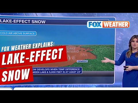
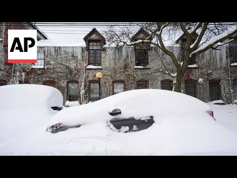
Lake-effect snow is a fascinating weather phenomenon that occurs when cold air moves over large bodies of warm water, like the Great Lakes. As the warm air rises, it picks up moisture and creates significant precipitation, resulting in heavy snowfall.
The main idea of creating lake-effect snow is the interaction between cold air and warm lake water, which transforms into intense snow bands that can dump several feet of snow in localized areas.
This unique weather pattern is common in regions near the Great Lakes, affecting cities and towns with its sudden and intense snowstorms. Lake-effect snow can develop rapidly with little warning, often leading to dangerous travel conditions and impacting daily life.
Understanding this phenomenon helps people prepare for the challenges associated with such extreme weather events.
For those interested in learning more about how these conditions form and their effects, exploring topics related to snow and ice offers deeper insights into the science behind these impressive weather events.
Mechanics of Lake-Effect Snow

Lake-effect snow forms through a specific set of interactions between cold air and warm lake water. Key factors include the warm temperatures of the Great Lakes, the characteristics of the cold air masses, and the influence of wind direction. Understanding these aspects reveals how this unique snow phenomenon occurs.
Role of the Great Lakes
The Great Lakes play a crucial role in producing lake-effect snow. These large bodies of water maintain warmer temperatures compared to the surrounding air in winter. This difference creates ideal conditions for snow formation.
Warm water evaporates, adding moisture to the air above the lakes.
When cold air moves over this warmer water, it picks up considerable amounts of water vapor. This moist air rises into the atmosphere, where it encounters colder temperatures. The moisture then condenses to form clouds, leading to substantial snowfall on the leeward shores.
This cycle can lead to significant precipitation, impacting local weather systems.
Cold Air and Warm Water Interaction
The interaction between cold air and warm water is essential for creating lake-effect snow. Typically, cold air masses come from regions like Canada and move southward over the lakes.
As this air passes over the lakes, it heats up due to the warmer water below.
This heating process causes the air to hold more moisture, turning it into water vapor. As the air rises, it cools and loses its capacity to hold moisture, causing the vapor to condense into droplets.
These droplets then freeze, forming snowflakes. This process can lead to heavy snowfalls, often accumulating several feet in localized areas.
Wind Direction and Fetch
Wind direction significantly influences lake-effect snow. Fetch refers to the distance over water that wind travels before reaching land. Long fetch allows winds to gather more moisture, enhancing snowfall amounts.
When prevailing winds blow across the lakes, the air collects moisture over a large area. If the wind is steady and flows directly from the lake to the land, it can bring intense snowfall to certain locations.
Changes in wind direction or speed can dramatically alter where the snow falls. Even slight adjustments can shift the heavy snow bands, making forecasting a challenging task for meteorologists.
Impacts and Forecasting of Lake-Effect Snow

Lake-effect snow has significant impacts on communities near large bodies of water. It can lead to heavy snowfall and challenging travel conditions. Accurate forecasting is essential to prepare for these wintry storms.
This section explores snowfall rates, meteorological techniques for forecasting, and the influence of climate change.
Snowfall Rates and Totals
Lake-effect snow can produce intense snowfall rates. In regions like upstate New York and Michigan’s Upper Peninsula, these rates can reach several inches per hour during peak conditions. Areas near the Great Salt Lake may also experience similar weather patterns.
Typically, snowfall totals can range from a few inches to several feet, often within just a few days. For instance, during strong lake-effect snowstorms, cities in Pennsylvania and Ohio can see accumulations of over a foot, especially if conditions remain favorable.
These heavy snow events severely impact local infrastructure, leading to delays and hazardous driving conditions.
Meteorological Forecasting Techniques
Forecasting lake-effect snow presents unique challenges for meteorologists. These weather events are highly localized, making precise predictions difficult. Changes in wind direction or temperature can dramatically shift snowfall patterns.
Meteorologists utilize advanced tools such as radar and satellite imagery to monitor conditions. They analyze temperature differences between the colder land and warmer lake water to predict snow formation.
Using models, they can provide estimates of snowfall rates and totals. Areas most affected by lake-effect snow rely on these techniques to prepare for potential disruptions caused by wintry storms.
Influence of Climate Change
Climate change is altering weather patterns, which can impact lake-effect snow. Warmer lake water temperatures can enhance snow production.
This change leads to increased snowfall rates in affected regions, including those around the Great Lakes.
Research indicates that as global temperatures rise, communities may experience more intense lake-effect snow events. Ice cover on lakes also affects how much moisture can be picked up by winds.
Reduced ice cover allows for more evaporation, potentially leading to heavy snowfalls. Understanding these trends is crucial for effective forecasting and preparation.
Adaptation strategies may be necessary to cope with the challenges posed by changing climate conditions.
