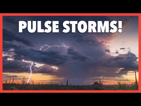
Single cell thunderstorms are among the simplest forms of storm systems, often featuring just one updraft. These storms can indeed produce tornadoes, albeit very rarely.
Tornadogenesis, or the process of tornado formation, typically involves specific atmospheric conditions that can sometimes be present even in these smaller systems.
It is important to understand that while larger supercell thunderstorms are more commonly associated with strong tornadoes, single cell storms can still create the right environment under certain circumstances.
As warm, moist air rises and interacts with existing weather conditions, there is a slight chance for these storms to develop rotation and produce a tornado, especially when conditions are favorable for severe weather.
Readers interested in severe weather should be aware of the unique nature of single cell thunderstorms. While they are less likely to be tornado producers compared to their more complex counterparts, understanding their potential is crucial for anyone monitoring weather patterns. This knowledge can enhance preparedness for sudden and severe weather events.
Thunderstorm Anatomy and Tornado Development

Understanding the structure of thunderstorms is crucial to grasping how tornadoes can form. Single-cell thunderstorms, while not typically associated with tornadoes, can produce them under certain conditions.
Key factors include updrafts, downdrafts, and wind shear, which all play important roles in the process of tornadogenesis.
Single-Cell Thunderstorms Characteristics
Single-cell thunderstorms, often referred to as ordinary cell thunderstorms, consist of a single updraft and downdraft. They typically form during warm, humid conditions and can be seen as towering cumulus clouds in their development.
The life cycle of these storms includes three main stages: cumulus, mature, and dissipating. During the mature stage, precipitation begins, which signals the beginning of downdrafts.
While they generally last for about an hour, a pulse storm may persist longer, producing brief heavy rain and lightning. In rare cases, these storms can produce weak tornadoes, albeit less frequently than more organized systems.
Mechanisms of Tornadogenesis
Tornadogenesis involves several mechanisms that can lead to the formation of tornadoes. Although single-cell thunderstorms are less likely to create tornadoes compared to supercells, they can still produce conditions favorable for their development.
Key processes include the presence of a strong updraft that can stretch vertically. This updraft can lead to wind shear, which causes different wind speeds and directions at various altitudes.
As the storm matures, a mesocyclone may form, serving as a rotating updraft that can intensify further into a tornado. Tornadoes often form under conditions of significant instability in the atmosphere, which allows for strong lifting and the organization of storm structures.
Variables Influencing Tornado Formation
Several variables can influence the likelihood of tornado formation within single-cell thunderstorms.
High levels of moisture in the lower atmosphere increase the potential for storm development. Additionally, vertical wind profiles play a critical role; strong wind shear can help organize the storm, creating a conducive environment.
Another important factor is instability, which can be enhanced by lifting mechanisms such as fronts or terrain. While most tornadoes are associated with supercell thunderstorms, the combination of sufficient lifting, moisture, and favorable wind conditions can occasionally allow for tornadoes to develop from ordinary cells, albeit infrequently.
Observations and Predictions of Severe Thunderstorms

Identifying conditions for severe thunderstorms and utilizing effective forecasting tools are crucial for predicting their development and potential hazards. Understanding various factors can help provide timely warnings to minimize damage and protect those at risk.
Identifying Severe Thunderstorm Conditions
Key factors contribute to the formation of severe thunderstorms.
Wind shear, which refers to changes in wind speed and direction with height, plays a crucial role in intensifying storms. When combined with a strong cold front or dry line, it can enhance storm development and increase the likelihood of severe weather.
Heavy rainfall is another significant indicator. When storms produce vertical motion, they can lead to strong downbursts and gusty winds. Gust fronts, which occur when outflow from a storm pushes ahead of it, can trigger new thunderstorm cells, known as back-building. Squall lines and bow echoes also indicate organized severe thunderstorm activity, often leading to wind damage.
Forecasting and Warning Systems
Effective forecasting relies on advanced weather models and tools.
Meteorologists use radar technology to track storm movements and intensity. This includes identifying features such as derechos, which are fast-moving windstorms that can result in significant damage.
Warning systems are essential for alerting the public about severe storms.
The National Weather Service issues watches and warnings based on real-time observations.
For instance, knowing the current temperature can help assess stability in the atmosphere, aiding in predicting thunderstorm development.
Timely updates allow communities to prepare for potential tornadoes and other severe weather events.
Monitoring these conditions ensures safety during unpredictable weather.
