
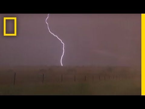
Thunderstorms are fascinating meteorological events that can vary in intensity and structure. Among these, the king of thunderstorms is the supercell.
Supercells are powerful and organized thunderstorm systems characterized by their rotating structure, which can produce severe weather conditions such as strong winds, hail, and tornadoes. Understanding the dynamics of these storms is crucial for anyone interested in extreme weather phenomena.
Supercells thrive in environments with specific climatic conditions, including warm, moist air at the surface and a cooler, drier air aloft. This setup allows for the rotation necessary to sustain these storms.
The impact of climate change is also significant, as it may alter the frequency and intensity of thunderstorms, especially supercells. As a result, monitoring trends in thunderstorms can provide valuable insights into changing weather patterns.
For those intrigued by the science behind such extreme weather, delving into topics like electrical storms and other atmospheric phenomena adds depth to the understanding of supercells. Researching and studying these elements can enhance appreciation for the complexities of our atmosphere and the forces that drive weather events.
The Science of Supercell Thunderstorms

Supercell thunderstorms are unique and complex weather systems known for their powerful tornadoes and hail. Understanding their structure and the conditions that lead to their formation helps explain why they are the most intense type of thunderstorms.
Anatomy of a Supercell
A supercell’s structure is distinctive, primarily featuring a mesocyclone, which is a rotating updraft. This vertical motion allows the storm to maintain its strength for longer periods compared to regular thunderstorms.
Inside a supercell, updrafts are found at the core, pushing warm, moist air upward. This contrasts with downdrafts, which occur on the storm’s periphery and carry cooler air downward. The interaction between these forces creates a tropopause, separating the storm from the stable atmosphere above. The result is a well-organized storm capable of producing severe weather events.
Atmospheric Conditions for Development
For a supercell to form, certain atmospheric conditions must exist. Key factors include atmospheric instability, which allows warm, moist air to rise quickly and create strong updrafts.
The presence of wind shear, or changes in wind speed and direction with height, is also crucial. This shear helps tilt the updraft, enhancing rotation and enabling the development of a mesocyclone.
Additionally, the occurrence of a lifting mechanism, such as a cold front or a geographic barrier, can trigger the storm’s formation. When these conditions align, a supercell can produce some of the most dangerous weather phenomena, including large hail and violent tornadoes.
Lifecycle of a Thunderstorm
The lifecycle of a supercell thunderstorm typically consists of three stages: development, maturity, and dissipation.
In the development stage, the storm begins with a strong updraft, fueled by warm air. As it matures, the storm reaches its peak intensity, exhibiting a well-defined structure and powerful downdrafts. This phase often produces severe weather.
Finally, in the dissipation stage, the updraft weakens as the downdraft takes over, leading to the storm’s eventual collapse. Despite this, supercells can still generate hazards even in the later stages due to their long-lasting nature and complex dynamics.
Environmental Impact and Safety Measures
Thunderstorms can cause significant damage to the environment and pose serious risks to safety. Understanding their impact and implementing safety measures can help reduce harm during such events.
Patterns of Damage and Safety Precautions
Thunderstorms can produce damaging winds, hail, and tornadoes, creating severe hazards. Wind damage can uproot trees, down power lines, and damage property. Hail can destroy crops and break car windows. Areas on the plains are particularly at risk due to their geography.
Safety precautions are essential. During a thunderstorm, individuals should seek shelter indoors, away from windows. If outside, moving to a sturdy building or vehicle can provide protection. It is crucial to avoid underpasses and seek higher ground to avoid flooding in case of heavy precipitation.
Role of Forecasting and NOAA Guidelines
Forecasting thunderstorms is vital for public safety. Organizations like NOAA provide timely information to help communities prepare. Forecasts often include warnings about high winds, hail, and potential tornadoes.
Capping inversions and anvil clouds are important meteorological concepts used to predict these storms. By understanding these patterns, meteorologists can offer guidance on safety measures. The NOAA guidelines emphasize the importance of staying informed through reliable weather sources, especially in regions frequently affected by storms.
Case Studies: Impact Across Regions
Thunderstorms impact various regions differently, from Europe to America.
For example, in the Great Plains, microbursts can create sudden, severe wind damage, leading to chaos and destruction.
In Europe, the summer storms often bring intense precipitation that can result in flooding.
Case studies reveal that regions experienced severe outcomes, prompting local authorities to improve safety protocols.
The Regional articles often highlight how communities are adapting to these changes.
By studying past storms, it becomes possible to enhance response strategies, ultimately reducing risks during future thunderstorm events.