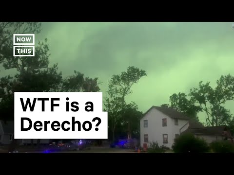
Derechos are powerful wind storms that can cause significant damage over large areas. These storms typically travel at impressive speeds, often exceeding 58 miles per hour.
In some cases, wind gusts within a derecho can reach as high as 130 miles per hour, making them one of the most intense weather phenomena.
Understanding how fast a derecho moves is crucial for safety. These fast-moving storms can develop quickly and impact regions suddenly.
As climate change influences weather patterns, the frequency and intensity of derechos may be affected, leading to increased risks for communities.
By exploring the dynamics of derechos and their travel speed, readers can gain insights into predicting their path and preparing for potential wind damage. This knowledge is essential for anyone living in areas prone to severe weather events.
Characteristics and Formation of Derechos

Derechos are powerful windstorms characterized by straight-line winds, often causing significant damage. Understanding their formation helps in predicting their occurrence and preparing for the impact.
Critical meteorological conditions contribute to the development of derechos, distinguishing them from other storm systems.
Meteorological Conditions for Derecho Formation
A derecho typically forms within a mesoscale convective system (MCS). This system is a cluster of thunderstorms that can produce widespread wind damage.
Key conditions include:
- Atmospheric instability: Warm, moist air rises, creating strong updrafts.
- Low-level jet streams: These high-speed winds provide additional lift.
- Moisture: High humidity is necessary for thunderstorm formation.
When these conditions come together, thunderstorms develop into a squall line, creating a bow echo. This bow shape is crucial as it indicates the potential for severe straight-line wind damage.
Gusts from a derecho can exceed 58 mph, leading to dangerous downbursts and microbursts.
Derecho Versus Tornado: Understanding the Difference
Though both derechos and tornadoes can produce strong winds, they differ significantly in behavior and formation.
Tornadoes are formed from rotating columns of air and have a smaller, more localized impact. In contrast:
- Derechos travel much farther, often covering hundreds of miles.
- Wind gusts in derechos are generally straight-line rather than spiraling as in tornadoes.
- Tornadoes form from severe thunderstorms, while derechos can develop from broader storm systems.
Both can cause serious damage, but derechos tend to impact larger areas. Understanding these differences helps communities prepare for the specific threats each storm type poses.
Stages of Derecho Development
Derechos typically go through several stages of development:
-
Initiation: Thunderstorms begin to form in an unstable atmosphere. High winds are present at lower levels.
-
Mature Stage: The storms grow in intensity. Strong updrafts are present, and the bow echo starts to form, indicating the development of high winds.
-
Outflow Dominance: Wind gusts from the storm spread out, causing damage over a wide area. This is when derechos become most dangerous, leading to significant straight-line wind damage.
Understanding these stages helps in forecasting and responding to severe weather events. Monitoring conditions that lead to derechos can aid in public safety efforts and reduce the impact of potential flash floods and high winds. For insights into wind patterns, check Wind.
Derecho Impact and Safety Measures

Derechos can cause significant damage with their intense straight-line winds. Understanding how to predict and track these storms, as well as knowing their historical impacts, is crucial for safety. The following sections provide essential information on these topics.
Predicting and Tracking Derechos
The National Weather Service (NWS) plays a vital role in predicting and tracking derechos. They use advanced storm prediction technology and radar systems to monitor conditions that may lead to these events.
Damaging winds associated with derechos can reach speeds of 58 mph, with gusts exceeding 100 mph.
Weather forecasts are critical for informing the public about potential threats. As conditions evolve, timely updates are essential.
The Storm Prediction Center (SPC) issues alerts based on weather patterns that indicate a growing risk for derecho development. Staying informed through media updates and weather apps can improve preparedness.
Historical Derecho Events and Their Impact
Historical events illustrate the destructive power of derechos. The June 2012 derecho, for instance, traveled over 700 miles in just 12 hours, causing widespread damage and power outages across the Eastern U.S. It left millions without electricity and caused significant structural damage to buildings and trees.
Falling trees pose severe risks, particularly to mobile homes and high-profile vehicles. The impacts extend beyond physical damage, affecting businesses and emergency response operations.
Climate change has also been linked to an increase in extreme weather events, potentially leading to more frequent and intense derechos in the future.
Preparedness and Safety Guidelines
Preparedness is key when a derecho is likely.
Individuals should have an emergency plan in place. This should include a supply kit with water, food, and first-aid essentials.
Secure outdoor items that could become projectiles in high winds.
In a storm, take shelter indoors, away from windows, to avoid injury from flying debris.
During power outages, use flashlights instead of candles to reduce fire hazards.
Businesses should create contingency plans to safeguard data and operations in case of severe weather disruptions.
Awareness and readiness can lessen the impact of derechos and enhance safety for all.
