
Many people wonder about the strength and impact of various weather events.
A derecho can cause devastating damage, comparable to that of a hurricane, but they are different storms with unique characteristics.
Understanding these differences is crucial for safety and preparedness.
Derechos are long-lived wind storms that can produce widespread damage over large areas, often exceeding 100 miles per hour. They usually occur in a straight line and can affect regions hundreds of miles long.
In contrast, hurricanes result in significant wind damage, flooding, and storm surges but typically have a more localized impact where they make landfall.
This distinction is vital for those in areas prone to extreme weather.
In the world of atmospheric phenomena, knowing how to respond to these events can save lives.
Awareness of the dangers of both derechos and hurricanes prepares communities for what might come next, whether it’s a quick-moving storm or a prolonged event.
For more information on severe weather, readers can explore various articles about atmospheric phenomena.
Comparative Analysis of Derechos and Hurricanes

Derechos and hurricanes are both powerful weather events, but they differ significantly in their characteristics, impacts on life and property, and how they are predicted.
Understanding these differences can help in preparing for and responding to these severe weather events.
Fundamental Characteristics
Derechos are long-lived wind storms that span hundreds of miles, typically forming from severe thunderstorms. They are defined by damaging winds that exceed 58 mph.
Though their wind speeds can reach over 75 mph, they are distinct from hurricanes.
Hurricanes are tropical storms with sustained winds of at least 74 mph, categorized based on wind speed. A major hurricane is classified as a Category 3 or higher, with winds exceeding 111 mph.
Whereas derechos often arise from a single atmospheric event, hurricanes develop over time through meteorological processes, driven by heat and moisture from warm ocean waters. This essential difference in formation leads to varying impacts on regions affected.
Impact on Human Life and Infrastructure
Both derechos and hurricanes can cause severe damage, but the nature of that damage often differs.
Derechos typically bring widespread wind damage, often impacting regions over 240 miles long. These storms can produce power outages, property damage, and pose risks for clean-up efforts.
Hurricanes, on the other hand, can cause extensive damage not just from wind but also through flash flooding and storm surges. Emergency services face unique challenges during hurricanes.
The scale of destruction often leads to more substantial insurance claims and longer recovery periods compared to those typically associated with derechos.
Predictive Measures and Warnings
Predicting derechos is challenging. The National Weather Service often struggles to anticipate when these storms will form.
Severe thunderstorms may develop rapidly without prior warnings. When derechos do occur, they can catch communities off guard.
In contrast, hurricanes are monitored through advanced satellite technology and storm prediction models. The tracking of hurricanes begins days in advance, allowing for preparation and evacuation measures.
The dedicated efforts of the National Weather Service and the Storm Prediction Center provide clearer warnings and allow for better planning in hurricane-prone areas.
Derechos Explained
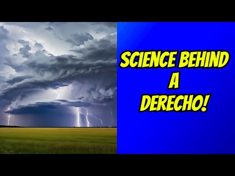
Derechos are powerful windstorms often associated with thunderstorms. They bring strong, straight-line winds that can cause significant damage, similar to hurricanes.
Understanding their characteristics and historical significance is important for community preparedness and safety.
Notable Historical Derechos
Many derechos have left a mark in history due to their severe impact.
The June 2012 derecho is one of the most notable, affecting areas from Indiana to the Ohio Valley. It produced wind gusts over 90 mph, resulting in widespread destruction and power outages affecting millions.
Another significant event occurred in Cedar Rapids, Iowa, in 2008, where a super derecho caused substantial damage, particularly to homes and infrastructure.
These storm complexes often originate from strong thunderstorm clusters, forming bow echoes that help propagate their strength.
Derechos like progressive derechos and serial derechos reflect varying patterns in movement and intensity, demonstrating the complexity behind predicting these events.
Preparation and Response
Preparation is crucial when a derecho is possible.
Communities should have emergency management plans and public safety measures in place.
Staying informed through severe weather alerts can help residents understand when to seek safety.
Local governments often provide resources for community preparedness.
This may include setting up storm shelters and organizing public safety campaigns.
Education on recognizing the signs of an incoming derecho, such as flattening clouds and strong gusts, is vital.
Effective disaster recovery plans also ensure that aid reaches those affected promptly.
Communities in the Midwestern United States, like Illinois and Nebraska, emphasize the importance of a coordinated government response to minimize the impacts of these dangerous storms.