
Storms along a squall line can be quite dramatic and dangerous. Typically, these storms are organized thunderstorms that can produce severe weather.
They often develop in a long line, leading to intense winds, heavy rainfall, and even tornadoes in some cases. Understanding what happens in these systems is essential for anyone living in areas prone to such weather.
As a meteorologist with decades of experience, it is clear that squall lines represent a specific type of weather pattern associated with significant atmospheric instability. These lines can yield various storms, primarily severe thunderstorms, which are responsible for causing serious impacts like flash flooding and damaging wind gusts.
Observing squall lines is crucial for accurate weather forecasting and science-based warnings.
Being aware of the potential for severe weather in squall line events helps communities prepare for the risks involved. This knowledge enables individuals to take necessary precautions when storms are forecasted, ensuring safety and minimizing damage.
Types of Storms Associated with Squall Lines
Squall lines are known for producing various types of storms. The most significant among these are thunderstorms and severe weather events. Understanding these storms helps in knowing the potential risks they bring.
Thunderstorms and Squall Lines
Thunderstorms often form along squall lines. These storms occur in a well-defined line and can produce heavy rain and lightning.
Squall lines typically lead to intense rainfall, creating conditions for flash flooding.
Key Characteristics:
- Heavy Precipitation: Squall lines can bring sudden, heavy rain.
- Wind: Thunderstorms in these lines can generate strong winds.
Sometimes, individual thunderstorms within a squall line can develop into more powerful systems, such as supercell thunderstorms. Supercells can rotate and lead to severe weather, including tornadoes.
Severe Weather Events
Severe weather associated with squall lines includes destructive straight-line winds and tornadoes. These winds can cause significant damage to structures and trees.
The winds from a squall line may reach speeds that exceed 60 miles per hour.
In some cases, squall lines can lead to derechos, which are long-lived wind events that produce widespread damage. The term “derecho” describes a series of storms that maintain their intensity over a large area. Heavy rain and damaging winds are the hallmarks of these events.
Atmospheric Dynamics of Squall Lines

Squall lines are often associated with strong storm systems that develop under specific atmospheric conditions. The dynamics involved include wind patterns and the processes that drive convective storms, as well as the structure and evolution of these storms.
Wind Patterns and Convective Processes
A squall line typically forms along a cold front where warm, moist air meets cooler, denser air. This interaction creates significant wind shear, the change in wind speed and direction with height.
Wind shear is critical for the development of strong convective storms.
As warm air rises, it cools and condenses, forming clouds and rain. The updrafts within these storms can lead to strong downdrafts.
These downdrafts cause gusty winds known as a gust front, which help to sustain the convective activity.
During this process, bow echoes can form, which are recognizable from radar images as bent lines of storms indicating intense wind. Such structures often signal severe weather, including downbursts, which are powerful, localized downdrafts that can produce damaging winds.
Storm Structure and Progression
Squall lines are commonly seen as a part of larger mesoscale convective systems (MCS).
Their structure usually includes a leading edge with intense precipitation and a trailing region of lighter rain.
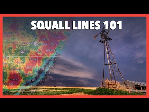
The shelf cloud, a feature associated with squall lines, forms at the front of the storms, signifying where the outflow boundary meets incoming warm air.
These systems develop as individual convective cells organize into a quasi-linear convective system.
Each cell can interact with its neighbors, reinforcing the line’s intensity.
As the storm progresses, it can evolve with varying intensities, impacting areas along its path.
Monitoring these dynamics helps forecasters issue timely warnings for severe weather events associated with squall lines, ensuring public safety and preparedness.
For further insights on the related atmospheric phenomena, see Atmospheric Phenomena.