
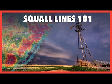
Squall lines are significant weather phenomena that can produce severe thunderstorms and extreme weather conditions. These lines most often form ahead of a cold front.
This setup creates an environment where warm, moist air rises, leading to the development of strong thunderstorms.
As the cold front advances, the contrast between the warm air and the cooler air can generate powerful updrafts within the squall line. This process enhances the potential for severe weather, including heavy rain, hail, and gusty winds.
Understanding the dynamics of squall lines is crucial for predicting when and where these severe thunderstorms will occur, especially for those monitoring conditions for safety or for activities influenced by weather.
Meteorologists closely observe these formations, as they often indicate an increase in severe weather activity. Changes in surface movement play a critical role in the strength and organization of squall lines, making it essential to track their development.
For more insights on the factors influencing squall lines, readers can explore the importance of surface movement in weather patterns.
Characteristics of Squall Lines

Squall lines display distinct features that help identify their formation and structure. They are often linked to severe weather events and can evolve into significant storm systems. Understanding these characteristics is essential for anticipating their impact on the environment.
Formation and Structure
A squall line typically forms ahead of a cold front, where warm, moist air meets cooler, denser air. The rising warm air generates cumulus clouds, which can evolve into organized storms.
This process involves updrafts that lift the moist air to higher altitudes, while the cool air triggers downdrafts. As these systems grow, they often develop an outflow boundary, where the downdrafts push out against the warm air, leading to further storm development.
The structure of a squall line can be quite complex, often featuring a bow echo, which is a bent segment that indicates areas of stronger winds. When conditions are right, these squall lines can transform into a mesoscale convective system or a quasi-linear convective system, capable of producing severe weather.
Types of Squall Lines
Squall lines can be classified into several types based on their characteristics. The most common type includes the bow echo, which forms a noticeable curve on radar. This indicates areas of enhanced wind and strong convective activity.
Another type is the derecho, a widespread and long-lived wind storm associated with a band of rapidly moving showers or thunderstorms.
The mature stage of squall lines is marked by intense rainfall, significant wind gusts, and the potential for tornadoes or hail. During this phase, gust fronts can lead to the formation of new storms.
As squall lines progress, they eventually enter the dissipating stage, where rainfall decreases, and the storms weaken.
Weather Phenomena Associated with Squall Lines
Squall lines are often associated with various weather phenomena that can pose risks. Heavy rain can lead to flash flooding, while strong winds can cause damage to structures and trees.
These storms also produce significant lightning, contributing to hazards during their passage.
The intensity of a squall line can lead to severe thunderstorms, which may spawn tornadoes. When conditions are particularly favorable, the gust front can enhance storm development, resulting in more severe weather.
The presence of hail can also be a concern, especially during the mature stage when updrafts are strong enough to support larger ice particles. For more details about related phenomena, check resources on Electrical Storms and Wind.
Impact of Squall Lines
Squall lines can significantly affect weather patterns and local conditions. These intense weather phenomena often bring heavy precipitation, high winds, and potential hazards. Understanding their impact is crucial for effective forecasting and public safety.
Squall Lines and Severe Weather
Squall lines commonly form ahead of cold air masses and can lead to severe weather events. They produce heavy precipitation and high winds that can create dangerous conditions.
Straight-line winds associated with these systems can exceed 50 mph, causing damage comparable to tornadoes. In some cases, squall lines evolve into derechos, which are widespread windstorms that travel long distances.
Meteorologically, squall lines can exhibit a line echo wave pattern. This unique structure indicates areas of turbulence and wind shear, allowing meteorologists to track their development.
The advancement of Doppler radar systems enhances the ability to pinpoint squall line activity, increasing the accuracy of severe weather warnings.
Predicting and Tracking Squall Lines
Effective weather forecasting plays a vital role in predicting squall lines. Meteorologists use various tools, including Doppler radar, to monitor atmospheric conditions.
Changes in temperature and pressure can signal the potential formation of squall lines. Heavy rain, high winds, and sudden temperature drops can all indicate severe weather is on the way.
Understanding wind shear is also critical. Variations in wind speed and direction at different altitudes can lead to the formation of squall lines.
Timely detection and accurate modeling help emergency management agencies prepare for expected impacts. This preparation is essential for ensuring public safety during severe weather.
Preparation and Safety Measures
Given the potential dangers of squall lines, preparation is key.
Communities need to develop a weather preparedness plan that includes understanding severe weather warnings.
Knowing how to respond to high winds and heavy precipitation can save lives.
Individuals should create an emergency kit with essentials, including water, food, and medical supplies.
Staying informed through local forecasts can provide early warnings about approaching squall lines.
Resources about temperature changes and local climate conditions present useful context for better preparation.
Public safety officials should also conduct drills to ensure effective response strategies.
Preparedness plans should be communicated clearly to minimize confusion during actual events.