When high winds and severe thunderstorms combine, meteorologists may use the term “derecho” to describe a specific kind of wind storm. The term comes from the Spanish word for “straight,” which reflects the storm’s straight-line winds that can cause significant damage.
These destructive winds usually travel in a well-defined path, leaving behind a trail of devastation over a wide area.
Derechos are unique weather events that can occur across various regions, primarily in the central and eastern United States. Unlike tornadoes, which are associated with rotation and cause localized damage, derechos can produce sustained high winds that impact large swathes of land, making them exceptionally dangerous.
Understanding why they are called derechos not only helps clarify the terminology but also highlights the serious nature of these storms.
As meteorologists study these severe thunderstorms, recognizing the characteristics and terminology surrounding derechos becomes essential for effective communication and preparedness. Learning about this fascinating weather phenomenon encourages readers to pay closer attention to storm warnings and remain aware of the potential impacts on their communities.
Meteorological Characteristics and Formation

Derechos are complex weather events that result from specific atmospheric conditions. They develop from severe thunderstorms and are characterized by straight-line winds that can cause significant damage.
Understanding how derechos form and the various types can help in predicting these storms.
Development Conditions for Derechos
Derechos usually form in the late spring and summer months when conditions are ripe. Atmospheric instability is crucial, allowing warm, moist air to rise rapidly.
This rising air is often met with vertical wind shear, which refers to changes in wind speed and direction with height. This shear helps organize the thunderstorm formation into a powerful mesoscale convective system.
As these thunderstorms develop, they can create bow echoes, which are curved lines of storms. This shape is significant because it indicates strong winds.
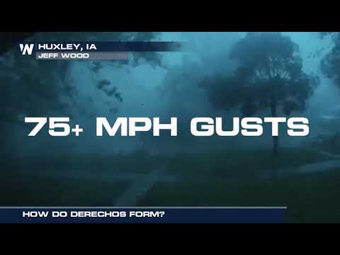
In addition to bow echoes, factors like high pressure systems can provide the necessary environment for derechos to thrive. Once formed, derechos can generate straight-line winds of over 58 miles per hour, with maximum gusts sometimes reaching 130 miles per hour, leading to extensive wind damage.
Derecho Types and Patterns
There are different types of derechos, each with unique features. The serial derecho consists of a series of storms that can develop in a line, causing widespread damage over a large area. In contrast, a progressive derecho has storms that move more quickly and generally affect regions in the eastern United States and central United States.
Another variation is the hybrid derecho, which includes elements of both serial and progressive types. These storms may lead to flash floods and other hazards due to heavy rainfall.
Knowing these types can aid meteorologists in predicting which areas may experience severe weather. Understanding these patterns can also reveal how derechos are influenced by broader atmospheric phenomena. For more insights into storm wind effects, refer to related topics on wind.
Impact, Prediction, and Safety Measures

Understanding the impact of derechos, how to predict them, and the necessary safety measures is crucial for minimizing risk. High winds and potential flooding can lead to serious damages. Awareness and preparation can help protect lives and property when these severe weather events strike.
Assessing Derecho Risks and Damages
Derechos can cause significant damage due to their strong winds, often exceeding 70 mph. These winds can uproot trees, down power lines, and cause widespread power outages.
The National Weather Service utilizes tools like Doppler radar to assess storm systems and provide timely updates. When a derecho approaches, it is essential for communities to be ready for the worst.
Meteorologists analyze previous weather patterns and conditions to determine the risk level. The Storm Prediction Center frequently issues alerts for severe weather, including derechos.
Communities should evaluate their vulnerabilities, such as proximity to large trees or weak structures, which can amplify the risk of wind damage. Additionally, flash floods can occur if heavy rain follows high winds, increasing the danger during and after a derecho.
Forecasting and Response Strategies
Accurate forecasting of derechos relies on advanced technologies and meteorological expertise.
The National Oceanic and Atmospheric Administration employs models that track weather systems to predict severe wind events. These models help identify areas at risk, providing critical information for proactive measures.
Once a derecho is forecasted, communities must implement response plans.
Public safety agencies should disseminate information quickly through social media, radio, and television broadcasts.
Residents should secure outdoor items and prepare for potential outages by creating emergency kits, which include food, water, and first aid supplies.
Staying informed during a derecho is crucial.
Officials encourage individuals to monitor alerts and updates from reliable sources, ensuring they are aware of changing conditions.
Following safety protocols can significantly reduce risks associated with these powerful storms.

