
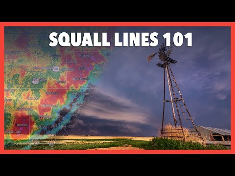
Squall line thunderstorms are unique weather events that can produce strong winds, heavy rain, and severe weather.
A squall line is a line of thunderstorms that can stretch for hundreds of miles and is typically only 10 to 20 miles wide. These systems often form ahead of a cold front and can lead to significant weather changes in a short time.
These thunderstorms usually bring gusty winds and can create dangerous conditions like flooding and wind shear. They are different from supercell thunderstorms, which are known for producing tornadoes. Understanding squall lines helps in anticipating severe weather situations, allowing for better safety measures.
For those interested in atmospheric phenomena, learning about squall lines can deepen knowledge about how various weather systems interact.
Monitoring squall lines is crucial for those in affected regions. By understanding their behavior and characteristics, individuals can be more prepared for the potential impacts of severe weather.
More details on this topic can be explored through articles related to atmospheric phenomena.
Formation and Structure
Squall lines are impressive weather phenomena that form under specific conditions. They typically arise in response to interactions between warm, moist air and cooler, denser air masses.
This section will cover how squall lines develop and the physical traits they exhibit.
Development of Squall Lines
A squall line develops when warm, moist air rises, creating strong updrafts. This process often occurs ahead of a cold front where wind shear—changes in wind speed and direction—enhances the storm’s organization.
As the air rises, cumulonimbus clouds form, which can lead to intense thunderstorms.
These storms become organized into a linear structure known as a mesoscale convective system (MCS). They can maintain their strength for several hours, often producing heavy precipitation, lightning, and sometimes hail. Doppler radar is useful for monitoring and predicting the development of these systems.
Physical Characteristics
Squall lines typically have distinct physical traits. They are often characterized by a shelf cloud observed at the leading edge, which indicates strong downdrafts and gust fronts pushing out from the storm. This can create a dramatic appearance, hinting at the severe weather ahead.
The storms within a squall line can develop into a bow echo, a specific shape seen on radar that indicates strong winds. These systems are known for heavy rainfall, gusty winds, and frequent lightning.
In a well-formed squall line, individual storm cells may merge, contributing to both severity and duration of the event.
Impact and Safety Measures

Squall line thunderstorms can bring various weather phenomena that pose risks to safety, especially in aviation. Understanding these impacts is vital for preparedness. Being aware of preventive actions can significantly reduce incidents and enhance flight safety during these storms.
Weather Phenomena Associated with Squall Lines
Squall lines often produce severe weather effects, including heavy rain, strong winds, hailstones, and even tornadoes.
Such storms may develop rapidly and can lead to extreme wind damage. For instance, a squall line can generate wind gusts exceeding 60 mph, creating hazardous conditions for pilots and ground operations.
Doppler radar plays a critical role in tracking these storms. It helps meteorologists identify features like mesoscale convective complexes (MCC), indicating substantial storms forming within a squall line. A derecho, a widespread straight-line windstorm, can also result from these storms, leading to significant property damage and risks to life.
Preventive Actions and Predictions
Effective safety measures involve monitoring weather forecasts issued by the National Weather Service and the Storm Prediction Center.
Pilots should stay updated on squall line developments, utilizing Doppler radar for real-time data.
Advance warning systems help in making timely decisions, like avoiding flight paths through developing squall lines.
Preparing for turbulence due to these storms is essential for flight safety.
Additionally, operators and air traffic control must coordinate to manage aircraft during severe weather.
Staying informed can prevent dangerous situations.
Resources on electrical storms provide valuable insights into safety practices as well.
Taking precautionary steps when squall lines are predicted ensures better protection against the impacts of severe weather.