
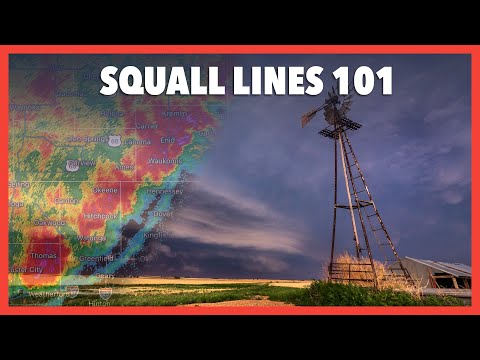
A squall line is a fascinating weather phenomenon that can produce intense and severe thunderstorms. These lines of storms often form along or ahead of cold fronts, leading to powerful winds and heavy rainfall.
Understanding how a squall line works can help individuals prepare for sudden weather changes and ensure safety during storms. A squall line operates by lifting warm, moist air, which fuels thunderstorms and creates a distinct line of severe weather.
As the squall line develops, downdrafts create a gust front. This gust front pushes cold air out ahead of the storms, lifting warmer air and maintaining the thunderstorm’s strength.
The combination of these strong winds and rising air helps sustain thunderstorm activity, making squall lines capable of lasting for several hours. Meteorologists closely track these systems to issue warnings and keep the public informed.
Formation and Structure
Understanding how squall lines form and their structure helps in predicting their impact. Squall lines are linked to specific atmospheric conditions that contribute to their development and characteristics.
Development of Squall Lines
Squall lines typically develop along or ahead of a cold front. They form when warm, moist air rises, creating instability in the atmosphere.
As this air ascends, it cools, promoting the creation of cumulus clouds. Wind shear, which is the change in wind speed and direction with altitude, plays a critical role. Strong wind shear can lead to rotating storms within the squall line.
As the warm, moist air rises, it encounters cooler air at higher altitudes. This interaction results in an updraft, vital for the formation of towering cumulonimbus clouds.
When enough moisture condenses, thunderstorms emerge. The continuous inflow of warm air and the forcing of cold air help sustain these storms.
The gust front from the storm can also trigger new updrafts, leading to new cells forming. For more on atmospheric factors, check out articles on atmospheric phenomena.
Characteristics of Squall Lines
Squall lines are distinguished by their long, narrow shape and intense precipitation. They can extend for hundreds of miles and often produce heavy rainfall.
The structure usually consists of a well-defined leading edge where moist air is forced up.
Heavy precipitation is common, but the squall line’s most dangerous feature is the potential for severe thunderstorms that produce strong winds, hail, and even tornadoes.
The temperature differences between air masses create a significant energy source. Humidity levels can enhance the storm’s intensity, resulting in sudden and severe weather changes. Observing wind patterns is crucial, as they signal the approach of a squall line. For more on wind factors influencing these storms, explore articles on wind, as they are essential to the understanding of squall line dynamics.
Impact on Environment and Society

Squall lines significantly influence both weather phenomena and human activities. These weather systems can lead to various severe conditions while also interacting with daily life, especially in terms of safety and preparedness.
Weather Phenomena Associated with Squall Lines
Squall lines are often linked with severe weather conditions, including heavy precipitation, strong winds, and turbulence. They can produce lightning, hail, and tornadoes, posing risks to both people and infrastructure.
When these systems develop, they may create a bow echo pattern on radar, indicating intense wind gusts.
During their passage, squall lines can lead to icing conditions for aircraft flying in affected areas. Pilots must prepare using their Pilot Operating Handbook and refer to weather radar data to adjust flight plans accordingly.
These weather systems are part of a larger complex called a mesoscale convective system, which can extend over vast regions. They may also form as derechos, which are long-lived wind events causing widespread damage.
Interactions with Human Activity
The effects of squall lines extend into daily life and activities, especially in regions prone to severe weather.
The National Weather Service monitors these phenomena to provide timely warnings to the public.
Awareness is crucial, as squall lines can disrupt outdoor events, transportation, and emergency services.
In aviation, turbulence penetration speed becomes important when navigating through squall lines.
Pilots must utilize advanced weather data to ensure safety and maintain visibility during flights.
The impacts can also affect ground transportation, leading to hazardous driving conditions due to strong winds and heavy rain.
Communities must remain vigilant and utilize resources, such as alerts about electrical storms, to enhance safety during these weather events.