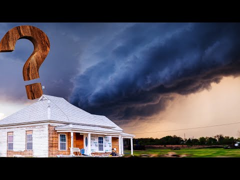
A shelf cloud is a dramatic sight, often appearing as a low-hanging formation during thunderstorms. Many people wonder whether these clouds can produce a tornado.
The answer is that while shelf clouds themselves do not generate tornadoes, they are often associated with severe weather conditions that can lead to tornado formation.
These clouds form at the leading edge of a thunderstorm, indicating a strong downdraft and potential for severe winds. Although they create a visually striking appearance, understanding their role in storm dynamics is crucial for weather safety.
Recognizing this link helps in assessing weather risks during severe storm events, allowing communities to stay informed and prepared.
By exploring the characteristics of shelf clouds, tornadoes, and the thunderstorms that spawn both, readers can gain valuable insights into severe weather phenomena. This knowledge not only fuels an appreciation for the power of nature but also enhances safety awareness during storm season.
Shelf Cloud Characteristics and Formation

Shelf clouds are unique weather phenomena often associated with severe thunderstorms. They present distinct features and form under specific conditions. Understanding these aspects helps in identifying the potential for severe weather.
Defining Shelf Clouds
Shelf clouds are a type of arcus cloud that form at the leading edge of a thunderstorm, typically a cumulonimbus cloud. They appear as a low, horizontal cloud formation that can look smooth or wedge-shaped. Shelf clouds are often darker at the bottom, indicating moisture and turbulence.
These clouds usually develop when cold air from a downdraft pushes beneath warm, moist air. As the warm air rises, it can create a dramatic visual structure. The cloud typically extends along the gust front, which signifies the boundary where the cold outflow meets the warm air.
Conditions for Formation
Several conditions must be met for shelf clouds to form effectively.
Firstly, high humidity in the atmosphere is essential. This allows adequate moisture to condense into cloud form.
Next, a strong updraft is needed, which occurs when warm air rises quickly through the colder air around it. This lifting action can generate turbulence, promoting the formation of clouds.
Additionally, the presence of a gust front is crucial.
As cold air undercuts the warm air ahead of a thunderstorm, it enhances the cloud development. If strong enough, this mechanism can lead to shelf clouds that precede severe weather events. Recognizing these conditions informs meteorologists about potential storm development.
Tornado Development from Storm Systems

Tornadoes often develop from specific storm systems under certain conditions. Understanding the details of these systems is crucial in predicting tornado potential during severe weather events.
Supercell and Tornado Genesis
Supercells are a primary type of thunderstorm known for their ability to produce tornadoes. They are characterized by a rotating updraft called a mesocyclone. This rotation is essential for tornado formation.
When conditions are right, the wind shear—the change in wind speed and direction at different altitudes—can create a strong updraft.
In this environment, the mesocyclone can develop into a wall cloud. This is a lower area in the storm where rotation is intensified. If a funnel cloud forms beneath this wall cloud and reaches the ground, it becomes a tornado. Supercells also bring heavy rain, strong downdrafts, and hail, contributing to their severe nature.
Distinguishing Shelf Clouds and Tornado Potential
Shelf clouds are a distinct feature often seen at the leading edge of thunderstorms. They form when cool, dense air from downdrafts pushes warm air upward, creating a shelf-like appearance.
While shelf clouds can signal severe weather, they do not directly produce tornadoes. Occasionally, small tornadoes can occur at the leading edge of these clouds, but this is rare.
Tornado potential significantly increases when a wall cloud is present below a supercell. Radar can help identify these features, allowing meteorologists to assess the risk of tornado formation. Recognizing the difference between shelf clouds and wall clouds is crucial for predicting tornado activity.

