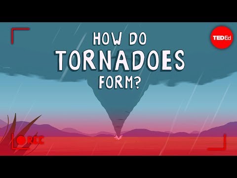
Tornadoes are often linked to intense thunderstorms, but the question arises: do they only form in supercells? The answer is no; while supercells are the primary producers of tornadoes, they are not the only type of storm that can spawn these dangerous weather events.
Tornadoes can also occur in other types of thunderstorms, although these cases are less common.
Supercells are distinguished by their rotating nature, which is key to tornado formation. These storms can create an environment where tornadoes can thrive, often resulting in the most severe tornadoes observed.
In contrast, some non-supercell thunderstorms, like those formed during squall lines, can also produce tornadoes under certain conditions.
Understanding tornado occurrence helps in preparing for severe weather events. The knowledge about where and how tornadoes develop provides crucial information for safety measures and alerts.
By exploring the different types of thunderstorms and their potential for tornado formation, readers can gain insight into this complex but fascinating aspect of meteorology.
Supercell and Tornado Formation

Supercells play a crucial role in tornado formation. They are distinct types of thunderstorms characterized by rotating updrafts known as mesocyclones.
Understanding their unique features and the dynamics behind tornado development offers insight into why most tornadoes occur within these powerful storms.
Characteristics of Supercells
Supercells are the most organized and severe type of thunderstorm. They typically have a well-defined rotation and can last for several hours.
One key feature is the presence of a rotating updraft called a mesocyclone, which can extend into the storm.
These storms are supported by significant wind shear, which refers to the change in wind speed and direction at different heights. High levels of wind shear contribute to the strength and longevity of supercells.
The combination of warm, moist air near the surface and cooler, drier air aloft often fuels the development of these thunderstorms.
Tornado Development in Supercells
Tornadoes develop from supercells when conditions are optimal. The process, known as tornadogenesis, usually occurs within the rotating updraft.
If the wind shear is strong enough, the rotation near the ground can intensify, ultimately leading to the formation of a tornado or funnel cloud.
Not every supercell produces a tornado, but those that do typically exhibit strong rotation and significant updrafts.
The tornadoes formed from supercells tend to be more powerful and long-lasting compared to those spawned from other storm types.
Understanding Wind Shear and Updrafts
Wind shear is essential for the formation of supercells and tornadoes. It creates the rotation necessary for developing a mesocyclone.
As warm, moist air rises, it encounters cooler air, generating instability in the atmosphere.
Strong wind shear helps tilt the rotating air from horizontal to vertical, which enhances the potential for tornado development.
This rotation becomes concentrated, and if the updraft is strong enough, it will continue to develop and potentially produce a tornado.
The Role of the Rear Flank Downdraft
The rear flank downdraft (RFD) is a significant feature of supercell storms. It occurs when cool air descends at the back of the storm, wrapping around the mesocyclone.
The RFD can interact with the warm, rising air around it, intensifying rotation.
This dynamic interaction can lead to increased rotation and help to tighten the mesocyclone. When conditions align perfectly, this can initiate the process of tornadogenesis, transforming the rotation into a visible tornado.
Understanding the role of the RFD is crucial for meteorologists tracking supercells. For more insight into the impact of wind, visit articles about wind.
Tornadoes Outside of Supercells

While most tornadoes originate from supercell thunderstorms, there are other types that can form under different conditions. These tornadoes can occur in various weather situations, including thunderstorms that are not classified as supercells.
Non-Supercell Tornado Types
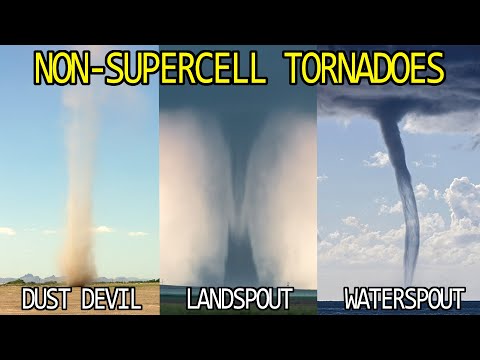
Non-supercell tornadoes can form in setups such as squall lines or quasi-linear convective systems. These types of storms often have organized areas of thunderstorms, but they lack the rotating updrafts typical of supercells.
One common type of non-supercell tornado is the landspout. Landspouts develop when warm, moist air rises and interacts with a cooler environment, usually near the ground.
These tornadoes are weaker than their supercell counterparts, typically producing lower wind speeds.
Another variety is tornadoes associated with strong shear in the atmosphere. These can develop quickly and may not produce significant damage. Non-supercell tornadoes often form in regions like Tornado Alley, where thunderstorms frequently occur.
Landspouts and Waterspouts
Landspouts are a type of non-supercell tornado that typically forms over land. They arise from strong wind shear and a diagonally moving updraft but do not require the presence of a supercell.
Landspouts tend to be short-lived and less intense than traditional tornadoes, but they can still cause localized damage.
Waterspouts, in contrast, form over water. They often develop from the same conditions that produce landspouts. Waterspouts can move onshore and become tornadoes if they maintain their strength.
Both landspouts and waterspouts lack the rotating structure seen in supercells, yet can still pose dangers to boats and coastal areas.
