
Cyclones, which are powerful storms forming over warm ocean waters, can indeed strike the United States.
Atlantic hurricanes are the most common type of tropical cyclones to make landfall in the U.S., impacting coastal regions and sometimes bringing severe weather inland. These storms are categorized based on their wind speeds, with major hurricanes causing significant damage and disruption.
The hurricane season runs from June to November, with the peak typically occurring in late summer.
During this time, the potential for tropical storms and major hurricanes increases, leading to heightened awareness and preparation along the coast.
Many notable storms have left a lasting impact on American history, reflecting the importance of studying these atmospheric phenomena for better forecasting and public safety.
For those interested in understanding more about these extreme weather events, exploring the dynamics of how tropical cyclones form and strengthen can be enlightening.
The implications of such storms are significant, not only due to the potential for destruction but also in terms of forecasting and climate change considerations. This knowledge plays a crucial role in preparing for future hurricane seasons and mitigating risks associated with landfalling storms.
Historical Impact of Cyclones in the USA
Cyclones have significantly shaped the history and landscape of the United States. These powerful storms have caused widespread devastation through their strong winds, flooding, and storm surges. Understanding their impact helps highlight the importance of preparation and monitoring.
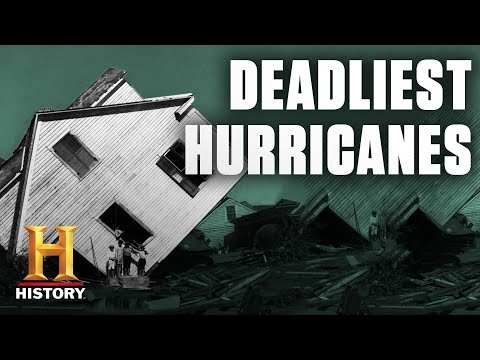
Devastating Cyclones and Their Legacy
The United States has faced many devastating cyclones throughout its history.
Hurricane Katrina in 2005 stands out as one of the deadliest, causing severe flooding and an economic toll of over $100 billion. It claimed more than 1,800 lives and displaced thousands.
Hurricane Andrew in 1992 was another major storm, causing immense destruction in Florida and Louisiana.
The Galveston Hurricane of 1900 remains the deadliest hurricane in U.S. history, killing around 8,000 people. More recent storms like Hurricane Harvey in 2017 have shown that even in modern times, cyclones can still cause catastrophic flooding.
Hurricanes like Camille and Michael also left their mark, with hurricane-force winds and extensive damage. Each storm serves as a reminder of nature’s power, leading to better preparedness efforts.
Tracking and Preparing for Tropical Cyclones
The National Hurricane Center (NHC) plays a crucial role in monitoring and tracking cyclones. They provide essential tools like forecast models and tropical cyclone products to predict storm paths and intensity. This data is vital for issuing alerts and warnings, such as storm surge watches.
The NWS Hurricane Prep Week emphasizes the importance of planning for storms.
Communities are encouraged to have emergency kits and evacuation plans. Education on hurricane safety is crucial, especially in coastal areas prone to hurricanes from the Atlantic and Gulf of Mexico.
The damage from past storms like Hurricane Ian reminds us to take preparedness seriously.
Proper action before a storm can save lives and reduce economic impacts. Stronger building codes and community awareness have become essential in navigating these fierce weather events. For more on storm impacts, check out details about electrical storms.
Scientific and Technical Understanding of Cyclones
Cyclones are complex weather systems that scientists study to predict their behavior and impact. This section explores their characteristics and classification, as well as the technological tools used for monitoring and research.
Characteristics and Classification of Tropical Cyclones
Tropical cyclones are classified based on their sustained wind speeds and pressure.
The Saffir-Simpson Hurricane Wind Scale categorizes these storms from 1 to 5, with Category 5 representing the most intense hurricanes. This classification relies on sustained wind speeds, with Category 5 boasting speeds exceeding 157 mph (252 km/h).
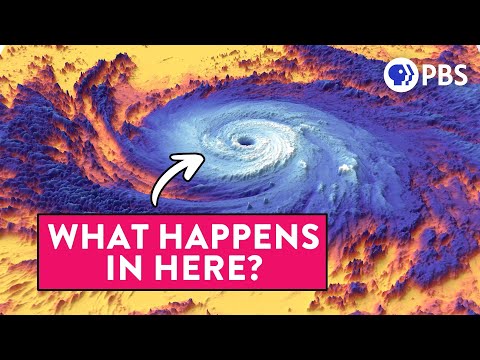
Key components of cyclones include the eye, a calm center, surrounded by the eyewall, where winds are strongest. The storm surge is a critical hazard, as it raises sea levels, leading to coastal flooding. Understanding these characteristics helps organizations like the National Hurricane Center in forecasting and issuing warnings.
Technological Advancements in Hurricane Monitoring and Research
Advancements in technology have greatly improved cyclone monitoring and forecasting.
The National Oceanic and Atmospheric Administration (NOAA) uses satellite imagery and radar imagery to track storms. These tools provide real-time data on cyclone intensity and movement.
Aircraft reconnaissance collects direct data from within storms. This firsthand information allows meteorologists to verify forecasts.
Additionally, the development of tropical analysis tools enhances understanding of storm behavior.
The tropical weather outlooks and tropical cyclone advisory are vital for public safety.
Resources like audio/podcasts and RSS feeds keep the public informed about changing weather conditions.
With these tools and techniques, scientists continue to improve the accuracy of forecasts, ultimately reducing the risks associated with these powerful storms.