
Line thunderstorms, often referred to as squall lines, are fascinating weather phenomena that form in specific atmospheric conditions.
These storms develop when warm, moist air rises quickly, creating a continuous line of thunderstorms that can stretch for hundreds of miles. Understanding how these storms come together helps people prepare for the severe weather they can bring, including strong winds and hail.
When conditions are right, a squall line can emerge, typically along or ahead of a cold front. As the cooler air moves in, it forces the warm air upward, leading to the formation of new thunderstorm cells.
This chain reaction can keep the line of storms active for several hours, making it essential for weather watchers to stay alert during these events.
For those interested in the science behind severe weather, grasping how line thunderstorms form is key. It not only sheds light on the dynamics of the atmosphere but also highlights the importance of being prepared for the intense weather that often accompanies these storms.
Fundamentals of Thunderstorm Formation
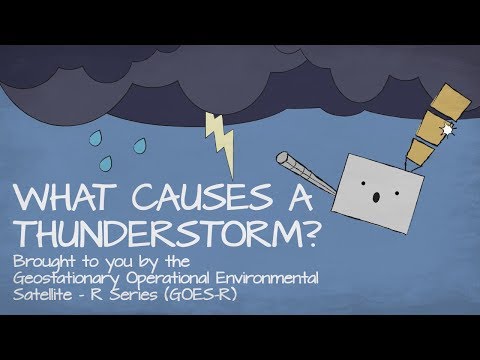
Thunderstorm formation depends on specific atmospheric conditions and the interaction between temperature and moisture. Understanding these factors helps clarify how storms develop and release energy.
Atmospheric Conditions for Thunderstorms
Three primary conditions must be present for thunderstorms to form: moisture, lift, and instability.
Moist air is crucial, as it provides the humidity needed for cloud and precipitation formation. When the dew point is high, more moisture is present in the air, increasing the potential for storms.
Lift is the rising of air, which can occur through various mechanisms. Examples include frontal boundaries, where warm air is forced over colder air, and orographic lift, where air rises over mountains.
Updrafts are essential, moving warm, moist air upwards.
Instability in the atmosphere allows these updrafts to grow stronger. The combination of warm, moist air rising and the presence of dry air above creates conditions for significant convection, feeding into the storm development process. These interactions can lead to powerful thunderstorms. For more details on electrical phenomena during storms, visit Electrical Storms.
Role of Temperature and Moisture
Temperature plays a vital role in the development of thunderstorms. Warm air is lighter than cold air, which makes it rise. When this warm moist air rises, it cools and condenses, forming clouds.
Several factors influence this: the humidity level and temperature variations across different layers of the atmosphere.
Moisture content is critical for storm strength. Higher humidity leads to more intense storms, as the air contains more moisture for the clouds to work with. As warm air rises, it encounters cooler air, which can lead to convection, generating powerful upward movements.
Understanding the interplay between temperature and moisture helps predict storm intensity. Tracking shifts in these conditions ensures better storm forecasting. To learn more about temperature effects, refer to articles on Temperature.
Dynamics of Line Thunderstorms

Line thunderstorms, also known as squall lines, are complex weather systems characterized by a narrow band of severe storms. Understanding their formation and behavior is crucial for predicting severe weather events.
These storms are influenced by various dynamic forces and exhibit specific features that set them apart from other types of thunderstorms.
Development of Squall Lines
Squall lines typically develop in response to atmospheric instability. Warm, moist air near the surface rises and meets cooler, drier air above, creating conditions ripe for thunderstorm development. As the air ascends, it cools, causing water vapor to condense and form clouds.
Wind shear plays a significant role in maintaining these thunderstorms. This refers to the change in wind speed or direction with height.
Strong wind shear can help organize thunderstorms into a line, allowing them to persist longer than typical single-cell storms. This organization often leads to the creation of a mesoscale convective system, which can produce a line of severe thunderstorms.
The forward momentum of the line is driven by gust fronts, which are created by downdrafts pushing cool air out from the storm. This can enhance lifting along the leading edge, causing new thunderstorms to form. Squall lines can evolve into dangerous systems, producing heavy precipitation, hail, and even tornadoes as they move.
Characteristics of Severe Line Thunderstorms
Severe line thunderstorms often exhibit distinct features. One noteworthy characteristic is the presence of a bow echo, which indicates strong winds and potential for straight-line damage.
This formation occurs when the storm’s outflow pushes the line outward, creating a bow shape on radar.
These storms can also bring heavy precipitation that may lead to flash flooding. The intense rainfall is often accompanied by strong winds and hail, posing risks to people and property.
The rapid downdrafts associated with severe storms can create downbursts, which can cause significant damage.
In extreme cases, squall lines can develop into a derecho, a widespread and long-lived windstorm that produces destruction over a large area.
Monitoring storm conditions, like wind shear and atmospheric pressure, helps forecasters predict the likelihood of these severe phenomena.
To learn more about wind impacts, visit relevant articles on wind.