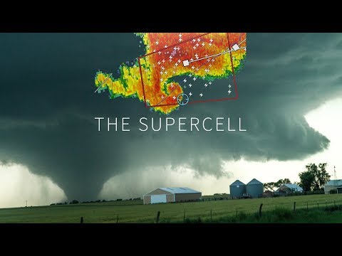
Supercells are a fascinating type of thunderstorm that can cause severe weather, including damaging winds and tornadoes. They are the least common type of thunderstorm, yet have the highest potential for severe impact.
While many people might think of thunderstorms as simply rain and occasional lightning, supercells can last for hours and travel great distances, resulting in significant hazards.
These powerful storms form under specific atmospheric conditions, making them a rare event compared to other thunderstorm types.
Regions prone to supercells, such as parts of the United States, often experience these intense storms during certain seasons. Understanding just how common supercells are can help individuals prepare for the risks they bring.
With a closer look at the factors that contribute to their formation, readers can appreciate the complexity of supercells and the importance of monitoring weather conditions. This knowledge is essential for anyone interested in severe weather, whether for safety or curiosity.
Supercell Characteristics and Formation

Supercells are unique and powerful thunderstorms that exhibit certain distinctive traits and formation processes. Understanding these features is crucial for predicting their behavior and assessing the potential for severe weather, such as tornadoes.
Defining Supercells
A supercell is a type of thunderstorm that is characterized by a rotating updraft known as a mesocyclone. It is different from other storm types due to its long lifespan and ability to produce severe weather, including hail, strong winds, and violent tornadoes.
Supercells are categorized into various types, such as classic, high-precipitation, low-precipitation, and miniature. These storms often form in environments with significant instability and moisture, which allows for enhanced vertical growth, leading to towering cumulus clouds that can develop into severe thunderstorms.
The Role of Wind Shear
Wind shear is crucial to the formation of supercells. It refers to the change in speed and direction of winds at different altitudes.
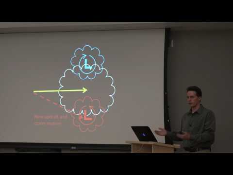
Strong vertical wind shear creates an environment where the updraft can tilt and strengthen, allowing it to become organized. This process helps separate the updraft from the downdraft, enhancing the storm’s structure.
Without adequate wind shear, storms tend to remain less organized and may not produce the severe weather typically associated with supercells. The presence of wind shear is essential for supporting the mesocyclone, which is key to the storm’s powerful rotation.
Updrafts and Downdrafts
Supercells have distinct updrafts and downdrafts that work together in a complex system. The updraft is the rising air that allows moisture to condense and form precipitation.
In supercells, this updraft is typically strong and sustained, leading to the formation of an anvil cloud at the top. On the other hand, downdrafts are areas of sinking air that can create precipitation and strong winds.
The relationship between the updraft and downdraft is vital for maintaining the storm’s longevity and intensity. When these elements are well-organized, supercells can produce significant weather events, including heavy rains and hail, as well as tornadoes.
The Mesocyclone Element
The mesocyclone is the heart of a supercell. It is a deep, rotating updraft that is key to the storm’s intensity.
The presence of a mesocyclone indicates that the storm has reached a mature stage, capable of producing severe weather. As the mesocyclone intensifies, it can lead to the development of a tornado.
Monitoring this aspect helps meteorologists assess the potential for dangerous weather. The understanding of how mesocyclones interact with wind patterns, moisture levels, and overall atmospheric conditions is crucial for accurate storm forecasting. For more information about these atmospheric phenomena, see articles on atmospheric phenomena.
Supercell Types and Associated Phenomena

Supercells come in different types, each with unique features and storm behaviors. Understanding these classifications, their life cycles, and associated weather patterns can help explain their impact on the environment.
Classic, High-Precipitation, and Low-Precipitation Supercells
Supercells are categorized into three types: classic, high-precipitation (HP), and low-precipitation (LP).
-
Classic Supercells are known for their rotating updrafts and can produce large hail, tornadoes, and damaging winds. They often have a well-defined wall cloud and a hook echo on radar reflectivity.
-
High-Precipitation Supercells produce heavy rainfall and strong winds but have less defined structure. They can lead to flash flooding due to the intense downpours and may not always produce tornadoes.
-
Low-Precipitation Supercells have less overall precipitation and are often mistaken for typical thunderstorms. They still can produce large hail, but the associated rain is minimal, and these storms can last for extended periods.
These types illustrate varying severity and risks associated with supercells.
Life Cycle of a Supercell
The life cycle of a supercell typically includes three stages: initiation, mature, and dissipating.
-
Initiation occurs when conditions such as wind shear and moisture come together. This sets the stage for a storm to form.
-
Mature Stage sees significant development, where updraft and downdraft coexist. This phase can last for hours, allowing for dangerous thunderstorms to develop, producing large hail, damaging winds, or even tornadoes from the wall cloud.
-
Dissipating Stage happens when the storm loses strength. Rain falls less intensely, and the storm eventually weakens. Even in this phase, some severe weather like downbursts can still occur.
Supercell Weather Patterns
Supercells can produce various weather phenomena, which can vary by type.
-
Large Hail forms when updrafts are strong enough to carry ice particles to higher altitudes, where they accumulate more layers before falling.
-
Damaging Winds can occur in all supercell types, but are particularly noted in HP supercells.
-
Flash Flooding is a risk due to the intense downpours, especially with HP supercells, leading to rapid water accumulation.
-
Tornadoes are most commonly generated from classic supercells, especially when a well-defined wall cloud appears.
Furthermore, the unique storm cloud formations indicate potential risks, making radar and real-time observation critical for safety.
For more insights on storm behavior, different aspects of surface movement can be explored.
