
Floods are among the most devastating natural disasters, impacting communities and ecosystems alike.
Scientists predict floods by using a combination of real-time rainfall data, river stage measurements, and historical storm patterns. This approach provides crucial insights into when and where flooding might occur, helping to save lives and reduce damage.
To understand flood prediction, it’s important to consider the hydrological cycle. This cycle describes how water moves within the environment, influencing rainfall patterns and river flow.
Scientists analyze this data to build models that forecast potential flooding risks during severe weather events, such as hurricanes.
With advancements in technology, including satellite data and sophisticated computer models, experts can better assess flood risks. This ongoing development improves the accuracy of predictions, allowing communities to prepare and respond effectively when floods threaten their regions.
Predictive Methodologies and Tools

Scientists use various methodologies and tools to predict floods accurately.
These approaches combine historical data, technological advancements, and climate data to assess flood risks and provide timely warnings.
Historical Data and Hydrological Models
Historical data is essential for flood prediction. Scientists analyze past rainfall patterns, river stages, and flood events within drainage basins. This information helps create hydrological models that simulate how water flows across land and within rivers.
These models consider factors such as ground temperature and snowpack levels. For example, snowpack data can indicate how much water may flow into rivers as it melts. Streamflow-gaging stations provide real-time data about river levels, which is crucial for flood forecasts.
By integrating historical patterns with real-time data, hydrological models become powerful tools for predicting flooding events accurately.
Technological Advancements in Prediction
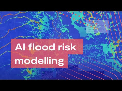
Recent advancements in technology have improved flood prediction capabilities. Satellite data from organizations like NASA provides critical information about precipitation, soil moisture, and vegetation. This data helps scientists understand how much water will drain into river systems.
Moreover, machine learning and artificial intelligence enhance predictive modeling by analyzing vast amounts of data quickly. These technologies can identify patterns that humans might miss, improving the accuracy of flood forecasts.
Using advanced models, scientists predict not only the likelihood of flooding but also its potential impact on communities and infrastructure.
Application of Climate Data
Climate data plays a significant role in flood prediction, especially in the context of climate change.
Scientists analyze long-term trends in rainfall and temperature to assess how future conditions might affect flood risks.
For instance, changes in rainfall patterns can increase the frequency and intensity of floods. The NOAA provides valuable climate data that helps researchers understand these trends.
By applying this climate information to existing models, scientists can better forecast the magnitude of flooding, taking into account changing weather patterns and their potential impacts on river stages. With accurate flood predictions, communities can prepare more effectively for potential disasters.
Impact Assessment and Risk Management
Effective flood prediction requires thorough impact assessment and risk management strategies. These approaches help identify vulnerable areas and improve response efforts, especially as climate change increases the likelihood of extreme floods.
Evaluating Flood Prone Regions
Assessing regions at risk of flooding involves analyzing several factors. Topography plays a crucial role, as steep slopes can lead to rapid water runoff. Soil-moisture conditions also affect how much rain the ground can absorb. Vegetation cover helps in slowing water flow, while areas with impermeable land like urban settings increase runoff rates.
The National Weather Service uses this data to develop flood predictions. They create flood watches to alert communities in flood-prone areas, helping them prepare effectively.
Advancing Flood Warnings and Responses
Advancements in technology enable better flood warning systems. Real-time rainfall data and hydrological models help predict flooding more accurately.
The integration of satellite data allows for monitoring ungauged watersheds, which are areas without measuring stations. Communities gain access to timely alerts, enabling effective responses to minimize damage.
The coordination between local authorities and emergency management teams is essential. Using established protocols assists in resource allocation during natural disasters, ensuring a swift response to changing conditions.
Future Flood Preparation Strategies
Looking forward, strategies for flood preparation must evolve.
Communities need to integrate climate models that consider anthropogenic climate change impacts.
Improved infrastructure, like better drainage systems and flood barriers, can mitigate risk.
Additionally, public education on the importance of flood readiness is vital for community resilience.
Simulation exercises can prepare emergency responders for various scenarios.
Adopting a proactive stance allows for more effective management of potential flooding incidents.
Access to updated data on changing weather patterns is crucial for informed decision-making.
Knowledge of water control measures can also aid municipalities in reducing vulnerability to flood events, promoting sustainable development.
For more on water-related risks, check out articles on water issues.