
When a hurricane strikes the Gulf Coast of Florida, storm surge can pose a significant threat. A common question during such events is just how far inland an 8-foot storm surge can travel.
Research indicates that an 8-foot storm surge can extend up to 15 miles inland, depending on factors like local topography and the strength of the storm.
Meteorologists, including experts from the National Hurricane Center, emphasize the importance of understanding storm surge risks during hurricane season.
Evacuations may be necessary not only for beachfront properties but also for areas well inland that could be affected.
As storms become more intense due to changing climate conditions, the impact of storm surge remains a pressing concern for residents living along the coast.
By staying informed and prepared, communities can better protect themselves from the dangers associated with hurricanes and their accompanying storm surges.
This knowledge is crucial for making safe decisions during emergencies and safeguarding lives when nature unleashes its fury.
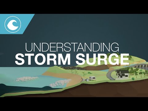
Predicting and Modeling Storm Surge

Understanding how far inland a storm surge can reach is crucial for effective preparedness.
Predicting and modeling storm surges involves understanding their mechanics, the current forecasting techniques used by experts, the technology that enhances these predictive models, and learning from past events like Hurricane Milton.
Understanding Storm Surge Mechanics
Storm surge refers to the rise in water level caused by a hurricane or tropical cyclone. This increase typically occurs due to strong winds, low pressure, and wave action.
Water is pushed toward the shore, creating a surge that can be especially dangerous.
The height of the storm surge is influenced by several factors, including the hurricane’s forward speed, coastal topography, and storm tide.
For example, a Category 5 hurricane can produce exceptionally high surges, potentially exceeding 20 feet. The effects can vary widely, as coastal areas with steep beaches may experience less surge penetration than flat, wide areas.
Current Forecasting Techniques
Meteorologists employ various forecasting models to predict storm surge height and inundation areas. These models utilize simulations of atmospheric conditions, wind patterns, and ocean behavior.
The National Hurricane Center (NHC) continuously updates these forecasts to provide real-time information.
Current techniques include combining hydrodynamic models with statistical methods. This ensures accuracy by analyzing historical data from past hurricanes like Hurricane Katrina and Hurricane Ian.
Additionally, surge watches are issued to alert communities of the potential flood risk and provide crucial time for evacuations if needed.
Use of Technology in Surge Prediction
Technology plays a pivotal role in storm surge forecasting.
Advanced modeling requires high-performance computers to simulate storm behavior accurately. Satellites and aerial reconstructions gather real-time data on sea levels and wave action.
Tools like NOAA’s Sea, Lake, and Overland Surges from Hurricanes model allow scientists to simulate the potential impacts of storm surge.
These simulations help predict not only the height of surges but also how far they can penetrate inland, which is vital for emergency response strategies.
Case Study: Hurricane Milton
Hurricane Milton, which occurred in 1996, serves as a learning point for storm surge prediction.
During this hurricane, models inaccurately forecasted the surge’s extent, causing much of the damage in coastal areas. The surge flooded areas unexpectedly, demonstrating the need for continual improvement in forecasting methods.
The lessons learned from Hurricane Milton have led to better modeling practices and improved communication from agencies like the NHC.
Now, by examining past storm data, meteorologists can provide more accurate predictions of storm surge reach and height, enhancing community preparedness for future events.
The Impact of Storm Surge on Coastal Regions
Storm surge can severely affect coastal regions, leading to significant risks for both communities and infrastructure. Understanding vulnerabilities, historical responses, evacuation procedures, and mitigation strategies is crucial for preparedness against future storm events.
Assessing Regional Vulnerabilities
Coastal areas are particularly vulnerable to storm surge due to their geography and proximity to the ocean. The angle of approach of a storm affects how it interacts with the coastline, influencing the height of the surge.
Regions along the Gulf Coast and East Coast face high risks, especially during hurricanes. Areas such as barrier islands and wetlands can absorb some floodwaters, but they also threaten local infrastructure when overwhelmed.
Moreover, rising sea levels exacerbate the impact of storm surge. As water rises, more inland areas become at risk during extreme weather events.
Communities must assess their specific vulnerabilities, focusing on elevation, existing barriers, and proximity to evacuation zones.
Historical Impacts and Responses
Storms like Hurricane Katrina and Hurricane Sandy provide insights into the destructive power of storm surges.
Historical summaries reveal that surged water heights significantly contributed to flooding and destruction in many coastal communities. In southwest Louisiana, for instance, the surge from Hurricane Ike pushed water inland for approximately 30 miles.
In response to such events, emergency management practices have evolved. Communities have implemented stricter building codes and zoning regulations.
These measures are aimed at reducing the impacts on homes and businesses in vulnerable areas. Understanding these historical events guides future preparations and responses, helping to save lives and property.
Evacuation and Public Safety
Evacuation is a critical part of storm safety. Local authorities use predetermined evacuation zones to facilitate quick responses to approaching storms.
Public awareness campaigns educate residents on when to leave and where to go. This preparedness can significantly reduce the risk of casualties during significant storm surges.
During these times, communication is vital.
Alerts about predicted surge heights and landfall timelines should be disseminated rapidly. Residents along the coast must stay informed about hurricane safety and rainfall forecasts that could amplify surge impacts.
Efforts must continue to enhance evacuation routes and public transportation options, ensuring they can handle large numbers of evacuees efficiently.
Mitigation Strategies and Infrastructure
To combat storm surge impacts, communities invest in infrastructure improvements. Building levees and sea walls are common approaches to protecting low-lying areas.
These barriers can help minimize water intrusion during storms, but they need regular maintenance to remain effective.
In addition, restoring natural features such as wetlands offers another layer of protection. Wetlands act as buffers, absorbing excess water during surges.
Planning for future developments must prioritize resilience against storm surge and assess how to improve existing structures to better withstand potential flooding events.