
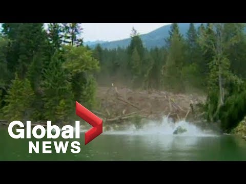
Landslides are among the most dramatic natural disasters, capable of reshaping landscapes in seconds. The fastest recorded landslide reached an astonishing speed of 402.3 kilometers per hour (about 250 miles per hour).
Understanding the mechanics behind such rapid mass movement can help in assessing risks in areas prone to landslides.
These events, fueled by factors like heavy rain or volcanic eruptions, can be incredibly destructive. The landslide’s speed can significantly impact the damage it causes, leading to extensive loss of life and property.
Such rapid movement of earth and debris reflects the power of nature and the importance of monitoring geological changes.
To learn more about the dynamics of landslides and how these powerful surface movements occur, explore topics related to mass movement.
The stories of these extreme natural events emphasize the need for caution and preparedness in vulnerable regions.
Characteristics of the Fastest Landslides

Fast landslides exhibit distinct characteristics influenced by various factors. Understanding these elements is crucial for assessing risks and behaviors associated with landslides.
From the forces that drive their motion to the remarkable examples in history, each component plays a vital role.
Factors Influencing Landslide Velocity
Several factors determine how quickly a landslide moves. Slope steepness is a primary factor; steeper slopes often result in faster movement.
Additionally, the type of material involved can greatly influence speed; for instance, a rock fall tends to be faster than a mudflow or debris avalanche.
Weather conditions also play a significant role. Heavy rain can weaken soil structure, increasing the likelihood and speed of a landslide.
Earthquakes and volcanic eruptions can trigger catastrophic landslides, as seen in the Heart Mountain slide.
Other influences include geological features and human activities, which can modify natural landscapes and create unstable conditions.
Recording and Measuring Landslide Speed
Accurate measurement of landslide speed is essential for understanding their impact. Data collection methods vary widely, including the use of GPS technology, which tracks movement in real-time.
High-speed cameras can capture rapid events, while satellite imagery offers broader overviews of affected regions.
Scientific studies often record the initial triggers, such as earthquakes or heavy rainfall, and monitor changes in debris flow.
Information gathered helps researchers identify patterns and anticipate future movements, providing crucial data for communities at risk.
Effective measurement practices are vital for developing safety protocols and improving early warning systems.
Notable Fast Landslides in History
Some landslides in history are particularly notable for their speed and impact. The Markagunt Gravity Slide is one of the largest and fastest recorded, showcasing the power of geological forces.
Other renowned examples include the 1980 eruption of Mount St. Helens, where landslides moved at impressive speeds due to volcanic activity.
The Haiyuan earthquake in China caused approximately 50,000 landslides, all influenced by the quake’s force.
Moreover, lahars—volcanic mudflows—can travel incredibly fast, mixing ash, water, and debris.
These historic events underline the unpredictable nature of landslides and their potential to cause significant disruption.
Climate changes can also contribute to more frequent and severe landslides as patterns of precipitation shift, increasing the risk of fast-moving events in vulnerable areas.
Impact and Management of High-Speed Landslides
High-speed landslides pose significant risks to communities and the environment. Understanding their consequences, assessing associated risks, and developing effective management strategies are crucial for reducing their impact.
Consequences of Rapid Mass Movements
Rapid mass movements like landslides can lead to various destructive outcomes. They often result in significant property damage, injury, and loss of life.
The force of a landslide can demolish buildings and disrupt transportation routes.
In areas of heavy rainfall, the risk increases. Landslides may trigger additional natural disasters such as mudslides or rockfalls. The aftermath can also create landslide dams, which pose risks of flooding.
Communities need to be aware of these potential hazards to prepare adequately.
Risk Assessment and Hazard Mitigation Strategies
To manage high-speed landslides, accurate risk assessment is vital.
Authorities often use geological surveys to identify areas prone to landslide hazards.
Monitoring weather conditions, particularly during volcanic activity or heavy rains, helps predict when landslides may occur.
Mitigation strategies include constructing drainage systems to manage water runoff and stabilize slopes.
Community education on recognizing hazards is also crucial. After a landslide, areas must be assessed to prevent future occurrences, ensuring safer environments for inhabitants.
Strategies might include installing retaining walls or vegetation to control erosion and improve slope stability.
Future Outlook and Research Directions
As climate change influences weather patterns, understanding landslides becomes more important.
Research focuses on developing better modeling techniques to predict when and where landslides might occur.
Advanced technology such as remote sensing and machine learning is being applied to enhance predictive capabilities.
Additionally, future studies aim to explore the effects of human activity, like construction, on landslide frequency.
There is a growing interest in how water management practices can help mitigate risks associated with water during heavy rainfall or volcanic eruptions.
Continuous research will play a key role in improving safety measures and disaster preparedness in vulnerable areas.