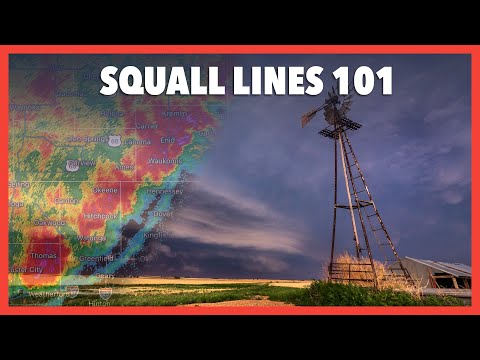
Derechos and squall lines are both types of severe weather events, but they are not the same. A derecho is a powerful windstorm that can cause extensive damage, while a squall line is a line of thunderstorms that often brings heavy rain and winds. Understanding the differences between these two phenomena is important for weather enthusiasts and anyone affected by storms.
Derechos typically develop from a group of thunderstorms that can span hundreds of miles. These storms produce straight-line winds that can rival those of tornadoes.
In contrast, squall lines are not as widespread and are often found ahead of cold fronts, producing sudden gusts and heavy precipitation but generally less intense damage.
For those interested in the complexities of severe weather, knowing about derechos and squall lines can provide insight into storm patterns and safety measures. Learning about these weather events can help individuals prepare better for potential threats in their area.
Characteristics of Derechos and Squall Lines

Derechos and squall lines are both important weather phenomena associated with severe thunderstorms. They share some similarities but also have distinct characteristics that set them apart. Understanding these differences is crucial for interpreting storm warnings and impacts.
Defining Derechos
A derecho is a type of severe wind storm that results from a fast-moving line of thunderstorms. To be classified as a derecho, the storm must produce a damaging wind swath of at least 250 miles.
These winds typically come in the form of straight-line winds, which can exceed 100 mph in extreme cases. Derechos usually form in environments with strong wind shear and atmospheric instability, allowing for a rapid intensification.
Derechos are often associated with a bow echo, a particular radar signature that indicates intense winds. They can occur as part of a larger convective system, like a mesoscale convective system (MCS), and often happen during the warmer months when conditions are favorable.
Squall Line Features
A squall line consists of a series of thunderstorms arranged in a line. These lines can stretch over hundreds of miles and may produce strong winds, heavy rain, and hail.
Unlike derechos, squall lines are typically less destructive and are less likely to spawn tornadoes compared to supercells.
The storms within a squall line can produce gust fronts, leading to sudden shifts in wind speed and direction. Wind shear plays a key role in the formation and strength of squall lines, creating conditions that can escalate storm activity. Wind and rain from squall lines pass relatively quickly, often lasting only minutes or hours.
Comparison of Atmospheric Dynamics
The atmospheric dynamics that drive derechos and squall lines are different, which affects their characteristics and impacts. Derechos often develop in environments with significant vertical wind shear, allowing strong winds to propagate forward within the storm system.
This setup leads to sustained, damaging winds across wide areas.
In contrast, squall lines typically form in less severe wind shear environments and often operate under lower atmospheric instability. This difference results in squall lines being less intense but still capable of causing localized flooding and wind damage.
Both phenomena showcase the complex nature of storm systems and the essential role of atmospheric conditions in severe weather events. For more insight, see resources on atmospheric phenomena and wind.
Impact and Prediction of Derechos

Derechos can cause significant damage, making understanding their impact essential for effective safety measures. Predicting these events helps communities prepare for the severe weather they bring, which can include wind damage, flash floods, and power outages.
Assessing Wind Damage and Implications
Derechos produce straight-line winds that can exceed 100 miles per hour. Such strong winds can cause extensive property damage, topple trees, and lead to dangerous situations on roadways.
Widespread wind damage is often a result of downbursts and microbursts, which can occur within the storms.
The aftermath of a derecho can lead to flash floods as rain falls heavily, overwhelming drainage systems. For cities and towns, this translates to disruptions in daily life, significant repair costs, and potential safety hazards. The National Weather Service emphasizes the importance of assessing wind damage swiftly to guide recovery efforts.
Forecasting and Early Warning Systems
Predicting derechos relies on advanced Doppler radar and weather forecasting techniques. Meteorologists analyze conditions conducive to these storms, such as temperature, humidity, and wind patterns.
Early warning systems provide alerts to communities at risk, helping them prepare.
As technology improves, forecasting methods continually advance. This improvement aids in quicker identification of severe storm potential, allowing for prompt action. The Storm Prediction Center plays a crucial role in monitoring these conditions and issuing timely warnings connected to derechos.
Historical Derecho Events
Several significant derechos have shaped public awareness and response strategies.
The Boundary Waters-Canadian Derecho in 1999 caused severe damage in eastern Canada and parts of the U.S. It helped raise awareness about the destructive nature of these storms.
The April 2011 derecho affected several states, creating widespread destruction along its path.
The I-94 derecho left a notable impact in the Midwest, emphasizing the need for robust prediction efforts.
Events like the “Storm of the Century” highlight how derechos can lead to disastrous consequences, reinforcing the necessity of continued research and public education on this severe weather phenomenon.
