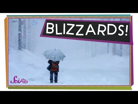
Blizzards are some of the most intense weather events during winter, characterized by strong winds and heavy snowfall.
One interesting fact is that a blizzard requires wind speeds of at least 35 mph and visibility of less than 1/4 mile for a sustained period, often leading to dangerous conditions.
These fierce winter storms can create whiteouts, making it hard to see even a few feet in front, which poses serious risks to anyone caught outdoors.
Another notable fact is that blizzards are not just about falling snow. A phenomenon known as a “ground blizzard” occurs when wind stirs up already fallen snow, causing whiteout conditions without any new snowfall. This can happen even after a storm has passed, showcasing the power of wind in these weather events.
Lastly, blizzards can have significant impacts on the environment and human activities. They can disrupt travel, cause power outages, and even lead to property damage from heavy snow accumulation.
Blizzard Phenomenology and Science

Understanding the science behind blizzards involves examining the meteorological conditions that lead to these severe snowstorms, the factors affecting visibility and wind speed, and the various formations that bring blizzards to life.
Each element plays a critical role in the severity and characteristics of these winter weather events.
Meteorological Conditions Leading to Blizzards
Blizzards occur when specific meteorological conditions align. This includes a significant amount of moisture in the atmosphere, which contributes to intense snowfall.
For a blizzard to develop, temperatures must be low enough to sustain snow, while strong winds often exceed 35 mph.
Cold air masses move in from the north, combining with warm, moist air. This contrast creates instability in the atmosphere, leading to heavy snow.
Locations near large bodies of water can experience lake-effect snow, where cold air passes over warmer waters, gathering moisture and causing localized heavy snowfall.
Visibility and Wind Speed Factors
Wind speed and visibility are critical factors in defining blizzards. When wind speeds rise above 35 mph, they can create whiteout conditions, reducing visibility to less than a quarter mile.
This low visibility is caused not only by falling snow but also by snowflakes blowing horizontally due to strong winds. The wind can lift previously fallen snow, adding to the chaotic scene.
Clear visibility is often impossible, making travel dangerous. Understanding these factors helps meteorologists issue appropriate warnings for severe winter weather.
Blizzard Formations: Nor’easters and Bomb Cyclones
Blizzards can form from different systems, notably Nor’easters and bomb cyclones.
A Nor’easter brings heavy snow and strong winds along the East Coast of the United States. It typically develops from low-pressure systems that gather moisture, then intensify as they move northward.
Conversely, bomb cyclones rapidly deepen, dropping atmospheric pressure significantly in a short time. This quick change leads to extreme cold, heavy snowfall, and severe winds.
Both formations highlight how climate conditions contribute to winter storms’ intensity. Monitoring these systems is essential for predicting blizzard activity.
Historical and Notable Blizzards

Throughout history, several notable blizzards have significantly impacted lives and landscapes. These events show the power of severe winter weather and the importance of preparedness.
The Great Blizzard of 1888
The Great Blizzard of 1888, also known as the Great Appalachian Storm, is one of the deadliest blizzards in U.S. history. It struck the Northeast in March 1888, bringing snowfalls of up to 55 inches. Winds reached over 40 mph, creating massive snowdrifts. Many areas faced whiteout conditions, making travel impossible.
This blizzard resulted in more than 400 deaths. The storm caused roof collapses due to the weight of the snow and led to widespread power outages and road closures. People were unprepared, which amplified the tragedy. The Great Blizzard of 1888 remains a benchmark for severe winter storms.
The Blizzard of 1978
The Blizzard of 1978 affected the Midwest and parts of the Northeast, leaving a lasting mark on those regions. It covered some areas with up to 48 inches of snow in just a few days. Winds exceeded 50 mph, also causing snowdrifts that blocked roads and trapped people in their homes.
This storm produced thundersnow, a rare phenomenon where thunder and lightning occur during snow. Many lost power, and emergency services struggled to reach those in need. Livestock was also affected as farmers fought to protect their animals during the severe weather. The Blizzard of 1978 serves as a reminder of nature’s unpredictable power.
1972 Iran Blizzard
The 1972 Iran Blizzard, sometimes referred to as the deadliest blizzard on record, occurred over a few days in February. It buried many remote villages under up to 26 feet of snow. The extreme conditions led to whiteout conditions, making it difficult for anyone to escape.
More than 4,000 people lost their lives due to the storm. This blizzard caused severe disruption in rural areas and halted transportation entirely. The Iranian government needed to mobilize military resources to aid rescue efforts. The 1972 Iran Blizzard highlights how severe weather can affect communities, especially in less accessible regions.
Recent Severe Blizzard Events
In recent years, severe blizzards have continued to impact areas like the U.S. and Europe.
For example, in 2016, a major blizzard struck the East Coast, prompting emergency declarations in several states. Conditions included strong winds and heavy snowfall, leading to significant travel disruptions and power outages.
These events remind everyone of the need for an emergency kit and preparedness plans.
Current weather forecasting has improved, yet the potential for extreme winter weather remains a serious concern.
Keeping informed and prepared can help mitigate risks during blizzard conditions.

