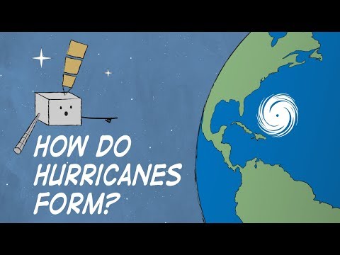
Before a storm evolves into a hurricane, it passes through several important stages of development. Understanding these stages helps to grasp how potentially dangerous weather systems form.
The first three stages are tropical disturbance, tropical depression, and tropical storm. Each phase represents a step in the intensification process, with distinct characteristics and significant implications for forecasting.
In the tropical disturbance stage, a cluster of thunderstorms begins to develop over warmer waters. If conditions are favorable, this can lead to the next phase, the tropical depression, where winds start to swirl around a low-pressure center.
As the storm gains strength and wind speeds increase, it can develop into a tropical storm, bringing more organized and powerful winds.
Monitoring these stages is crucial for predicting the path and intensity of storms. Early detection can help communities prepare for the potential impact of a hurricane, which can cause significant damage and disruption.
Understanding the journey from tropical disturbance to hurricane empowers individuals and organizations to take informed actions as severe weather approaches.
Formation of a Tropical Depression

Tropical depressions are the initial stages in the life cycle of a tropical cyclone. Understanding how these systems form provides insight into the weather patterns that can develop into hurricanes. The following sections will explore the origins of a tropical disturbance and how it progresses into a tropical depression.
Origins of a Tropical Disturbance
A tropical disturbance typically begins with an easterly wave, which is a type of atmospheric trough. This wave creates conditions where warm, moist air rises, leading to low pressure at the surface.
As this air rises, it cools and condenses, releasing latent heat. This energy warms the surrounding air, causing it to rise faster, which further lowers surface pressure and enhances the disturbance.
The convergence of winds in the area supplies additional moisture, crucial for development. The presence of water vapor helps fuel the system, allowing it to grow.
As the surface inflow of air increases, the chances of developing a tropical depression heighten. By gathering momentum, the system can potentially evolve into a more organized structure.
From Disturbance to Depression
When wind speeds reach between 25 and 38 mph, the disturbance is classified as a tropical depression. This stage signifies that the system has developed a closed circulation pattern. The organized winds around a calm center, known as the eye, begin to form, although it is not yet a hurricane.
As the system intensifies and wind speeds approach 39 mph, it transitions into a tropical storm. Warm ocean water serves as the fuel for this growth, providing the necessary energy for sustained winds.
The process of transformation from a tropical disturbance to a tropical depression can be rapid, sometimes occurring within just a few days. The combination of factors like wind speed, surface humidity, and atmospheric conditions all play a vital role in this development.
Escalation to a Tropical Storm and Hurricane

The development of a storm into a tropical storm or hurricane involves specific criteria and stages. Understanding these phases is crucial for predicting storm behavior and potential impacts.
Criteria for a Tropical Storm
A tropical storm forms when sustained wind speeds reach between 39 and 73 mph. This classification is vital as it indicates a storm’s intensity and potential dangers.
The energy for a tropical storm comes from warm ocean waters, which release latent heat of condensation as the moisture rises. This energy fuels the storm’s growth and contributes to the increasing wind speeds.
As the storm gathers strength, the atmosphere plays a significant role. Upper-level outflow must be present to allow the storm to develop. This outflow helps to remove air from the top of the storm, allowing more warm, moist air to enter from below.
Monitoring agencies like NOAA watch for these changes closely, as they can indicate the storm’s potential to escalate.
Transition to Hurricane Status
A storm transitions to hurricane status when sustained wind speeds exceed 74 mph. At this stage, it can start causing significant destruction, including storm surge and tornadoes.
The eye of a hurricane forms, creating a calm center surrounded by the most intense winds.
During this phase, the storm’s structure becomes well-defined with clear convection patterns. The warm waters continue to provide energy, amplifying the storm’s power.
Meteorologists analyze various factors, including the wind profiles and pressure levels, to predict hurricane behavior. Changes in wind speed during this phase can dramatically influence potential impact areas.
Reaching Hurricane Maturity
Once a storm achieves hurricane maturity, it often reaches maximum wind speeds, which can exceed 157 mph in the case of major hurricanes.
This stage is marked by a well-formed eye and organized wind patterns. The dynamics within the storm become complex, with sustained winds generating massive ocean swells and significant storm surges.
The hurricane can also interact with other weather systems, influencing its path and intensity. Understanding these interactions is key for forecasters.
They study patterns to predict where a hurricane may strike and what impacts it could have.
The destructiveness of a mature hurricane is typically widespread, threatening coastal areas with high winds and flooding.
Monitoring ongoing changes is critical for public safety and timely warnings. For further reading on related wind patterns, visit Wind – ChaseDay.com.
