Severe thunderstorms can bring powerful winds, heavy rain, and dangerous lightning. Understanding the different types of these storms is key for anyone who wants to stay safe during severe weather events.
There are three main types of severe thunderstorms: supercell, multi-cell, and single-cell storms. Each type has unique characteristics and varying levels of intensity, which can lead to different weather outcomes.
Supercell thunderstorms are often the most severe and can produce tornadoes, large hail, and extreme wind. Multi-cell thunderstorms consist of clusters of storms that can cause heavy rain and flash flooding. Single-cell storms are typically short-lived but can still produce localized severe weather.
By recognizing the differences among these types, people can better prepare and respond during stormy weather.
Learning about these severe thunderstorms will help anyone understand the risks associated with each type. This knowledge is essential for making informed decisions when severe weather strikes.
Types of Severe Thunderstorms

Severe thunderstorms can take on various forms, each presenting unique risks and characteristics. Understanding these types can help prepare for their impacts. The main types include supercell thunderstorms, squall line thunderstorms, and single-cell and multicell cluster storms.
Supercell Thunderstorms
Supercell thunderstorms are a powerful type of storm that can last for several hours. They are characterized by a rotating updraft, known as a mesocyclone. These storms can produce severe wind damage, large hail, and even tornadoes.
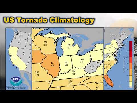
Supercells are often responsible for most of the significant tornadoes in the U.S.
With their strong updrafts, supercells can cause extreme weather, including flash flooding and catastrophic winds. As they lose strength, they can generate derecho events, which are long-lived wind storms. The potential for lightning is also high, making these thunderstorms particularly hazardous.
Squall Line Thunderstorms
Squall line thunderstorms form in a line and are typically associated with a cold front. These storms consist of multiple cells that can create straight-line winds exceeding 60 mph. The gust front produces dangerous conditions, including heavy rainfall, hail, and intense lightning.
Squall lines can lead to downbursts, microbursts, and flash flooding. These events often occur in the late afternoon or evening, affecting wide areas. Because they travel fast, squall lines can bring rapid changes in weather, creating a risk for both urban and rural areas.
Single-Cell and Multicell Cluster Storms
Single-cell thunderstorms are small and short-lived, often referred to as “popcorn” storms. They typically occur in warm, humid conditions and do not last long. These storms may produce brief heavy rain and lightning but are generally less severe.
In contrast, multicell cluster storms consist of several cells working together. These storms can produce wind damage and heavy rainfall, causing localized flash flooding. Unlike supercells, they do not have a strong rotating updraft. However, both types can lead to hazardous weather events and should be monitored closely for changes.
Severe Thunderstorm Hazards and Impacts

Severe thunderstorms can cause various hazards that significantly impact communities. The primary threats include damaging winds, large hail, tornadoes, and flooding. Understanding these dangers can help individuals prepare and respond effectively.
Wind and Hail Threats
Strong winds from severe thunderstorms can lead to extensive damage. Wind speeds can exceed 58 miles per hour, uprooting trees and causing power outages. This wind damage can occur due to downdrafts, which are strong downward currents of air.
Hail is another significant concern. Hailstones can vary in size from small pellets to golf ball-sized or larger, causing destruction to crops, vehicles, and roofs. Severe Thunderstorm Warnings are often issued when hail is expected to be one inch or larger. Communities should take precautions as even smaller hail can result in costly damage.
The risk of wind and hail emphasizes the importance of staying informed during storm events.
Tornadoes and Flooding
Tornadoes can form in severe thunderstorms, especially in supercell storms. While many tornadoes are weak, others can cause catastrophic damage. The National Weather Service (NWS) closely monitors conditions for tornado formation. Residents should heed any tornado watches or warnings issued.
Flooding, particularly flash flooding, can occur rapidly during severe storms. Heavy rainfall can overwhelm drainage systems, leading to dangerous water levels. In urban areas, this often results in significant property damage and can put lives at risk.
Preparedness is crucial. Staying updated through alerts from the NWS can help individuals respond to these threats in a timely manner.
Weather Predictions and Warnings
Accurate weather predictions and timely warnings are key to safety during severe thunderstorms.
The NWS continually analyzes weather data to issue alerts, such as Severe Thunderstorm Watches or Warnings. A watch indicates the potential for severe weather, while a warning signals that severe conditions are occurring.
Public awareness is essential, and utilizing resources from the NWS helps keep communities informed.
This includes monitoring local forecasts and understanding the signs of severe weather. By staying prepared, individuals can significantly reduce their risk during severe thunderstorm events.
Stay connected and informed through reliable sources for the best outcomes during severe weather situations.

