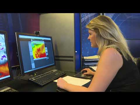
A hook echo is a distinctive radar signature commonly associated with severe thunderstorms, especially supercells.
This radar pattern appears as a hook shape and indicates the presence of a rotating updraft within the storm, providing vital clues about tornado formation.
Meteorologists use these signatures to assess potential tornado activity and improve early warning systems.
The formation of a hook echo occurs as air and precipitation are drawn into the storm’s center, creating a curved feature on radar. As the strong updraft rotates, precipitation is wrapped around, which leads to the recognizable “hook” shape.
This phenomenon typically happens in the latter stages of a supercell, making it a crucial element in severe weather prediction. Understanding this atmospheric feature can help communities stay prepared and safe.
Detecting a hook echo is essential for identifying tornado threats. Although not all hook echoes result in tornadoes, their presence warrants further investigation.
For those interested in atmospheric phenomena, exploring the dynamics behind hook echoes reveals much about the power and complexity of severe storms.
Understanding the Meteorological Background

The formation of a hook echo is closely tied to specific weather phenomena.
Key elements like supercells, radar reflectivity, and other meteorological factors play crucial roles in how these unique radar signatures develop and are detected.
The Role of Supercells in Severe Weather
Supercells are a type of thunderstorm characterized by a rotating updraft called a mesocyclone. This rotation is crucial for generating conditions that can lead to severe weather, including tornadoes.
As warm, moist air rises, it can create a powerful updraft. This energy helps organize the storm, allowing it to grow taller and stronger compared to typical thunderstorms.
In a classic supercell, the interaction between updrafts and downdrafts creates a distinct pattern in its structure. The presence of a mesocyclone often indicates a significant risk of severe outcomes like hail or tornadoes.
When viewed on radar, the rotation can create a pronounced hook echo. This unique radar echo is typically found in the rear flank of the storm, indicating where rain and debris are being pulled into the storm’s structure.
Radar Reflectivity and Detection
Radar technology, especially Doppler radar, is essential in detecting phenomena like hook echoes. Doppler radar sends out pulses and measures the return signals, which reflect off precipitation and other objects in the atmosphere. This information creates radar images that illustrate the storm’s structure.
A hook echo appears as a distinct curve or “hook” on radar images, often associated with a velocity couplet. The velocity couplet shows areas of swirling winds, providing clues about a storm’s intensity and rotation.
Such information is critical for meteorologists who issue warnings. Effective use of radar systems allows for better responses and the potential to save lives when severe weather strikes.
For more on meteorological elements, exploring factors like wind can deepen understanding of storm dynamics.
Deciphering the Hook Echo Signature

The hook echo is a well-known radar signature that signals the presence of severe storms. Understanding its characteristics, formation, and implications can enhance tornado detection and weather forecasting.
Hook Echo Characteristics and Formation
A hook echo appears as a distinctive hook-shaped pattern on radar reflectivity images. It typically forms in the lower sections of a supercell thunderstorm, where air and precipitation interact with a rotating updraft. This radar echo results from rainfall, hail, or debris being wrapped around the storm’s core.
The phenomenon is often associated with a bounded weak echo region (BWER). This area indicates a strong updraft at the storm’s center, leading to the distinctive structure of the hook. In addition, a rear flank downdraft (RFD) contributes to this formation by pushing precipitation into the hook shape as it spirals around the mesocyclone.
Association with Tornado Development
The presence of a hook echo is an important clue in predicting tornado development. It typically indicates favorable conditions for tornado formation within a supercell.
The National Weather Service often uses this radar signature to issue tornado warnings.
While a hook echo suggests that a tornado may be forming or already present, it does not guarantee one will occur. It is essential to analyze other factors, such as wind patterns and the tornado vortex signature (TVS), to make accurate assessments.
Meteorologists must pay close attention to the velocity data alongside the hook echo to assess the likelihood of a tornado.
Analyzing Radar Data for Weather Predictions
Meteorologists analyze radar echo patterns to predict severe weather events like tornadoes. By examining the amplitude of the hook echo, they can assess the strength of the associated storm.
Radar data is crucial for early warnings. The quicker the analysis, the more effective the warning system becomes in protecting communities.
For example, following severe weather outbreaks in regions like Champaign, Illinois, experts emphasize the need for rapid interpretation of radar signals.
Various types of hook echoes may be seen, each indicating different storm behaviors. By recognizing these patterns, meteorologists can provide timely and accurate weather information.
Understanding the role of radar echoes and their implications is vital in the ongoing efforts of experts like Donald Staggs at the Illinois State Water Survey, who are dedicated to improving severe weather forecasting.

