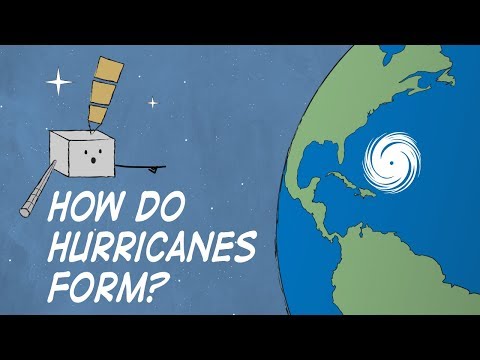
Hurricanes are powerful storms that form over warm ocean waters.
The primary cause of hurricanes is the combination of warm, moist air rising from the ocean surface, which creates areas of low pressure that draw in more air. These storms can develop into devastating cyclones in tropical regions, affecting millions of people.
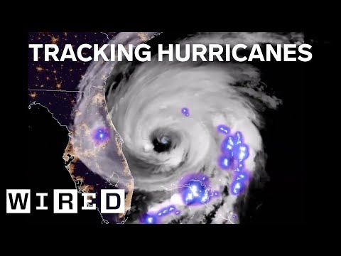
Using satellite data, meteorologists can track the development of these storms from their initial formation to their peak intensity.
The wind patterns and atmospheric conditions play a crucial role in determining how strong a hurricane will become. Organizations like NOAA monitor these conditions closely, aiding in early warnings and preparation efforts.
Understanding the scientific processes behind hurricanes helps demystify these natural events and informs safety measures.
Readers interested in the mechanics of these storms will find insights that reveal not just how hurricanes form, but also the ongoing efforts to predict and respond to their impacts.
Hurricane Formation and Characteristics

Hurricanes are powerful storms that develop under specific conditions within tropical regions. They require warm ocean waters, defined wind patterns, and a unique atmospheric setup to evolve.
This section explores the vital aspects of how hurricanes form and their distinct features.
The Role of Warm Ocean Waters
Warm ocean water is crucial for hurricane formation. Hurricanes typically form over water temperatures of at least 26.5 degrees Celsius (about 80 degrees Fahrenheit) at a depth of 50 meters. This warmth feeds energy into the storm.
As the sun heats the ocean, the warm water evaporates, creating humid air above. When this humid air rises, it cools, forming clouds.
Specifically, cumulonimbus clouds play a significant role in developing thunderstorms that contribute to hurricane formation. These thunderstorms are essential for the storm’s growth as they organize into a low-pressure area.
The greater the ocean warmth, the more energy fuels the storm, increasing its intensity as it progresses into a tropical depression or tropical storm.
Atmospheric Conditions and Winds
A suitable wind environment is critical for hurricane development. Low wind shear, or the change in wind speed and direction with altitude, is necessary. High wind shear can disrupt the storm’s structure, preventing it from strengthening.
The Coriolis effect also influences hurricanes. This effect allows storms to rotate and gain organization as they establish a low-pressure center. As air rushes into this low-pressure area, it spirals upward, creating the distinct rotation.
Throughout hurricane season, from June to November, favorable atmospheric conditions help strengthen hurricanes and allow them to travel across vast distances.
Hurricane Anatomy
Understanding hurricane anatomy is crucial for grasping their power. The central part of a hurricane is called the eye, which is a calm area surrounded by the eye wall. The eye wall contains the storm’s most intense winds and rain.
Most of the storm’s destructive features emerge from this eye wall. The strong winds extend outward, causing storm surges that can lead to flooding.
Wind speeds within a hurricane can exceed 74 mph, classifying it as a hurricane. The wind patterns and structure of the storm change as it develops, contributing to its overall strength and potential impact.
Hurricane Impact and Tracking

Hurricanes can cause devastating effects when they make landfall. Understanding how these storms are tracked and the consequences they bring is essential for preparedness and safety.
Predicting Hurricane Paths
Weather forecasters use advanced technology to predict hurricane paths. Tools like NOAA’s GOES satellites help monitor storms from space.
These satellites provide real-time images and data, allowing meteorologists to track changes in a storm’s speed and direction. Forecast models analyze various factors, such as water temperatures in the Gulf of Mexico.
Warm waters fuel hurricanes, increasing their intensity. Wind patterns also play a crucial role. Meteorologists use this data to make predictions, which help in issuing warnings to affected areas.
Consequences of Hurricanes
Hurricanes can unleash severe damage at landfall. Wind speeds can exceed 74 miles per hour, leading to destruction of buildings and infrastructure.
The storm surge can cause flooding in coastal areas, often the most dangerous aspect of a hurricane. Flooding can extend inland, impacting communities far from the ocean.
Recovery can take years due to property loss and structural damage. In particular, Hurricane Katrina demonstrated the devastating flood impacts on cities like New Orleans, showing how vital tracking and preparedness are in mitigating consequences.
Historical and Notable Hurricanes
Several hurricanes have left lasting marks in history.
Hurricane Katrina in 2005 caused catastrophic flooding in the Gulf of Mexico region and is remembered for its tragic loss of life and economic impacts.
Another notable event was Hurricane Andrew in 1992, which struck Florida and caused extensive damage.
These storms highlight the importance of effective hurricane tracking and preparedness to minimize risks in tropical areas, specifically those near the Atlantic Ocean.
Their legacies remind communities of the need for robust systems to monitor and respond to extreme weather events.
