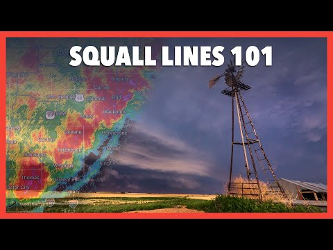
Squall lines are powerful weather formations that often lead to severe thunderstorms.
The primary cause of a squall line is typically the presence of a cold front, which interacts with warmer air ahead of it.
As the cold air from the front pushes into warmer air, it creates a gust front that can trigger intense storms along a line.
These thunderstorms are a significant aspect of severe weather patterns. They can produce strong winds, heavy rain, and even hail.
Understanding how they form is essential for predicting and preparing for potential extreme weather events, especially during spring and fall when they are most common.
Meteorologists monitor these formations closely, as they can rapidly develop and impact large areas.
Learning more about squall lines and their causes provides valuable insights into warning systems and safety measures during severe weather events. Discovering more about atmospheric phenomena can help deepen one’s understanding of these dynamic systems.
Formation of Squall Lines

Squall lines typically form in the presence of cold fronts, enhanced by specific atmospheric conditions.
Key elements such as wind shear, instability, and the interaction of updrafts and downdrafts play crucial roles in their development.
Role of Cold Fronts
Cold fronts are significant in the formation of squall lines.
As a cold front advances, it pushes cold air under warmer, moist air. This creates an area of low pressure that forces the warm air to rise rapidly. This lift can lead to the development of thunderstorms.
These storms often line up along the cold front in a series of clouds, forming a squall line.
The temperature contrast between the cold and warm air increases the instability, which helps sustain the storms. The moisture from the warm air fuels these thunderstorms, resulting in heavy rain and strong winds.
Because of this, cold fronts are often associated with severe weather.
Influence of Updrafts and Downdrafts
Updrafts and downdrafts are critical for the life cycle of squall lines.
As warm, moist air rises in updrafts, it cools and condenses, forming clouds and precipitation. The process creates low pressure at the surface and enhances the storm’s strength.
Wind shear, the difference in wind speed and direction with height, helps to organize the thunderstorms, increasing their longevity.
Once the storm matures, downdrafts begin. These downdrafts push cold air down and spread out, creating a gust front. This front can lead to low-level convergence, drawing in more warm air and sustaining the squall line.
The interaction between updrafts and downdrafts is vital for maintaining the storms, resulting in powerful weather events.
Characteristics of Squall Lines

Squall lines are unique weather systems characterized by their distinct storm structure and the types of severe weather they produce. Understanding both aspects is important for predicting their impact.
Storm Structure and Development
A squall line typically forms along or ahead of a cold front, leading to a line of thunderstorms. The line can stretch for hundreds of miles and is often marked by intense activity.
The storm structure includes several stages. Initially, the updrafts develop as warm, moist air rises.
As storms mature, they may display features like bow echoes. These are curved line segments visible on radar that indicate the potential for damaging winds.
Vertical wind shear, which refers to changes in wind speed and direction at different altitudes, plays a key role in the formation and intensity of squall lines. The shear helps maintain the storm’s organization, allowing it to persist longer than typical thunderstorms.
Squall lines also generate outflow boundaries, which occur when cold air from downdrafts spreads out and can trigger new storms.
Associated Severe Weather Phenomena
Squall lines are known for producing severe weather, including strong winds, heavy rain, and even tornadoes. The winds associated with these systems can be particularly damaging, sometimes exceeding 60 miles per hour.
This can lead to significant destruction.
Lightning and heavy precipitation are common during these events. The intense lightning can create hazardous conditions.
Hail is another potential threat, with large hailstones being observed along some squall lines, increasing the risk of damage to property.
These systems can develop into derechos, which are widespread, long-lived wind storms associated with fast-moving squall lines. They can lead to severe storms that impact large areas in a short time.
Understanding the characteristics of squall lines helps communities prepare for the extreme weather they can produce, ensuring safety measures are in place.

