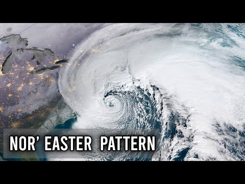
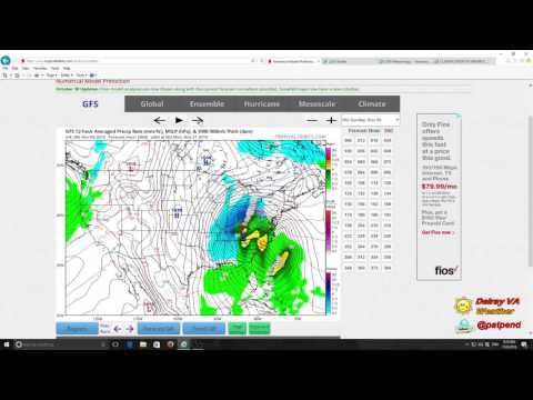
Miller B storms are a unique type of winter weather system that can produce significant snow and ice across the eastern United States.
These storms typically develop when a low-pressure area forms in the Midwest and moves toward the East Coast, leading to various forms of precipitation, including heavy snowfall.
Unlike their Miller A counterparts, these systems often bring more snow to inland areas, affecting regions from the Carolinas up through New England.
Meteorologists observe that Miller B storms can result in prolonged weather events. As the low-pressure system moves, it can transfer energy to another storm forming along the coast.
This process can lead to days of winter storms, causing challenges such as hazardous travel conditions and power outages from heavy, wet snow. Understanding the dynamics of these storms is essential for proper forecasting and preparation.
In the realm of atmospheric phenomena, acknowledging the characteristics of Miller B storms can help communities better brace for winter’s impact.
By recognizing how these storms develop and travel, residents can stay informed and ready for whatever weather comes their way. For more details on various weather systems, visit articles on atmospheric phenomena.
Formation and Characteristics of Miller Type B Storms

Miller Type B storms are an important weather phenomenon that typically affect the eastern United States. They originate in the Midwest and are influenced by various atmospheric factors, including low-pressure systems. Understanding their formation and characteristics helps in predicting their impact.
Origins and Development
Miller Type B storms often begin as low-pressure systems over the Ohio Valley. These systems gain strength as they move eastward toward the Atlantic Ocean.
They typically start near a warm front, merging with the Gulf Stream to draw in moist air. As warm air rises over colder air, significant precipitation, including snow, can result.
These storms usually arise when cold fronts interact with a low-pressure system, enhancing their development. The warmer, moist air from the Gulf of Mexico contributes to the storm’s growth.
As the storm tracks northeast, heavy snowfall can occur, particularly in areas like the Mid-Atlantic and parts of New England.
Comparison with Miller Type A Storms
While both Miller Type A and Miller Type B storms are types of nor’easters, they differ significantly in their origins.
Miller Type A storms start in the Gulf of Mexico and track along the East Coast, while Miller Type B storms originate further north in the Midwest.
Miller Type A storms typically bring moisture directly from the Gulf, leading to higher snowfall amounts in areas such as the coastal regions. In contrast, Miller Type B storms produce heavy snow after traveling across land, often leading to a different distribution of precipitation.
This difference in origin affects their track and intensity, making each type unique in its weather patterns.
For more insights into the factors that influence storm patterns, consider exploring articles on surface movement and how snow impacts different regions.
Impact and Significance

Miller B storms can have widespread effects on regions along the East Coast. These storms bring heavy snow, strong winds, and sometimes significant rain, directly impacting daily life and infrastructure. Understanding their regional effects and historical significance highlights their role in shaping winter weather patterns.
Regional Effects
Miller B storms typically affect areas from Georgia up to New England. As these storms travel north along the Atlantic, they can draw moisture from the Gulf Stream, intensifying precipitation.
Coastal regions, including cities like Boston and New York City, often face heavy snow and strong winds.
Inland areas such as New Jersey and Pennsylvania may experience less snow but still endure strong rain mixed with snow showers. This can create hazardous road conditions and disrupt travel.
Maritime provinces in Canada can also feel the impact as the storm moves into their area.
Cities like Philadelphia and Washington, D.C., are frequently hit with heavy rain, leading to flooding concerns. The combination of strong winds and heavy precipitation can lead to power outages and disruptions in services. Understanding these effects helps communities prepare for the challenges posed by these storms.
Historical Storm Events
Significant events like the Superstorm of 1993 illustrate the impact of Miller B storms on the East Coast. This storm produced over 20 inches of snow in some areas, affecting millions. It brought the region to a standstill, showcasing the storm’s potential for disruption.
Another example includes the January 2005 Blizzard in New England, which was classified as a Miller B storm. It caused considerable snowfall across New York and New Jersey. The heavy snow and subsequent cold caused travel disruptions and property damage.
These historical events highlight patterns that can recur with Miller B storms. Awareness of past storms helps meteorologists predict future occurrences and informs communities to better prepare for similar situations.
Understanding the significance of these storms allows for improved response strategies when they strike the East Coast.

