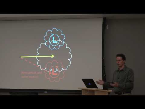
Supercell science focuses on a specific type of thunderstorm known as a supercell, which is characterized by a deep, rotating updraft called a mesocyclone. These storms are capable of producing severe weather events, including tornadoes, hail, and damaging winds, making them a critical area of study in meteorology.
Understanding supercells not only helps meteorologists predict extreme weather but also provides valuable insights into the environments that enable these powerful storms to form.
Supercells develop in unstable atmospheric conditions where warm, moist air meets cooler, drier air. This combination creates a breeding ground for intense storms.
The unique structure of supercells allows for prolonged rainfall and can lead to tornado formation, emphasizing the importance of monitoring these weather patterns.
With 30 years of experience in extreme weather, he recognizes the significance of studying supercells to enhance public safety and improve forecasting techniques.
By exploring what supercell science entails, readers can gain a better appreciation for the complexities of weather systems and their impacts on our lives. This knowledge is crucial for those interested in meteorology as well as anyone affected by severe weather phenomena.
Supercell Characteristics and Dynamics

Supercells are powerful thunderstorms recognized for their unique structure and the severe weather they can produce. Understanding their characteristics sheds light on how they develop, their lifecycle, and the atmospheric conditions that support them.
Atmospheric Conditions Fostering Supercells
Supercells typically form in environments with high atmospheric instability. A key factor is the presence of sufficient water vapor, which fuels the storm.
This moisture rises from the Earth’s surface into the troposphere, where it can condense and release energy.
Additionally, wind shear, or the change in wind speed and direction with height, is crucial. This helps create a rotating updraft known as a mesocyclone.
Wind shear allows the storm to maintain its structure, setting supercells apart from standard thunderstorms. Regions with severe weather patterns such as the central United States often experience this combination of conditions, making them hotspots for supercell activity.
Structure and Features of Supercell Storms
Supercell thunderstorms exhibit distinctive features that enhance their strength. One of the most notable is the updraft, a powerful column of rising air that drives the storm’s development.
Above this updraft, the cloud may form what’s called an overshooting top, indicating strong vertical growth.
The wall cloud forms beneath the mesocyclone and may become a site for tornadoes to form. This storm structure results in advanced radar signatures like a hook echo, which helps meteorologists identify potential severe weather.
Moreover, the bounded weak echo region is a radar feature that often signifies strong updrafts and is crucial for understanding a supercell’s intensity.
Lifecycle and Evolution of Supercells
The lifecycle of a supercell typically includes four stages: developing, mature, shrinking, and dissipating.
The developing stage begins with a strong updraft and an organized rotation.
As the storm enters the mature phase, it reaches its peak intensity, producing heavy rain, large hail, and damaging winds. This is when severe weather phenomena are most common.
During the shrinking stage, the storm begins to weaken, and the updraft loses strength. Finally, in the dissipating stage, the storm fades away, often leaving behind a complex interaction of downdrafts and remnants of its structure.
Supercells can create conditions for powerful storms, including heavy rainfall and large hail, which pose risks to safety and property. Understanding their lifecycle is important for forecasting and warning systems to protect against severe weather events.
Impacts and Predictive Techniques

Supercells can cause severe weather events like tornadoes and hailstorms, particularly in regions like the Great Plains and the Oklahoma Panhandle. Understanding these impacts is crucial for effective forecasting and monitoring techniques.
Supercell-Related Severe Weather Phenomena
Supercells are known for producing some of the most intense weather phenomena. They often lead to tornadoes, which can cause catastrophic damage.
Hailstorms accompanying supercells can produce large hailstones, leading to property damage and agricultural losses. Unique features such as above-anvil cirrus plumes can be indicators of severe storms.
These storms can also produce hydraulic jumps, which are sudden changes in wind speed and direction. These changes can impact storm behavior and intensity, influencing prediction models. Meteorologists study these elements to improve assessments of severe weather threat levels.
Forecasting and Monitoring of Supercells
Forecasting supercell storms involves advanced techniques and observational tools.
Meteorologists utilize radar technology to track storm movements and features. For instance, enhanced radar images help in identifying mesocyclonic structures that indicate supercell development.
Effective monitoring also requires understanding surface movement, which influences storm dynamics.
Regular assessments include looking for conditions like periodic boundary layers that can impact storm intensity.
Combined efforts in observation enhance predictive capabilities, allowing for timely warnings to communities at risk.
Access to accurate information ensures preparedness in the face of severe weather events.
For more on storm tracking, see articles on surface movement.
