
Storm surge is a significant concern during hurricanes and tropical storms. It is the abnormal rise in seawater level caused primarily by the strong winds pushing water toward the shore.
The average height of storm surge can vary widely, but it often ranges from 1 to 5 feet, with more severe storms causing surges of 10 feet or higher.
Understanding the potential for storm surge is crucial for coastal communities to prepare for extreme flooding and protect themselves.
The National Hurricane Center and NOAA provide valuable resources for gaining insight into storm surge risks. These organizations analyze data related to past hurricanes, helping to predict potential surges for upcoming storms.
By looking at historical trends and advancements in technology, they improve forecasting accuracy, ultimately aiding in public safety efforts.
As storms develop, it becomes increasingly important for residents in affected areas to stay informed. The impact of storm surge can be devastating, leading to significant property damage and potential loss of life.
Knowledge about storm surge height helps communities prepare and take necessary precautions, ensuring safety in the face of extreme weather events.
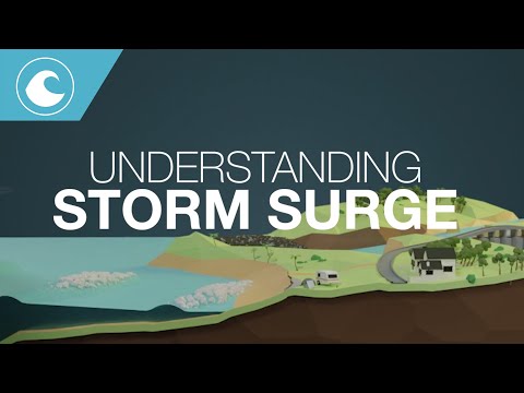
Understanding Storm Surge
Storm surge is a critical phenomenon that affects coastal areas during severe weather events. It results from a combination of factors including wind, atmospheric pressure, and the unique geography of the coastline.
Understanding how storm surge forms, how it is measured, and its impacts on coastal communities is essential for preparedness and response.
Formation and Factors
Storm surge occurs when strong winds from cyclones, hurricanes, or tropical storms push seawater toward the shore. The intensity of the surge depends on several factors, including wind speed, storm size, and the forward speed of the storm.
The angle of approach of a storm also plays a role. For example, a storm hitting the coast at a direct angle can create higher surges compared to one approaching at an angle.
Additionally, the topography of the coastline can influence water levels. Areas with shallow continental shelves tend to experience more dramatic surges.
As storms approach land, the rise in water levels from storm surge combines with the normal astronomical tide, creating what is known as storm tide.
Measuring Surge Heights
Surge heights are measured using various tools that help gauge the impact of storms. Tide stations monitor regular water levels, while pressure sensors track atmospheric changes during storms.
High water marks left after storms provide historical data about extreme surge events. NOAA collects and analyzes this data to determine storm surge heights.
Methods to calculate surge involve estimating the total water level, which includes the storm surge and the astronomical tide.
Understanding these measurements helps researchers predict future storm impacts and improve forecasting accuracy.
Impact on Coastal Areas
Storm surge can lead to severe flooding in coastal communities. When surge forces coincide with high tides, the risk of storm surge inundation increases dramatically.
This flooding not only damages property but can also disrupt local economies and displace residents.
The vulnerability of coastal areas varies based on elevation and geography, with some regions lying less than 10 feet above sea level. Climate change is intensifying concerns regarding storm surge, as rising sea levels exacerbate flooding risks.
Communities need to prepare for possible surges by having response plans in place, which may include evacuation routes and local resources to mitigate flooding.
Predicting and Tracking Storm Surges

Predicting and tracking storm surges involves a mix of advanced models, real-time data, and public resources. These tools are essential for understanding potential flooding risks during storms.
Forecast Models and Tools
Several sophisticated models are used for predicting storm surges. The SLOSH model (Sea, Lake, and Overland Surges from Hurricanes) is a key tool employed by the NOAA and the National Hurricane Center.
This model simulates how storm surges will move inland based on various storm parameters.
In addition to the SLOSH model, storm surge forecasting relies on satellite imagery and radar imagery to observe storm conditions.
Aircraft reconnaissance missions gather data directly from storms, helping to enhance forecasts. Forecast models are updated during severe weather events, providing the latest information to emergency services and the public.
Tropical weather outlooks and advisories inform individuals about current conditions and expected developments. Tools like GIS products and experimental products offer detailed assessments of potential impact areas.
Public Awareness and Resources
Public awareness is vital when it comes to storm surge predictions.
The National Weather Service (NWS) conducts events like Hurricane Prep Week to educate communities about storm safety.
They also provide Tropical Cyclone Products and Storm Surge Watches/Warnings to relay crucial information.
Individuals can access a range of resources, including storm surge products and historical hurricane summaries.
These resources help residents understand past storm impacts and prepare for future threats.
Educational materials focus on the NWS Hurricane Safety guidelines, teaching the public how to respond during a storm.
Utilizing these resources can significantly reduce risks associated with storm surges and enhance community resilience.