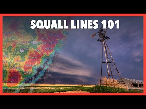
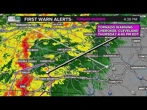
A squall line is a fascinating and powerful weather phenomenon that can deliver severe weather across a wide area.
The primary cause of a squall line is the pressure difference between a mesoscale high and lower pressures ahead of the line, which generates strong winds and intense thunderstorms. These lines can develop rapidly, often resulting in heavy rain, strong winds, and even hail. Understanding the dynamics behind squall lines helps to appreciate their role in extreme weather.
As squall lines form, they can evolve into a series of severe thunderstorms. This transformation is driven by the interaction of warm and cool air, creating the conditions needed for sustained growth.
Because of their linear structure, squall lines can cover hundreds of miles, bringing a sudden change in weather. People living in affected areas must stay alert during these events, as they can produce damaging winds and heavy rainfall in a short period.
Meteorologists closely monitor squall lines, especially during severe weather outbreaks. These systems are particularly noteworthy because they can move faster than typical thunderstorms, often leading to increased risks for those in their path. Understanding what causes a squall line and how it operates is crucial for preparing for extreme weather events that can impact communities significantly.
Formation and Characteristics

Squall lines are complex weather phenomena formed under specific atmospheric conditions. Their development involves interaction between cold and warm air, resulting in unique characteristics.
Atmospheric Conditions
The key ingredients for squall line formation are temperature contrasts and wind shear. A significant temperature difference can occur between warm and cold sectors, often along a cold front.
Strong wind shear also plays a critical role, enhancing the vertical movement of air. This instability allows cumulonimbus clouds to develop quickly. When air rises in an unstable atmosphere, it can lead to a mesoscale convective system (MCS), which then evolves into a squall line. Additionally, interactions near frontal zones can intensify these storms.
Development Stages
Squall lines progress through three primary stages: mature, dissipating, and initial development.
In the initial stage, scattered thunderstorms form along a line due to shifting winds. When a squall line reaches its mature stage, it exhibits severe weather features, including heavy rain and strong winds. The gust front produced can initiate new thunderstorm cells.
As it enters the dissipation stage, the storms weaken but can still produce rain and gusty winds. Understanding these stages helps in forecasting their impact on weather conditions.
Types of Squall Lines
Squall lines can be categorized into various types. The most common include straight-line squall lines and bow echoes.
Straight-line squall lines feature a continuous line of thunderstorms, whereas bow echoes create a distinctive arch shape and are often associated with intense wind gusts. A derecho is a broader type of windstorm that can result from a bow echo setup.
Squall lines are notably more active during specific seasons, increasing the risk of severe weather across regions. They often occur in the warm sector ahead of a cold front, affecting large areas quickly. For more on wind patterns, it is essential to understand their impact on storm dynamics.
Impacts and Detection

Squall lines can lead to significant severe weather events that pose risks to life and property. Detecting these systems early is crucial for issuing timely warnings, allowing individuals to prepare for intense weather conditions.
Severe Weather Events
Squall lines often bring severe thunderstorms that include dangerous lightning, heavy rain, and strong winds.
These weather phenomena can result in flash flooding, damaging winds exceeding 60 mph, and even hail as large as golf balls. Often, these storms can produce tornadoes, especially when conditions are favorable.
Forecasters must monitor radar data closely to observe these systems as they develop. The National Weather Service plays a crucial role in alerting communities about impending severe weather. Recognizing the signs of a squall line can help localities prepare for potential disruptions.
Weather Prediction and Alerts
Forecasting squall lines involves analyzing various atmospheric components.
Meteorologists evaluate moisture levels, wind patterns, and temperature differences to anticipate the formation of these storms. Modern radar technology enhances the ability to detect squall lines, revealing their strength and movement.
Timely alerts from the National Weather Service can help individuals respond to dangers like extreme winds and heavy precipitation. For those in affected areas, staying informed through weather information and apps is essential for personal safety. Additionally, understanding the nuances of severe weather alerts can empower communities to take appropriate action as situations unfold.
Safety and Preparedness
Preparedness is critical when a squall line approaches.
Individuals should have emergency plans in place, including a designated safe space free from windows.
It is advisable to stay tuned to local news or weather apps for real-time updates about severe thunderstorms and related hazards.
Bringing outdoor items indoors can prevent damage from high winds. In cases of heavy rain, knowing how to avoid flood-prone areas is vital.
Additionally, keeping a flashlight and extra batteries on hand can be helpful during power outages caused by damaging storms.
Being informed and prepared can significantly reduce risk and ensure safety as severe weather events unfold.
For more on dealing with electrical storms, refer to articles on electrical storms.

