
Understanding severe weather is crucial for safety and preparedness.
A derecho is a type of storm characterized by a widespread, long-lasting windstorm that produces straight-line winds, while a haboob is a large dust storm often caused by collapsing thunderstorms.
Both phenomena can arise from extreme weather conditions, yet they manifest in very different ways.
Derechos typically develop in warm, humid conditions and can travel for hundreds of miles, bringing with them destructive winds that can cause extensive damage.
Haboobs, on the other hand, appear as immense walls of dust, usually resulting from high winds in a thunderstorm, sweeping across the landscape and significantly reducing visibility.
This difference in formation and impact makes it important to recognize how each can affect safety during severe weather events.
For those interested in learning more about such atmospheric phenomena, exploring more about these types of storms can deepen understanding of weather patterns. These events remind us of the power of nature and the significance of being prepared. For further insights into various atmospheric phenomena, check out articles on Atmospheric Phenomena.
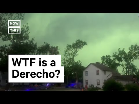
Defining Derecho and Haboob

Derechos and haboobs are both intense weather events, but they differ significantly in formation, characteristics, and impacts. Understanding these differences can help in recognizing and responding to severe weather conditions.
Characteristics of a Derecho
A derecho is a widespread, long-lived wind storm associated with a complex of thunderstorms. It features straight-line winds of more than 58 miles per hour.
The National Weather Service identifies a derecho based on its longevity and the pattern of damage it leaves.
Derechos can span hundreds of miles and often form during hot, humid conditions. They typically occur in the summer months, moving rapidly across the landscape.
These storms can bring heavy rain, but the main threat comes from damaging wind gusts that can topple trees and power lines. Wind gusts can reach over 100 mph in severe cases, causing widespread destruction.
Understanding Haboobs
A haboob is a type of dust storm that occurs mainly in arid regions. It is characterized by a wall of dust or sand that is lifted and propelled by strong winds, often during thunderstorms. When cold air from a collapsing thunderstorm rushes down, it can pick up large amounts of dust, forming a dense veil.
Haboobs can move quickly, with gusts often exceeding 40 mph. They reduce visibility to nearly zero and can cause significant travel hazards.
Unlike derechos, which primarily involve wind and rain, haboobs specifically involve dust and sand, impacting air quality and visibility rather than causing structural damage.
Comparing Structural Differences
The structural differences between derechos and haboobs are stark. Derechos stem from thunderstorms, relying on intense wind patterns and moisture. Their formation involves a line of storms producing significant straight-line winds.
In contrast, haboobs arise directly from severe wind gusts moving through dry areas, without the influence of moisture-laden systems. The dust is lifted and carried as air pressure changes during or after a storm.
While both phenomena can arrive suddenly and with little warning, their development processes and effects on the environment are quite different.
For more information on wind-related storms, check out articles on wind.
Impacts and Responses
Derechos and haboobs can cause significant damage and safety issues in affected areas. How communities prepare and respond to these events is crucial for minimizing harm. This section explores the specific impacts and responses associated with each phenomenon.
Damage and Dangers of Derechos and Haboobs
Derechos primarily produce strong straight-line winds, often exceeding 60 mph. This intense wind can uproot trees, damage buildings, and disrupt power lines. The National Weather Service warns that the destruction path can stretch over 240 miles.
In contrast, haboobs are large dust storms with strong winds that can exceed 40 mph. They obscure visibility, creating dangerous driving conditions. Haboobs can transport dust and debris over long distances, affecting air quality and respiratory health.
Both phenomena pose dangers to public safety. Downed power lines and fallen debris are common after a derecho, while reduced visibility during a haboob can lead to accidents.
Response and Preparation Strategies
Preparedness is key when facing derechos and haboobs. Communities should have emergency plans in place, including clear communication systems.
The Storm Prediction Center and the National Weather Service provide alerts to keep residents informed about severe weather events.
Establishing safe shelters, especially in areas frequently affected by derechos, is also vital. Educating the public about the difference between tornadoes, derechos, and haboobs can help communities respond more effectively.
Individuals should keep emergency kits with essentials, such as water, food, and first-aid supplies. Regularly reviewing and updating these kits ensures readiness when severe weather strikes.
Meteorological Analysis and Data
Meteorological data plays a crucial role in understanding and predicting both derechos and haboobs.
Meteorologists analyze historical patterns, wind speeds, and moisture levels to enhance forecasting accuracy.
The National Weather Service collects data to improve models that predict storm development. This information helps assess where and when these events might occur.
By studying past occurrences, researchers identify conditions that contribute to the formation of derechos and haboobs. This knowledge aids in issuing timely warnings, thereby safeguarding lives and property.
Continuous analysis helps refine strategies to mitigate the impacts of severe weather in America.