Hurricanes and extratropical cyclones are both types of cyclones but differ significantly in their formation and characteristics.
A hurricane is a tropical cyclone with sustained winds of at least 74 mph, while an extratropical cyclone can form over land or water, often associated with cooling temperatures and varying wind patterns.
Understanding these differences is crucial for comprehending how severe weather events develop and affect communities.
Tropical cyclones, including hurricanes, arise in warm ocean waters and rely on heat and moisture for energy.
In contrast, extratropical cyclones form mainly due to temperature contrasts between warm and cold air masses, often leading to windy and wet conditions. These low-pressure systems can bring about different types of weather, including heavy rain and winter storms.
For those interested in the dynamics of these atmospheric phenomena, resources about the unique characteristics can provide further insights.
Both hurricane and extratropical cyclone forecasting is essential for safety and preparedness.
Meteorologists analyze patterns and predict the paths of these storms, enabling communities to respond effectively. People can learn more about tracking their development and the associated risks through various articles that cover atmospheric phenomena.
Characteristics of Tropical Cyclones vs. Extratropical Cyclones

Tropical cyclones and extratropical cyclones have distinct characteristics that set them apart. Understanding their formation, structures, and impacts helps clarify their differences.
Formation and Development
Tropical cyclones form over warm ocean waters, typically during the hurricane season.
These storms begin as low-pressure systems, gathering strength from the heat released during the condensation of water vapor, known as latent heat. The process of cyclogenesis involves the creation and intensification of these storms.
They often develop in tropical regions, with sustained winds reaching hurricane-force.
In contrast, extratropical cyclones are born from the contrast in temperature between cold and warm air masses. They also have a connection to fronts, such as cold and warm fronts, affecting larger areas. This difference in formation leads to varying intensities and scale of impact.
Physical Structure and Dynamics
Tropical cyclones have a symmetrical structure with a calm center known as the eye. Surrounding this eye, powerful winds form the eyewall, which is where the strongest winds and heaviest rain occur.
Wind speeds can exceed 74 miles per hour, classifying them as hurricanes when they reach that intensity.
On the other hand, extratropical cyclones lack the distinct eye. They consist of a low-pressure center accompanied by cold and warm fronts, making their structure more complex.
Their winds can vary in speed but are generally lower than those found in tropical cyclones. They also produce a range of weather conditions, from storms to snow, especially in colder months.
Impact and Behavior
Tropical cyclones can lead to significant storm surge, flooding, and extensive damage in coastal regions due to their high wind speeds and heavy rainfall. The impact is often catastrophic, affecting infrastructure and ecosystems.
In comparison, extratropical cyclones can cause severe weather, including heavy snowfall and strong winds, especially when they interact with cold fronts.
Their behavior tends to follow a west-to-east movement, impacting a broader geographical area. The aftermath of an extratropical cyclone can include reduced temperatures and widespread precipitation, which can bring beneficial rain or cause disruptions.
Tracking and Predicting Cyclone Activity

Tracking and predicting cyclone activity relies on advanced observation techniques and efficient warning systems. These methods are essential to help communities prepare for severe weather and reduce the impacts of hurricanes and extratropical cyclones.
Observation Techniques
Meteorologists use various observation techniques to monitor cyclone activity.
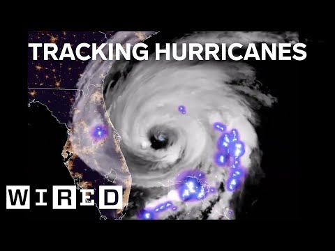
Satellite imagery provides real-time visuals of storm formations, helping to track their development. This imagery shows wind speeds and cloud patterns, which are crucial for identifying tropical disturbances, tropical waves, and tropical depressions.
Doppler radar is another vital tool. It measures precipitation levels and can detect wind patterns within the storm.
By analyzing this data, meteorologists can predict how a storm may intensify or weaken. These observations contribute to issuing alerts such as a hurricane watch or warnings about storm surges and other hazards associated with these storms.
Warning Systems and Preparedness
Effective warning systems are critical for public safety during cyclone events.
A hurricane watch signals the potential for a hurricane to strike within a specific timeframe. Meanwhile, a hurricane warning indicates imminent danger.
These alerts provide communities with time to prepare evacuations and secure property.
Additionally, storm surge watches and warnings notify people about the risk of flooding along coastlines.
Local meteorologists play a key role by disseminating information about storm tracking and potential impacts.
By staying informed through various channels, individuals can take necessary precautions to protect themselves and their property from the devastating effects of a tropical storm or extratropical storm.
