
Understanding the differences between various weather phenomena can be essential for anyone interested in severe weather. Two terms often heard during thunderstorms are shelf clouds and supercells.
A shelf cloud is a low, horizontal cloud formation indicating outflow from a thunderstorm, while a supercell is a type of thunderstorm characterized by a deep, rotating updraft.
Meteorologists study these formations closely as they can signal very different weather patterns.
For instance, shelf clouds typically form along the leading edge of a storm and suggest rain or gusty winds. In contrast, supercells are capable of producing severe weather like tornadoes and large hail due to their powerful updrafts and rotation.
Gaining insight into these atmospheric phenomena can enhance awareness and preparedness during stormy conditions.
Those curious to learn more about the various aspects of weather systems can explore the broader categories of atmospheric phenomena.
Characteristics of Supercells and Shelf Clouds
Supercells and shelf clouds play important roles in severe weather systems. They exhibit distinct features that set them apart from one another, both in structure and impact on the atmosphere.
Defining Supercell Thunderstorms
Supercells are a unique type of rotating thunderstorm known for their potential to produce severe weather events. They are characterized by a rotating updraft, or mesocyclone, which helps them maintain their structure longer than regular thunderstorms.
Supercells are divided into three types: high precipitation, low precipitation, and classic supercells.
High precipitation supercells often produce heavy rainfall and hail, while low precipitation versions are associated with significant tornado risks. Classic supercells are well-balanced, featuring both wind shear and a clear rotating structure.
These storms can cause intense weather effects, such as tornadoes and strong winds. The wind shear within the environment supports the development of these powerful storms, making supercells a primary focus during severe weather forecasts.
Understanding Shelf Clouds
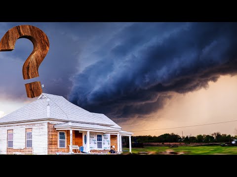
Shelf clouds are found at the leading edge of a thunderstorm’s outflow and are typically low-hanging and horizontal in appearance. They often form along the front of a gust front, which is the boundary separating a mass of cold air from warmer air.
As cool air spreads out, it forces warm air upward, leading to cloud formation.
The appearance of a shelf cloud signals unstable weather ahead, often indicating the presence of severe thunderstorms or a storm system like a squall line.
They differ from the more violent clouds associated with supercells, as shelf clouds do not usually produce tornadoes. Instead, they may indicate heavy rainfall and strong winds.
These clouds contribute to the overall structure of severe storms, serving as a visual cue for onlookers and meteorologists alike. For further insights, explore more about the relationship between severe storms and cloud types in Electrical Storms.
Comparative Analysis of Supercells and Shelf Clouds

Supercells and shelf clouds represent distinct weather phenomena with unique characteristics. Understanding their differences helps predict hazardous weather events and improves safety measures for affected communities.
Visual and Structural Differences
Supercells are complex thunderstorms known for their rotating updrafts, which form a distinctive structure.
They typically produce a wall cloud, a lowering from the main cloud base that may spawn tornadoes. In contrast, shelf clouds are low, horizontal cloud formations. They appear at the leading edge of a thunderstorm’s downdraft and signify severe weather.
The anvil cloud at the top of a supercell can stretch far and indicates strong updrafts. Shelf clouds are often precursors to squall lines, forming due to gust fronts from downdrafts.
While supercells can develop funnel clouds leading to tornadoes, shelf clouds rarely produce tornadoes but can indicate severe storms with damaging winds.
Impact on Weather and Environment
Supercells can lead to some of the most extreme weather events, including violent tornadoes and large hail.
These storms are capable of producing severe damaging winds and flash flooding. The rotation within a supercell contributes to strong wind patterns, generating storm-relative winds that can enhance the potential for hazardous weather.
Shelf clouds, while unsettling, generally indicate a line of storms with less severe impacts compared to supercells. They are often associated with strong gusts and may deliver brief heavy rain.
Although they can lead to damaging winds, the severity of weather linked to shelf clouds is usually lower than that of supercells.
Detection and Monitoring Technologies
Monitoring supercells relies heavily on Doppler radar, which detects wind patterns and precipitation.
The National Weather Service uses this data to issue warnings for tornadoes and severe storms. Doppler radar helps identify rotating updrafts and wall clouds, allowing timely warnings for the public.
For shelf clouds, visual observation is key. Forecasters look for changes in cloud structures and rapid shifts in wind.
Though not as dynamically monitored as supercells, shelf clouds indicate strong wind fronts. Advanced satellite imagery can also enhance detection capabilities, providing a broader view of storm development and movement.
Monitoring the complexities of both phenomena is essential for effective storm tracking and safety planning.