
Weather enthusiasts often encounter the terms squall line and bow echo when discussing severe thunderstorms. The main difference is that a squall line is a continuous line of thunderstorms that can produce severe weather, while a bow echo is a specific radar signature indicating a bulge in that line, often associated with damaging winds.
Understanding these distinctions helps both meteorologists and the public better prepare for potential severe weather events.
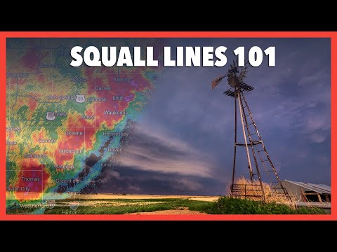
Squall lines are long lines of thunderstorms that can stretch for hundreds of miles and are typically driven by atmospheric conditions that lead to storm development. They are known for producing heavy rain, strong winds, and sometimes tornadoes.
In contrast, a bow echo forms within or along these squall lines, presenting a unique pattern on radar that signals intense wind gusts.
By knowing how to differentiate between a squall line and a bow echo, readers can gain insight into the specific hazards that may accompany these severe weather phenomena. Awareness of these differences is crucial for safety and preparedness when severe thunderstorms are in the forecast.
Characteristics of Squall Lines
Squall lines are important features in severe weather that can lead to damaging conditions. Their formation, structure, and associated meteorological conditions play a critical role in understanding the hazards they present.
Formation and Structure
Squall lines form along or ahead of a cold front, which is a boundary between warm and cold air. As warm, moist air rises over cooler air, it creates updrafts, leading to the development of thunderstorms.
The line echo wave patterns (LEWPs) are common in squall lines, producing a series of thunderstorms that align in a linear fashion.
These systems often have a cold pool at their surface, which enhances downdrafts. This process can lead to damaging straight-line winds.
A well-defined squall line can also exhibit wind shear, which is the change in wind speed or direction with height. This shear can contribute to the severity of any storms within the line.
Meteorological Conditions
Squall lines thrive in environments with high instability and basic atmospheric lifting mechanisms. Conditions such as high CAPE (Convective Available Potential Energy) indicate that the atmosphere has energy for strong storms.
Wind shear also plays a vital role, allowing thunderstorms to maintain their structure and strength.
These systems generally occur when there is a significant temperature difference between the warm and cold air masses. A gust front, often generated by downdrafts, can further intensify the storms by lifting surrounding air.
Such conditions can lead to severe weather phenomena like tornadoes, hail, and downbursts, which can risk lives and property.
Hazards and Impacts
The hazards associated with squall lines can be significant. They are known for producing damaging straight-line winds that can exceed 60 mph. These winds can cause extensive property damage and pose serious risks during severe thunderstorms.
Additionally, the intense rainfall from squall lines can lead to flash flooding and greatly reduce visibility for drivers, making travel dangerous.
Hail is another concern; it can damage crops, vehicles, and roofs. Given their potential for spawning tornadoes, squall lines are closely monitored during severe weather events. Awareness of these risks enables better preparedness and safety measures during severe weather.
Distinguishing Bow Echoes

Bow echoes are significant radar signatures that indicate the potential for severe weather, often including straight-line winds and even tornadoes. This section discusses their formation, behavior, and methods for detection, helping to identify the key features that set them apart from squall lines.
Development and Behavior
Bow echoes form along squall lines, characterized by a crescent shape on radar. They typically develop when wind shear is strong in the lower atmosphere, aiding the formation of a rear-inflow jet.
This inflow can enhance the forward movement of storms, resulting in a rapid increase in wind speeds.
Bow echoes often appear in conjunction with mesoscale convective systems, creating conditions ripe for straight-line winds and wind damage.
The lifespan of a bow echo usually ranges from 3 to 6 hours, varying in size from 20 to 200 kilometers. Such features are crucial in the study of convective storm detection due to their association with severe weather events.
Comparison with Squall Lines
While both squall lines and bow echoes are associated with severe weather, there are notable differences.
Squall lines are extensive, long-lasting, and can exhibit a series of line echo wave patterns, while bow echoes are more compact and typically have a prominent “bowing” shape, indicative of strong winds.
Bow echoes can produce damaging winds that are more intense than those typically observed in squall lines. They have a higher potential for brief tornadoes that develop on the leading edge. Understanding these differences is essential for both meteorologists and the public to respond effectively to severe weather warnings.
Detection and Monitoring
Radar reflectivity is a vital tool in detecting bow echoes.
Meteorologists analyze patterns on radar, paying close attention to the distinctive bow shape and accompanying wind velocity data.
The National Weather Service often uses this information to issue warnings for potential wind damage or tornadoes associated with bow echoes.
Monitoring systems are crucial for real-time data, allowing for timely alerts.
This proactive approach enhances public safety during severe weather.
Understanding radar signatures helps identify not only the presence of bow echoes but also their potential risk for damaging events like derechos, which can produce widespread destruction.