When it comes to understanding thunderstorms, two terms often surface: squall lines and supercells.
The primary difference between these storm types lies in their structure and behavior.
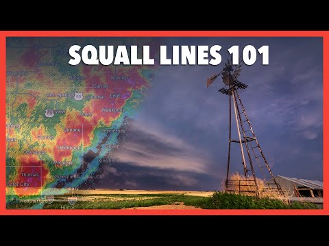
Squall lines are a series of storms that form in a line, often producing strong winds and heavy rain but are generally less capable of producing tornadoes.
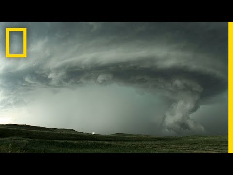
In contrast, supercells are organized thunderstorms characterized by a rotating updraft, which allows them to sustain themselves for a longer period and can result in severe weather, including tornadoes.
Both squall lines and supercells can bring intense weather, making understanding their differences crucial for those monitoring severe weather.
Squall lines, often found ahead of cold fronts, can stretch for hundreds of miles and bring damaging winds.
Supercells, on the other hand, are more isolated and can lead to significant weather events such as hail and tornadoes. Recognizing these patterns can help in predicting the potential impact of each storm type.
For those interested in atmospheric phenomena, distinct behaviors of these storms provide valuable insights into weather prediction.
Following storm trends can enhance safety and preparedness during severe weather events.
Exploring these differences not only benefits meteorology enthusiasts but also promotes awareness of how storm systems develop and affect communities.
Characteristics and Development

Squall lines and supercells have distinct characteristics and development processes that set them apart. Understanding these differences is essential for grasping how severe weather occurs.
Formation of Squall Lines
A squall line forms along or ahead of a cold front. This line consists of multiple storm cells that can extend for hundreds of miles.
When warm, moist air meets cooler air, instability increases, allowing thunderstorm cells to develop.
As storms form, a gust front develops. This boundary between cold air and warm air leads to strong winds and can produce a shelf cloud.
The storms in a squall line typically move quickly and are organized in a line, which helps to maintain their strength.
Pre-existing conditions, such as a strong cold front, play a crucial role in creating squall lines.
These systems can produce damaging winds, heavy rain, and sometimes tornadoes, although these tornadoes tend to be less intense than those found in supercells.
Structure of Supercells
Supercells are a type of thunderstorm distinguished by their unique structure. They feature a mesocyclone, a rotating updraft that can persist for an extended period.
This rotation is caused by varying wind speeds and directions.
Supercells develop from individual cells, leading to a more organized and severe storm. The updrafts within these storms are much stronger than those in squall lines, allowing them to last for hours.
The presence of a hook echo on radar often indicates a supercell, as it shows the rotation associated with the mesocyclone.
These storms can produce significant weather effects, including large hail, strong winds, and intense rainfall. They are also more likely to generate tornadoes, especially when they exhibit a well-defined rotating updraft. Understanding the structure of supercells is vital for meteorologists tracking severe weather. More information on severe weather can be found here.
Impact and Safety Considerations

Understanding the impact and safety considerations of squall lines and supercells is critical. Each type of storm poses unique threats that can significantly affect the environment and public safety.
Consequences of Squall Lines
Squall lines are known for producing heavy rain and damaging winds.
These lines can span hundreds of miles and often lead to flash flooding. Rainfall rates can exceed one inch per hour, significantly reducing visibility for drivers and increasing the likelihood of accidents.
Additionally, squall lines can generate downbursts, which are powerful winds that can cause sudden hazards.
These downbursts can lead to tree damage, power outages, and hazardous travel conditions.
While tornadoes can occasionally form within squall lines, they are less common than in supercell storms. The National Weather Service often issues warnings for severe weather associated with squall lines, guiding communities to take protective measures.
Hazards of Supercell Storms
Supercell storms are among the most severe forms of thunderstorms. They are well-organized and can persist for hours, making them particularly dangerous.
Violent tornadoes can easily develop from supercells, causing catastrophic damage. Large hail is another serious hazard associated with these storms, which can damage vehicles and crops.
The potential for severe weather and intense downbursts also makes supercells risky, particularly in populated areas.
In addition, supercells often produce extreme winds, which can lead to destruction over wide areas. The ongoing monitoring by the National Weather Service is vital for issuing timely warnings and ensuring public safety in the face of these storms.

