
Thunderstorms come in various types, each with unique characteristics. Among these, squall lines and supercells are two noteworthy formations that play critical roles in severe weather patterns. The key difference lies in their structure and behavior: squall lines are linear formations of storms, while supercells are more isolated, rotating storms that can cause significant tornadoes.
Squall lines are often associated with heavy rain and strong winds, forming ahead of a cold front. They can stretch for hundreds of miles and may produce severe weather, but they typically move quickly.
In contrast, supercells are known for their powerful rotating updrafts, which allow them to persist for longer periods and develop into more dangerous storms. These storms can lead to extreme weather events, including heavy rain, hail, and tornadoes.
Understanding these differences is crucial for anyone interested in meteorology and severe weather. For those looking to explore more about atmospheric phenomena, resources are available to provide deeper insights into these complex systems.
Fundamentals of Squall Lines and Supercells
Squall lines and supercells are two important types of thunderstorms that display distinct characteristics and behaviors. Understanding these differences is essential for predicting severe weather events, including tornadoes, hail, and damaging winds.
Characteristics of Squall Lines
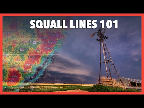
A squall line is a narrow band of thunderstorms that forms along or ahead of a cold front. These storms are often associated with straight-line winds and can produce severe weather quickly.
Key features include:
- Length: Squall lines can stretch for hundreds of miles.
- Formation: Often linked to a gust front, these lines develop in environments with sufficient vertical wind shear.
- Intensity: They typically last only a few hours but can deliver intense rainfall and damaging wind gusts, sometimes exceeding 60 mph.
Visibility of squall line thunderstorms can lead to phenomena such as the bow echo, which indicates strong winds and potential for severe damage. The cold pool at the surface plays a crucial role in maintaining the line’s strength.
Defining Features of Supercells
Supercells are a unique and powerful type of thunderstorm that possess a rotating column of air called a mesocyclone. This makes them different from regular thunderstorms and often leads to more severe weather, including tornadoes and large hail.
Characteristics include:
- Structure: Supercells maintain a well-defined updraft and downdraft that are separated, allowing for the potential to produce severe weather for an extended period, often over an hour.
- Rotation: The rotation, or wind shear, within a supercell is critical for its development and longevity. The tilted updraft enhances the likelihood of severe weather.
- Hail Production: Supercells are known for producing significant hail that can cause extensive damage due to the strength of the updraft and the time hailstones spend in the cloud.
Storm Dynamics and Development
The development of squall lines and supercells involves complex dynamics related to wind shear and other meteorological factors.
In squall lines:
- The gust front pushes warm, moist air upward, leading to the formation of thunderstorms.
- Interaction between the warm air and the cold front enhances storm intensity.
Supercells differ in:
- Their reliance on a strong, rotating updraft that allows for sustained severe weather.
- The presence of vertical wind shear, which tilts the updraft and separates it from the downdraft.
Both storm types necessitate careful monitoring for predicting severe weather. Understanding these processes aids in effective forecasting and warning efforts.
Impacts and Safety Considerations

Squall lines and supercell thunderstorms both lead to severe weather but differ in their specific impacts and safety concerns. Understanding these differences is essential for effective preparedness and response.
Weather Hazard Effects
Squall lines produce sudden and severe weather conditions, including damaging straight-line winds, heavy rain, and lightning. They can lead to flash flooding because of intense downpours over a short period. These storms may develop rapidly, causing risks such as hailstones and brief tornadoes.
In contrast, supercell thunderstorms are more organized and have a potential to produce significant tornadoes. Supercells can also create heavy precipitation, leading to flash floods over a larger area. The hazards associated with these storms include strong winds, hail, and prolonged weather threats, which can last several hours.
Safety and Preparedness Strategies
To stay safe during squall lines, people should monitor weather updates regularly. Having a reliable weather app or NOAA weather radio can provide real-time alerts.
It is advisable to seek shelter indoors during severe weather events to avoid injuries from flying debris or lightning.
For supercells, preparedness is crucial due to their potential for violent tornadoes. Establishing a communication plan and knowing local shelter locations can save lives.
Communities should conduct regular drills to ensure readiness. Keeping emergency kits stocked with food, water, and first aid supplies is also essential.
Being proactive helps reduce the risks associated with these powerful storms.