
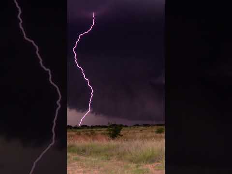
Thunderstorms are fascinating and powerful weather events that capture the attention of meteorologists and weather enthusiasts alike.
Among various types of thunderstorms, some can move exceptionally fast, making them particularly noteworthy. The fastest moving thunderstorms are known as derechos, capable of traveling at speeds of over 58 miles per hour and sometimes reaching up to 130 miles per hour.
These powerful storms form in specific atmospheric conditions and can result in significant damage similar to that caused by tornadoes.
The National Weather Service and the Storm Prediction Center closely monitor such severe weather patterns, providing vital information to keep communities prepared. Understanding the behavior of these storms is essential for safety and effective storm forecasting.
Meteorologists with extensive experience recognize the importance of fast-moving thunderstorms in weather events.
By studying their patterns and effects, it becomes possible to anticipate their impact and improve public safety.
This blog post will explore the characteristics of derechos and other rapid thunderstorms, highlighting what sets them apart in the realm of severe weather.
Characteristics of Severe Thunderstorms

Severe thunderstorms display unique features that can result in significant weather events. Understanding their dynamics, measurements, and associated phenomena helps in predicting severe weather impacts.
Supercell Storm Dynamics
Supercell thunderstorms are the most powerful type. They are known for their rotating updrafts, called mesocyclones.
These storms can last several hours and create severe weather like tornadoes and large hail. The strong rotation is driven by shear, which refers to changes in wind speed and direction with height.
This shearing leads to atmospheric instability, allowing supercells to develop.
The updrafts can exceed wind speeds of 30 m/s (about 67 mph) in extreme cases. The organization of these storms into a mesoscale convective system helps maintain their strength.
Supercells are characterized by their ability to produce wind damage with straight-line winds and the potential for downbursts.
Meteorological Parameters and Measurements
Key parameters for assessing severe thunderstorms include wind speed, atmospheric pressure, and humidity levels.
Meteorologists often use radar systems to track storm intensity and movement. Radar can detect updrafts and downdrafts, which play crucial roles in storm development.
Wind speed measurements help determine the storm’s strength. A Severe Thunderstorm Warning is issued when wind gusts exceed 58 mph. This type of data is essential for estimating the likelihood of tornado formation as well.
Areas with high atmospheric instability are more prone to severe thunderstorms. Monitoring these parameters aids in timely warnings and preparedness efforts.
Derechos and Downbursts
Derechos are widespread, long-lived wind storms associated with severe thunderstorms. They produce damaging straight-line winds that can exceed 100 mph.
Eight different criteria must be met for a storm to qualify as a derecho. One notable feature is the continuous wind damage over a large area.
Downbursts are localized, intense downdrafts that can occur within severe thunderstorms, leading to rapid wind speed increases at the surface.
They can cause destructive winds, similar to tornadoes, but over smaller areas. Both derechos and downbursts pose significant risks to life and property, generating keen interest among meteorologists who study wind effects on the environment and structural damage. Understanding these events helps in effective forecasting and risk management.
Most Intense Thunderstorms on Record
Intense thunderstorms can produce powerful storms that cause significant damage. Some of the most notable events include derechos and tornado outbreaks, each with unique characteristics and impacts.
Historic Derecho Events
A derecho is a widespread and long-lived windstorm associated with a band of severe thunderstorms.
One significant event was the June 2012 derecho, which affected the Mid-Atlantic and East Coast. This storm traveled over 700 miles and produced wind gusts exceeding 90 mph.
The wind damage swath from this derecho was extensive, impacting millions of people. Homes were damaged, trees were uprooted, and power outages affected thousands. The progressive derecho type often leads to more severe weather as it moves. The super derecho classification indicates exceptional strength, featuring severe thunderstorm capabilities.
High-Impact Tornado Outbreaks
Tornadoes, a common feature of intense thunderstorms, can be particularly devastating.
The Midwestern United States frequently experiences tornado outbreaks, especially during spring and early summer.
For instance, the outbreak in May 2003 resulted in over 30 tornadoes across several states.
These tornadoes can cause catastrophic damage, with EF5 tornadoes representing the highest level of destruction.
The most notable tornadoes often develop from supercell thunderstorms, which are highly organized and can produce severe weather.
Wind speeds from these tornadoes may exceed 200 mph, creating a hazardous environment for both people and infrastructure.