
Heavy rainfall can create significant challenges for communities around the world. The heaviest rain is often referred to as a “downpour” or “deluge.” These terms describe intense and persistent rainfall that can lead to extreme flooding and other weather-related hazards.
Records show that torrential rain can occur as part of severe weather events, making it crucial to understand the impact of precipitation on our environment.
With climate change and global warming influencing weather patterns, the frequency and intensity of these heavy rain events have been increasing.
Understanding the factors that contribute to extreme rainfall can help predict when and where these storms may occur.
Monitoring rainfall records is essential for developing strategies to mitigate the effects of severe weather and protect vulnerable communities.
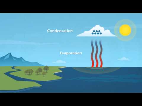
For those interested in the science behind these systems, exploring various atmospheric phenomena can provide deeper insights into how and why these conditions arise.
Types of Heavy Rainfall

Heavy rainfall occurs in various forms, often linked to specific weather patterns. Understanding these types can help predict their impact on different regions, especially in areas prone to extreme weather events.
Tropical Storms and Hurricanes
Tropical storms and hurricanes are significant sources of intense rainfall. These storms can produce extremely high rainfall rates, exceeding 10 inches per hour in some cases.
They form over warm ocean waters and develop strong winds, causing rain to fall in heavy bursts.
The impacts are often severe, leading to flooding in coastal areas. For example, hurricanes in the tropics can unload massive amounts of rain, leading to dangerous conditions. The devastation from these storms highlights the importance of monitoring and preparing for such weather events.
Monsoons and Seasonal Variations
Monsoons are seasonal wind patterns that bring heavy rain, particularly to regions like India. These rains occur during the summer months when the land heats up, creating a low-pressure system that draws moist air from the ocean.
The result is prolonged and intense rainfall that can last for weeks.
Rainfall intensity during monsoon season can reach up to 12 inches per day in some areas. This water is vital for agriculture but can also cause flooding and landslides, affecting communities and infrastructure. Understanding this seasonal variation is crucial for successful farming and disaster management.
Orographic and Convective Rainfall
Orographic precipitation occurs when moist air rises over mountains. As the air ascends, it cools and releases moisture in the form of heavy rain on the windward side. The leeward side often experiences dry conditions due to this rain shadow effect.
Convective rainfall, on the other hand, is caused by rising warm air, which cools and condenses quickly, leading to thunderstorms and heavy downpours.
This type of rain can happen suddenly, often producing localized flooding. Understanding these processes helps in predicting weather patterns and preparing for potential impacts in affected areas.
For detailed information on precipitation patterns, refer to regional weather articles.
Measuring and Analyzing Heavy Rain
Measuring heavy rain requires advanced tools and techniques. Meteorologists gather data on rainfall intensity and analyze its impact on systems and society. Understanding these methods helps to improve forecasting and preparedness.
Modern Meteorological Tools
Meteorologists use various tools to measure rain accurately. One common device is the rain gauge, which collects precipitation and measures it over time.
These gauges can be simple or digital, providing precise readings of rainfall amounts.
Weather radar is another important tool. It helps to detect rain patterns and track storms. By analyzing radar data, meteorologists can see where heavy rain is falling and predict its movement.
This technology is essential for issuing timely warnings to affected areas.
In regions like Cherrapunji, known for record rainfall, advanced tools are vital. It is crucial to monitor rainfall to prevent flooding and ensure public safety.
Rainfall Data and Records
Data collection is essential for understanding heavy rainfall. The National Weather Service compiles rainfall records to identify trends over time.
This data helps determine return periods, which indicate how often a certain amount of rain is expected.
Meteorologists analyze historical data to categorize rainfall intensity. This analysis allows them to classify rain as light, moderate, or heavy based on the rate of precipitation.
For example, heavy rain typically exceeds 7.6 mm (0.3 inches) in an hour. It can lead to significant flooding, especially in vulnerable areas.
Understanding past rainfall patterns also helps in disaster response planning. Knowing when heavy rain is most likely to occur can enhance community preparedness for severe weather events.
Impact of Heavy Rain on Society
Heavy rain can profoundly affect communities. Flooding is one of the most significant risks, impacting infrastructure, agriculture, and public safety.
Urban areas are particularly vulnerable due to limited drainage systems, leading to road washouts and property damage.
The Indian Ocean can influence heavy rainfall patterns through monsoons, affecting countries nearby. Seasonal shifts can bring unexpected heavy rain, causing challenges for local governments.
Visibility can be severely reduced during heavy rain, creating dangerous driving conditions. Awareness of these impacts helps officials implement safety measures during storms.
Community education on understanding weather alerts is crucial for minimizing risks associated with heavy rainfall.
For further insights on water-related issues, visit articles on Water.