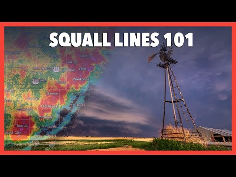
Squall lines are powerful weather phenomena that can produce severe weather events, including thunderstorms, heavy rain, and strong winds. These lines of thunderstorms can be hundreds of miles long and are often associated with significant wind shifts and intense lightning activity.
They typically form along or ahead of cold fronts and play a crucial role in the overall dynamics of storm systems.
Within a squall line, the interaction between updrafts and downdrafts creates a gust front that pushes cold air out ahead of the storm. This process can enhance the severity of the weather, leading to heavy precipitation and sometimes the formation of tornadoes.
Understanding these processes can help individuals prepare better for dangerous weather conditions.
Meteorologists constantly study squall lines to improve forecasts and safety measures. By recognizing the patterns and characteristics of these systems, they provide crucial information to communities at risk of severe weather events. Readers will gain valuable insights into the nature of squall lines and how to stay safe when they occur.
Characteristics of Squall Lines

Squall lines are specific types of thunderstorms characterized by their unique formation and structure. Understanding their dynamic weather patterns and atmospheric conditions is crucial in predicting severe weather events.
Formation and Structure
Squall lines typically form ahead of a cold front, often associated with a low-pressure area. They begin in the cumulus stage, where rising air creates cumulus clouds. As the process continues, they reach the mature stage, marked by strong updrafts and downdrafts. This stage produces heavy precipitation, powerful winds, and the potential for hail and tornadoes.
In the dissipating stage, the storm weakens. The formation often takes on a bow echo shape, indicating intense wind gusts at the surface. A gust front commonly emerges, pushing cooler air ahead of the storm, creating turbulence. The rapid development and movement of these lines can lead to dangerous weather conditions.
Dynamic Weather Patterns
The movement of squall lines is influenced by several dynamic factors. Wind shear, particularly vertical wind shear, plays a vital role in their development. It helps maintain the structure of the squall line, allowing it to efficiently organize and strengthen.
When squall lines move along the jet stream, they can intensify. This interplay between the storm and upper-level winds contributes to the potential for severe weather.
As squall lines progress, they can lead to heavy rain and strong winds, impacting vast areas as they travel.
Atmospheric Conditions
Certain atmospheric conditions favor the formation of squall lines. Warm, moist air at the surface, combined with cooler, stable air aloft, creates an environment conducive for storms. This temperature contrast can enhance vertical lift, enabling clouds to develop rapidly.
The presence of cumulonimbus clouds is prominent in a squall line. These towering clouds are essential for heavy precipitation and strong winds. They act as a catalyst for turbulence, which can lead to severe weather events. The Coriolis force also plays a role, influencing the rotation within the system.
Understanding these atmospheric conditions is crucial for effective weather forecasting, especially during dynamic weather events. More insights are available on various atmospheric phenomena.
Impacts of Squall Lines

Squall lines can cause a range of severe weather phenomena. They produce heavy precipitation, high winds, and even tornadoes. Understanding these impacts helps in preparation and response to these dangerous weather events.
Weather Events and Hazards
Squall lines are known for generating severe thunderstorms. They often develop into multi-cell or supercell thunderstorms, bringing heavy rain and damaging straight-line winds. These winds can reach speeds over 60 mph, leading to wind damage in their path.
Intense precipitation can create flash floods, especially in low-lying areas. Squall lines can also produce frequent lightning, posing risks for outdoor activities. In certain cases, downbursts can occur, where suddenly descending air creates damaging winds at the surface. Hail is another concern, with the potential for significant property damage.
Meteorological Detection and Prediction
Detection of squall lines primarily relies on radar technology. Meteorologists use radar reflectivity to monitor precipitation and identify the structure of thunderstorms.
Surface analysis is crucial in predicting the strength and movement of these lines. Advanced weather information systems offer real-time updates on squall line formation and development. This data is vital for issuing warnings and improving safety measures.
With improved radar capabilities, meteorologists can provide better forecasts, helping communities prepare for severe weather events effectively.
Safety and Navigation
Safety during squall line events is critical for both outdoor and aviation activities.
Pilots must remain aware of extreme turbulence, which can affect aircraft stability.
Tools like the artificial horizon become essential for maintaining control during turbulent conditions.
It’s also crucial for boats at sea to avoid these powerful weather systems.
Proper navigation strategies can mitigate risks associated with high winds and heavy rain.
Individuals should stay informed about current weather status to ensure safety during severe conditions.
Resources like information on hazardous wind conditions can aid in planning and response.
