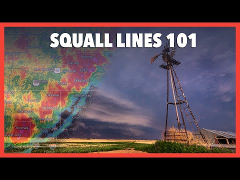
Squall lines are fascinating weather phenomena that can significantly impact local conditions. A squall line is a line of thunderstorms that often forms along or ahead of a cold front. It’s characterized by strong winds and heavy rainfall. These storms can stretch for hundreds of miles but are typically only a short distance wide.
Understanding how and when squall lines develop can help individuals prepare for sudden and severe weather changes.
As the squall line matures, cold air pushes out rapidly, creating strong gust fronts that lift warmer air, fueling the thunderstorms. This process keeps the storms active for longer periods compared to isolated thunderstorms.
Drivers and outdoor enthusiasts should pay close attention to weather forecasts, as squall lines can arrive quickly and bring dangerous conditions, including torrential rain and reduced visibility.
Meteorologists emphasize the importance of recognizing squall lines in weather patterns. These lines can lead to severe weather events, which not only pose risks at ground level but also impact air travel and outdoor activities. With adequate knowledge and preparation, people can stay safe when these powerful storms are on the horizon.
Characteristics and Formation

Squall lines are unique weather phenomena characterized by their specific structure and formation. They typically consist of a series of thunderstorms that can produce severe weather, including heavy rain and strong winds.
Understanding how these systems form requires a look at their defining features and the meteorological conditions that drive their development.
Defining Squall Lines
A squall line is a continuous line of thunderstorms. These storms can extend for hundreds of miles but remain relatively narrow, often only 10 to 20 miles wide.
They commonly form along or ahead of a cold front, which is where warm, moist air meets cooler air. The upward motion created by this interaction leads to significant updrafts and downdrafts within the storm.
This setup promotes severe weather conditions, including hail, heavy rain, and lightning. Wind speeds can be extreme, sometimes reaching over 60 mph. Squall lines are crucial to understand for those tracking severe weather events, as they often indicate dangerous conditions.
Meteorological Conditions
The formation of squall lines requires several specific meteorological conditions. Strong wind shear, which refers to changes in wind speed and direction with altitude, can enhance storm organization.
Instability in the atmosphere is also essential. Warm, moist air near the surface combined with cooler air aloft creates an unstable environment. This instability promotes vigorous thunderstorm development.
Additionally, the presence of a gust front can trigger new storms as cooler air pushes out from the initial squall line. Precipitation can be intense, with heavy rains often occurring in short bursts.
Knowing these factors helps meteorologists predict the timing and impact of squall lines. For more on how wind influences weather patterns, see related articles about wind.
Impact and Weather Phenomena

Squall lines can produce significant weather events, affecting communities in various ways. These phenomena include strong winds, potential tornadoes, and other severe weather conditions.
Types of Squall Lines
Squall lines can be classified mainly into two types: bow echoes and derechos. Bow echoes appear like a bow on radar, indicating strong winds and potential damage. These can often produce winds exceeding 60 mph, leading to severe weather alerts.
Derechos are another type associated with widespread wind damage. They consist of a series of thunderstorms that travel long distances, usually in a straight line. Such events can lead to damaging winds, hail, and even tornadoes in extreme cases.
Cumulonimbus clouds are integral to the formation of squall lines. These towering clouds develop during the mature stage of thunderstorms. The outflow boundary produced by these storms can strengthen the squall line as it moves forward.
Effects and Warnings
The impact of squall lines includes damaging winds that can cause power outages and property damage.
The National Weather Service often issues severe thunderstorm warnings to alert the public.
High winds may lead to downed trees and damaged structures.
Tornado warnings may also accompany these systems, especially if individual supercells develop within the squall line.
Residents in affected areas should stay tuned to local weather reports.
Heeding warnings and taking precautions during severe weather events can reduce risks associated with squall lines.

