Hurricanes, cyclones, and typhoons are powerful storms that can cause significant damage.
The regions where these storms occur most frequently include the Atlantic Ocean, the Eastern Pacific, and parts of the Indian Ocean.
In the Atlantic, the hurricane season runs from June to November, with peak activity seen between August and October. The Gulf of Mexico and the Caribbean Sea also experience a high number of tropical storms during this time.
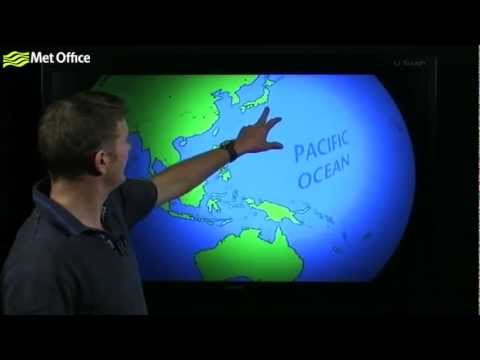
In the Western Pacific, typhoons can be quite common and typically occur from May to October. The Eastern Pacific is the second most active area for tropical cyclones, with storms often forming from tropical waves that track westward.
Understanding these patterns can help communities prepare for these extreme weather events and respond effectively.
Meteorologists study these atmospheric phenomena to better predict their paths and intensity. Their insights can provide valuable information to people living in at-risk areas.
For more information on how these storms develop and their impact, check out articles related to atmospheric phenomena.
Geographical Distribution of Hurricanes

Hurricanes primarily form in areas with warm ocean waters and specific geographical conditions. Understanding the regions where these storms originate helps in predicting their paths and impacts.
Atlantic and Eastern Pacific Basins
The Atlantic Basin includes the Atlantic Ocean, Gulf of Mexico, and the Caribbean Sea.
The peak of the Atlantic hurricane season runs from June 1 to November 30. Tropical waves feed off warm waters, providing the energy needed for storm development. Some notable hurricanes have affected coastal areas like Bermuda and regions along the U.S. East Coast.
In the Eastern Pacific, the hurricane season also aligns with the Atlantic’s, starting June 1. Meteorologists track storms closely as they can move toward countries like Mexico and the United States, causing significant damage.
Western Pacific and Indian Ocean Dynamics
The Western Pacific is known for having the highest formation rate of typhoons. The warm waters there support intense storms that impact countries such as China, Japan, and several Pacific island nations.
Meanwhile, the Indian Ocean sees storms forming particularly during its own cyclone season. The Bay of Bengal is notably prone to severe cyclones. Warm ocean currents and tropical waves in these regions contribute to the formation of these powerful systems, which often lead to devastating impacts on coastal communities.
Impacts of Climate Change on Hurricane Locations
Recent studies suggest climate change is altering traditional hurricane patterns. Rising ocean temperatures can lead to more frequent and intense storm systems. Areas historically less affected by hurricanes may see an increase in activity.
For instance, the South Pacific is becoming a region of concern as storms move into new areas. Meteorologists are adapting to these changes, focusing on safety and preparedness. Understanding these shifts is vital for coastal communities that need to implement effective hurricane safety measures. The ongoing research helps local governments better plan for future storms.
Characteristics and Measurement of Tropical Cyclones

Tropical cyclones, also known as hurricanes or typhoons, are characterized by their organization and intensity. Understanding their classification, measurement techniques, and the impacts they have is crucial for preparation and mitigation.
Tropical Cyclone Classification and Structure
Tropical cyclones are classified into several categories based on their wind speed and structure. They begin as tropical depressions with wind speeds below 39 mph.
When winds increase to between 39 and 73 mph, they are termed tropical storms. Major storms, categorized as hurricanes, have sustained winds of 74 mph or higher.
The structure of a tropical cyclone includes the eye, the calm center of the storm, surrounded by an eyewall where the strongest winds and heaviest rainfall occur.
Strong winds and low air pressure define these systems, with many forming in warm ocean waters. They mainly affect areas like Central America and Hawaii, causing significant damage.
Wind Scales and Measurement Techniques
The intensity of tropical cyclones is measured using the Saffir-Simpson Hurricane Wind Scale, which ranges from Category 1 (74-95 mph) to Category 5 (157 mph and above). This scale helps categorize the potential damage from winds associated with each category.
Wind speeds are accurately measured using both ground-based instruments and advanced satellite imagery. Meteorologists utilize wind shear data to assess the storm’s potential for development or dissipation. These measurement techniques are vital for issuing timely evacuation orders and public safety warnings.
Storm Surge and Coastal Impact
Storm surge is a critical hazard associated with tropical cyclones. It is defined as the rise in sea level caused by the storm’s winds pushing water toward the coast. This phenomenon can lead to catastrophic flooding and is often the most damaging aspect of a storm.
Tropical cyclones create a storm surge watch to alert communities of impending risk. These surges can vary greatly depending on the storm’s intensity, forward speed, and coastal topography.
Understanding storm surge is essential for preparing for potential coastal impacts. This is because it can inundate low-lying areas and lead to severe flooding and erosion.
