
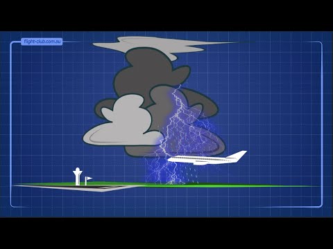
Squall lines are a significant aspect of severe weather phenomena, often bringing intense thunderstorms and strong winds.
These storm lines typically occur ahead of cold fronts, primarily in the warm sector of midlatitude cyclones.
Understanding where squall lines form helps meteorologists predict extreme weather events, making this knowledge invaluable for safety and preparedness.
As squall lines develop, they can lead to dangerous conditions including heavy rainfall, lightning, and damaging gust fronts.
These systems can stretch for hundreds of miles and intensify as they approach land, posing risks to both populated areas and agricultural regions.
Observing the formation and movement of these thunderstorms is crucial for effective weather forecasting and public safety.
For those interested in atmospheric phenomena, recognizing the typical locations of squall lines enhances the appreciation of how these weather systems operate.
Exploring their patterns can deepen the understanding of severe weather dynamics, making it easier for individuals and communities to respond effectively.
Formation and Characteristics

Squall lines are powerful weather phenomena that form under specific meteorological conditions. They are recognized for their heavy precipitation and strong winds, often leading to severe weather events. Understanding how squall lines develop and their physical structure is essential for predicting their impact.
Meteorological Conditions for Formation
Squall lines commonly develop along or ahead of a cold front where warm, moist air meets cooler, denser air. The contrast in temperatures creates instability, leading to convection.
When the warm air rises, it forms cumulus clouds, which can develop into larger cumulonimbus clouds.
This process is aided by wind shear, which is the change in wind speed and direction with altitude.
The wind shear helps organize the storm structure by enhancing updrafts and sustaining the downdrafts necessary for forming heavy precipitation.
Radar reflectivity often shows a defined line of intense precipitation as the squall line matures.
Physical Structure of Squall Lines
Squall lines typically exhibit a linear or bowing structure. The leading edge often produces a distinctive shelf cloud, which marks the arrival of the storm.
Inside the squall line, multiple downdrafts and updrafts interact, creating turbulent conditions.
As the squall line evolves, it can enter a mature stage, characterized by severe wind gusts and heavy rain.
The bow echo is a specific pattern within a squall line associated with strong winds. They can also lead to flash flooding and localized damage. Understanding the physical features helps in recognizing the threats associated with these systems, making it crucial for safety and preparedness.
Impacts and Safety Measures
Squall lines can lead to severe weather events that pose risks to life and property. Understanding these impacts and knowing safety measures are vital for communities at risk.
Severe Weather Events Associated with Squall Lines
Squall lines often generate a variety of dangerous weather phenomena. These include tornadoes, damaging winds, large hail, and heavy rain.
Tornadoes can form quickly and with little warning, particularly in the warm sector of a squall line.
High wind speeds can create a gust front that pushes ahead of the storm, resulting in straight-line winds that can cause significant damage.
Derecho events, which can extend over large areas, are another concern. These powerful windstorms can travel for hundreds of miles, and their impacts can be severe.
The National Weather Service monitors these conditions closely, using weather radar and radar reflectivity to track squall lines. Their warning systems are crucial for alerting the public and facilitating effective emergency planning.
Predicting and Reacting to Squall Lines
Predicting squall lines involves understanding meteorological patterns and using technology effectively.
The National Weather Service employs advanced algorithms and weather models to anticipate the formation and movement of these storms.
Community awareness is essential. Residents should stay informed through weather broadcasts and apps that provide real-time updates.
When a squall line is approaching, individuals should seek shelter in sturdy buildings. In areas prone to tornadoes or damaging winds, preparing an emergency kit and having a plan is vital.
By staying vigilant and informed, people can respond effectively to the dangers posed by squall lines and protect themselves and their families from severe weather events.