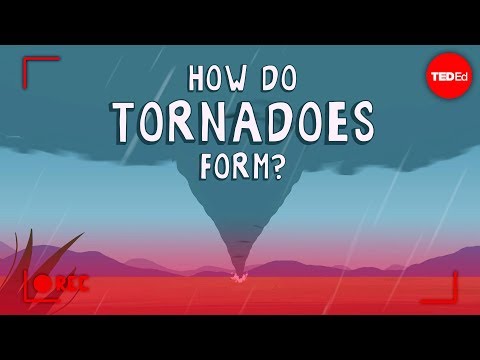
Tornadoes are fascinating and powerful weather phenomena that can leave a lasting impact on both nature and human lives. Many people wonder why they can see the air moving in a tornado.
The visibility of the air within a tornado is largely due to the condensation of water droplets and entrained debris that create a visible funnel, highlighting the violent rotation of the vortex. Understanding this creation of visibility can deepen appreciation for the dynamics of tornado formation and severe weather patterns.
As a tornado develops, it often picks up dust, dirt, and moisture from the ground. This combination enhances the visibility of the air swirling in the tornado.
The strong updrafts within the thunderstorm can also contribute to the formation of a condensation funnel. Each tornado is unique, and its appearance can change rapidly, influenced by environmental conditions.
In extreme scenarios, the swirling air can be filled with various particles, making the tornado even more pronounced and dramatic.
Exploring tornadoes within the context of atmospheric phenomena can reveal much about their behavior and the forces at play. For those interested in further understanding these fascinating weather events, there are many resources available on atmospheric phenomena that provide additional insights.
Understanding Tornadoes and Visibility

Tornadoes are unique atmospheric phenomena characterized by a rotating column of air. Visibility during tornado events is influenced by various physical and meteorological factors. These elements help explain why the air within a tornado becomes visible, often changing the landscape dramatically during severe weather events.
Physical Structure of Tornadoes
A tornado develops from a mesocyclone, which forms within a thunderstorm when wind shear creates rotating updrafts. This rotating column of air grows into a visible funnel cloud.
Tornadoes have a low-pressure center, allowing air to rush in from surrounding areas. As the air rotates, it picks up dust, debris, and moisture.
This combination contributes to the characteristic appearance of a tornado. The visible elements, like dust and water droplets, create a striking display as the wind spins powerfully. In regions like “Tornado Alley,” where tornadoes occur frequently, understanding this structure is crucial for forecasting severe weather events.
Scientific Explanation for Visibility
The visibility of air in a tornado is mainly due to condensation. As moist air enters the tornado, it cools, and the water vapor condenses into tiny droplets or ice crystals. This process transforms the invisible air into a visible mass.
Additionally, dust and debris caught in the violent winds enhance visibility. As the air pressure drops dramatically inside the tornado, the extremity of these conditions contributes to the formation of a distinct, rotating vortex. The combination of these factors makes the air inside a tornado observable, revealing its funnel-shaped nature.
Role of Meteorological Conditions
Meteorological conditions play a significant role in tornado visibility. The amount of moisture in the air influences condensation levels.
In humid environments, such as during severe thunderstorms, the likelihood of visible air increases. The presence of dust and other particulate matter also affects visibility.
Strong winds, which can reach speeds over 100 miles per hour, lift debris into the air, making it more noticeable. Together, these conditions create a visual spectacle that can be both mesmerizing and dangerous. For those tracking weather systems, elements like wind and pressure drops are vital for understanding tornado development and predicting their behavior.
Tornado Detection and Safety Measures

Understanding how tornadoes are detected and the safety measures that should be in place can significantly reduce risks during tornado season. Advanced technologies help in early detection, while safety protocols ensure people are prepared for potential disasters.
Advanced Detection Technologies
Modern detection technologies are vital in identifying tornado formation and tracking their paths. Doppler radar is one of the most important tools used by meteorologists.
It can detect rotating air patterns that may indicate a tornado, often leading to a tornado watch or warning. In addition, researchers are developing new algorithms to enhance the accuracy of tornado detection.
The National Severe Storms Laboratory has created the Tornado Detection Algorithm, which monitors specific weather patterns for signs of tornado activity. Storm chasers often use this real-time data to locate tornadoes and gather essential information for tornado research.
Safety Protocols and Precautions
Safety measures are crucial when a tornado is imminent. When a tornado warning is issued, individuals should immediately seek shelter in a designated tornado shelter or a safe room.
These areas are designed to provide protection from flying debris and high winds. An effective evacuation plan is essential for communities at risk.
Residents should know safe routes away from danger zones. Local authorities often employ storm spotters to alert the public about tornado occurrences and monitor conditions. Regularly reviewing safety protocols helps ensure everyone knows what to do in an emergency.
Tornado Intensity and Impact Assessment
Tornado intensity is measured using the Enhanced Fujita Scale, which categorizes tornadoes from EF0 (weakest) to EF5 (strongest). This scale helps assess potential damage, enabling timely warnings and responses.
Understanding the potential for tornado damage is vital for safety preparations.
High-intensity tornadoes can destroy buildings and uproot trees, leading to dangerous situations with flying debris. Being aware of the tornado’s path is crucial for avoiding harm.
Communities can implement better building codes to withstand tornado impacts, reducing risks during severe storms.
Tornado season brings specific challenges, and knowing how to stay safe is essential.
Effective detection and preparation can save lives and reduce damage significantly.
For more insights on monitoring storms, consider visiting ChaseDay.com.
